Search options

Orientation
Colour

Display options

View

Print

To print search results, use print friendly version of this page.

2491528 Search Results

Lower Antelope Canyon - Textures and colors inside Lower Antelope Canyon

PIX4672687: Lower Antelope Canyon - Textures and colors inside Lower Antelope Canyon / Bridgeman Images

Lower Antelope Canyon - Textures and colors inside Lower Antelope Canyon

PIX4672712: Lower Antelope Canyon - Textures and colors inside Lower Antelope Canyon / Bridgeman Images

3 April 2016 - Canopee - Les Halles, Paris, Architects: Patrick Berger and Jacques Anziutti

OMG4672746: 3 April 2016 - Canopee - Les Halles, Paris, Architects: Patrick Berger and Jacques Anziutti / Bridgeman Images

Italy: Archeological site of Herculanum: House of Aristide: Detail base of a marble column

GYS4720223: Italy: Archeological site of Herculanum: House of Aristide: Detail base of a marble column / Bridgeman Images

Florida Shuttle View - Florida View by Shuttle STS - 95 October 199

PIX4672999: Florida Shuttle View - Florida View by Shuttle STS - 95 October 199 / Bridgeman Images

Tikal - Temple I and the constellation Orion - Tikal - Temple I and Orion constellation - Temple I or Temple of Ah Cacao or Temple of the Great Jaguar was built around 734, and rises to 47 metres in height. Tikal (or Tik'al according to modern Mayan spelling) is one of the largest archaeological sites and urban centers of the Mayan precolombian civilization. Located in what is now northern Guatemala, it was declared a UNESCO World Heritage Site in 1979. Temple I (also known as the Temple of Ah Cacao or Temple of the Great Jaguar) is a funerary pyramid dedicated to Jasaw Chan K'awil, who was entombed in the structure in AD 734, the pyramid was completed around 740 - 750. The temple rises 47 meters (154 ft) high. Tikal (or Tik'al according to the modern Mayan orthography) is one of the largest archaeological sites and urban centres of the pre-Columbian Maya civilization. It is located in the archaeological region of the Peten Basin in what is now northern Guatemala. In 1979 it was declared a UNESCO World Heritage Site

PIX4673069: Tikal - Temple I and the constellation Orion - Tikal - Temple I and Orion constellation - Temple I or Temple of Ah Cacao or Temple of the Great Jaguar was built around 734, and rises to 47 metres in height. Tikal (or Tik'al according to modern Mayan spelling) is one of the largest archaeological sites and urban centers of the Mayan precolombian civilization. Located in what is now northern Guatemala, it was declared a UNESCO World Heritage Site in 1979. Temple I (also known as the Temple of Ah Cacao or Temple of the Great Jaguar) is a funerary pyramid dedicated to Jasaw Chan K'awil, who was entombed in the structure in AD 734, the pyramid was completed around 740 - 750. The temple rises 47 meters (154 ft) high. Tikal (or Tik'al according to the modern Mayan orthography) is one of the largest archaeological sites and urban centres of the pre-Columbian Maya civilization. It is located in the archaeological region of the Peten Basin in what is now northern Guatemala. In 1979 it was declared a UNESCO World Heritage Site / Bridgeman Images

Chichen Itza - The El Caracol Observatory of Chichen Itza in Mexico. El Caracol, the observatory in Chichen Itza, Yucatan, Mexico

PIX4673284: Chichen Itza - The El Caracol Observatory of Chichen Itza in Mexico. El Caracol, the observatory in Chichen Itza, Yucatan, Mexico / Bridgeman Images

Chesapeake Bay - USA - Chesapeake Bay seen from space - Chesapeake Bay on the eastern coast of the United States houses an impact crater about 80 km in diameter buried more than 300 metres deep. This crater, dating back to 35.5 million years, was discovered in 1983. Mosaic of six photographs obtained by the Landsat-5 satellite between 2009 and 2011. In 1983 the largest impact crater of the United states of America has been discovered there. With a diameter of 80 km, this 35.5 million year - old crater is buried more than 300 meters beneath the lower part of the bay. Mosaic of six Landsat 5 images collected in July 2009 and 2011.The Washington D.C. - Baltimore - Philadelphia - New York City corridor can be clearly seen (look for silvery purple) as can the Chesapeake and Delaware Bays and the coastal Atlantic barrier islands from Fishermans Island, Virginia to Sandy Hook, New Jersey

PIX4673314: Chesapeake Bay - USA - Chesapeake Bay seen from space - Chesapeake Bay on the eastern coast of the United States houses an impact crater about 80 km in diameter buried more than 300 metres deep. This crater, dating back to 35.5 million years, was discovered in 1983. Mosaic of six photographs obtained by the Landsat-5 satellite between 2009 and 2011. In 1983 the largest impact crater of the United states of America has been discovered there. With a diameter of 80 km, this 35.5 million year - old crater is buried more than 300 meters beneath the lower part of the bay. Mosaic of six Landsat 5 images collected in July 2009 and 2011.The Washington D.C. - Baltimore - Philadelphia - New York City corridor can be clearly seen (look for silvery purple) as can the Chesapeake and Delaware Bays and the coastal Atlantic barrier islands from Fishermans Island, Virginia to Sandy Hook, New Jersey / Bridgeman Images
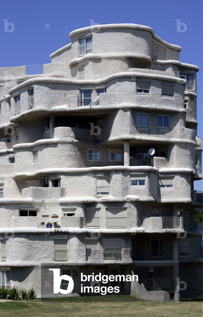
Housing cite Pasteur Montplaisir in Angers (Maine et Loire). End of construction 1976, architect Pavel Kalouguine.

TEC4673317: Housing cite Pasteur Montplaisir in Angers (Maine et Loire). End of construction 1976, architect Pavel Kalouguine. / Bridgeman Images

Hunting horn
Hunting horn

LRI4673398: Hunting horn / Bridgeman Images

New York night view - 12/2010 - New York City by night 12/2010 - New York City by night seen by the International Space Station (ISS) on December 8, 2010. New York metropolitan area at night seen from the International Space Station (ISS) on December 8, 2010

PIX4673420: New York night view - 12/2010 - New York City by night 12/2010 - New York City by night seen by the International Space Station (ISS) on December 8, 2010. New York metropolitan area at night seen from the International Space Station (ISS) on December 8, 2010 / Bridgeman Images

Lake Powell - Utah: Lake Powell, Utah, USA, seen from the International Space Station (ISS) on September 6, 2016. This panorama, photographed by an astronaut aboard the International Space Station, shows almost the full length of Lake Powell, the reservoir on the Colorado River in southern Utah and northern Arizona. Note south is at the top left of the image. Image acquired on September 6, 2016.

PIX4673489: Lake Powell - Utah: Lake Powell, Utah, USA, seen from the International Space Station (ISS) on September 6, 2016. This panorama, photographed by an astronaut aboard the International Space Station, shows almost the full length of Lake Powell, the reservoir on the Colorado River in southern Utah and northern Arizona. Note south is at the top left of the image. Image acquired on September 6, 2016. / Bridgeman Images

Corona Arch - Arches National Park - Utah - Night Sky at Corona Arch - The lactee road above Corona arch. The moon lies under the ark. The Milky Way is visible next to Corona Arch, while the Moon sets right under the arch

PIX4673621: Corona Arch - Arches National Park - Utah - Night Sky at Corona Arch - The lactee road above Corona arch. The moon lies under the ark. The Milky Way is visible next to Corona Arch, while the Moon sets right under the arch / Bridgeman Images
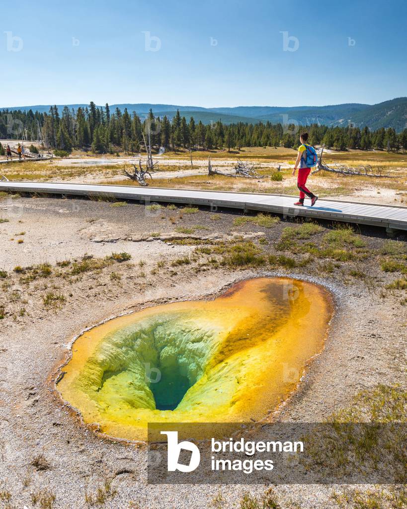
Belgian Pool - Yellowstone - 2017 - Tourist near Belgian Pool, a hot spring located in the Upper Geyser Basin of Yellowstone National Park. August 2017. A hiker walks by the Belgian Pool, in Yellowstone National Park, USA

PIX4673671: Belgian Pool - Yellowstone - 2017 - Tourist near Belgian Pool, a hot spring located in the Upper Geyser Basin of Yellowstone National Park. August 2017. A hiker walks by the Belgian Pool, in Yellowstone National Park, USA / Bridgeman Images
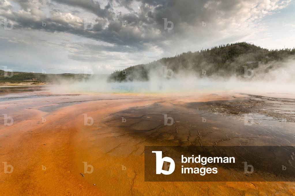
Grand Prismatic Spring - Yellowstone - 2017 - The Grand Prismatic Spring is a large heated water pool with over 70* C located in Yellowstone National Park, USA. It is the largest known American hot spring. Aug 2017

PIX4673750: Grand Prismatic Spring - Yellowstone - 2017 - The Grand Prismatic Spring is a large heated water pool with over 70* C located in Yellowstone National Park, USA. It is the largest known American hot spring. Aug 2017 / Bridgeman Images

Hurricane Marilyn seen by shuttle 09/95 - Hurricane Marilyn over Puerto Rico seen by shuttle STS - 69 on 15/09/95

PIX4673781: Hurricane Marilyn seen by shuttle 09/95 - Hurricane Marilyn over Puerto Rico seen by shuttle STS - 69 on 15/09/95 / Bridgeman Images
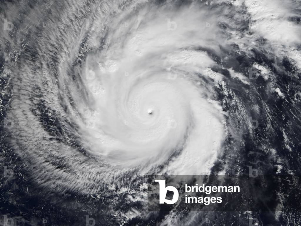
Typhoon Faxai seen by satellite 12/2001 - Typhoon Faxai 12/2001 - Typhoon Faxai (category 5) seen over the Pacific Ocean on 22 December 2001. The category 5 super typhoon Faxai seen above the Pacific ocean on december 22, 2001

PIX4673898: Typhoon Faxai seen by satellite 12/2001 - Typhoon Faxai 12/2001 - Typhoon Faxai (category 5) seen over the Pacific Ocean on 22 December 2001. The category 5 super typhoon Faxai seen above the Pacific ocean on december 22, 2001 / Bridgeman Images

The family of Guise (Aisne), founded by the industrialist Jean-Baptiste (Jean Baptiste) Andre Godin (1817-1888). Realization 1862. Photography 10/06/90.

TEC4674000: The family of Guise (Aisne), founded by the industrialist Jean-Baptiste (Jean Baptiste) Andre Godin (1817-1888). Realization 1862. Photography 10/06/90. / Bridgeman Images

Typhoon Sangda seen from ISS. 09/2004 - Typhoon Sangda seen from the international space station. 09/2004. - Typhoon Sangda seen by the international space station in September 2004

PIX4674013: Typhoon Sangda seen from ISS. 09/2004 - Typhoon Sangda seen from the international space station. 09/2004. - Typhoon Sangda seen by the international space station in September 2004 / Bridgeman Images

The family of Guise (Aisne), founded by the industrialist Jean-Baptiste (Jean Baptiste) Andre Godin (1817-1888). Realization 1862. Photography 10/06/90.

TEC4674020: The family of Guise (Aisne), founded by the industrialist Jean-Baptiste (Jean Baptiste) Andre Godin (1817-1888). Realization 1862. Photography 10/06/90. / Bridgeman Images

Hurricane Felix seen since ISS 09/2007 - Hurricane Felix seen over Cuba by members of Expedition 15 of the International Space Station. 3 September 2007. This view of Hurricane Felix was taken from the Earth - orbiting International Space Station (ISS) by an Expedition 15 crewmember using a digital still camera equipped with a 28 - 70 mm lens set at 32 mm focal length on Sept. 3, 2007 at 11:39:56 GMT. The ISS was located at the nadir point of 20.4 degrees north latitude and 80.4 degrees west longitude, over Pickle Bank, the waters between Grand Cayman Island and Cuba. At approximately noon GMT, Hurricane Felix was near 14.2 degrees north latitude and 76.9 degrees west longitude, about 260 miles (425 kilometers) south of Kingston Jamaica, and 425 miles (685 kilometers) east of Cabo Gracias a Dios on the Nicaragua/Honduras border, moving west at 21 miles per hour (33 kilometers per hour). The sustained winds were 165 miles per hour with higher gusts making it a category 5 on the Saffir - Simpson scale

PIX4674038: Hurricane Felix seen since ISS 09/2007 - Hurricane Felix seen over Cuba by members of Expedition 15 of the International Space Station. 3 September 2007. This view of Hurricane Felix was taken from the Earth - orbiting International Space Station (ISS) by an Expedition 15 crewmember using a digital still camera equipped with a 28 - 70 mm lens set at 32 mm focal length on Sept. 3, 2007 at 11:39:56 GMT. The ISS was located at the nadir point of 20.4 degrees north latitude and 80.4 degrees west longitude, over Pickle Bank, the waters between Grand Cayman Island and Cuba. At approximately noon GMT, Hurricane Felix was near 14.2 degrees north latitude and 76.9 degrees west longitude, about 260 miles (425 kilometers) south of Kingston Jamaica, and 425 miles (685 kilometers) east of Cabo Gracias a Dios on the Nicaragua/Honduras border, moving west at 21 miles per hour (33 kilometers per hour). The sustained winds were 165 miles per hour with higher gusts making it a category 5 on the Saffir - Simpson scale / Bridgeman Images
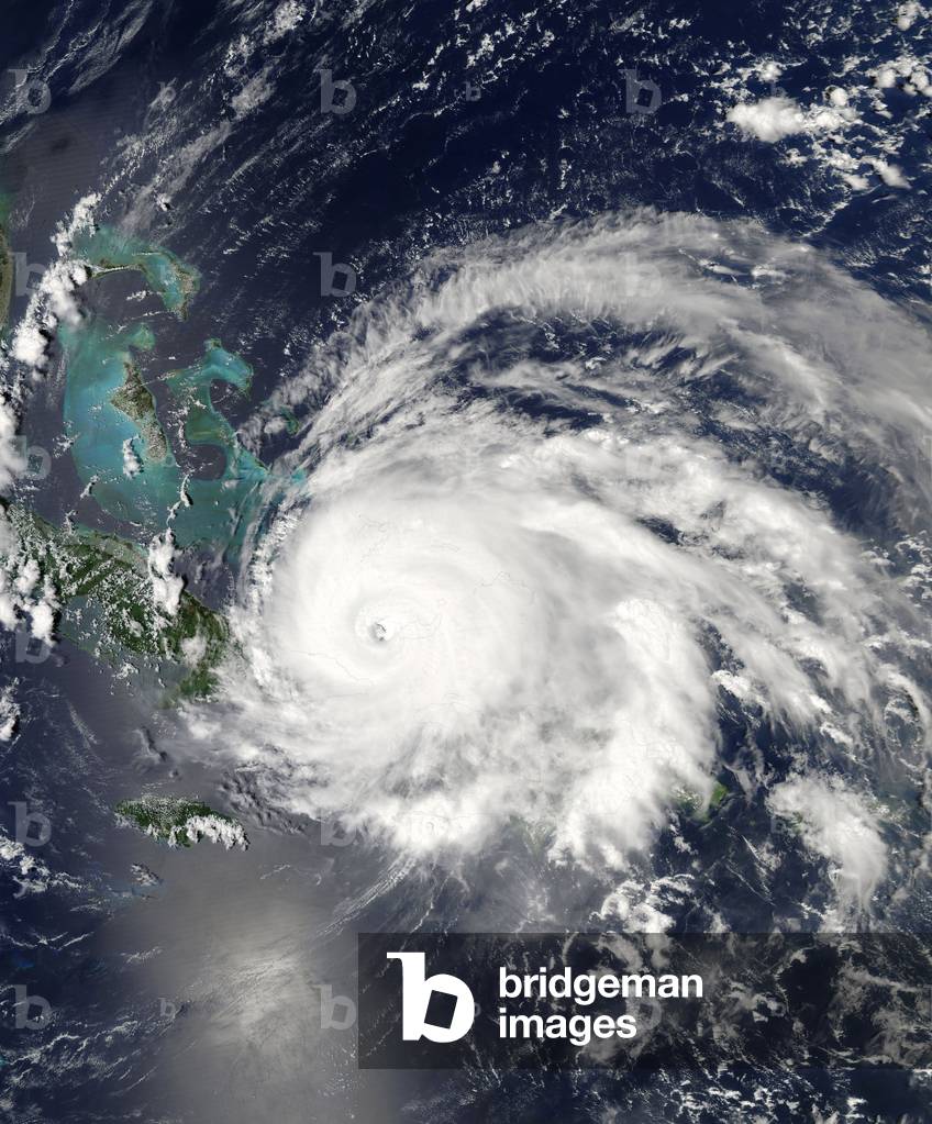
Hurricane Ike seen by satellite 09/2008 - Hurricane Ike above Cuba 09/2008 - Hurricane Ike seen over Cuba on 7 September 2008. Image obtained by the American satellite Aqua. Just an hour and a half after this image of Hurricane Ike was captured by the MODIS on NASA's Aqua satellite on September 7, 2008, the National Hurricane Center released its 2:00 p.m. EDT public advisory, warning residents of Cuba and other Caribbean islands, as well as the Florida Keys, that Ike was a dangerous Category 4 hurricane, with winds near 135 mph (215 kilometers per hour), with higher gusts. The image shows Ike approaching eastern Cuba, the eye just west of Great Inagua Island (one of the Turks and Caicos Islands). According to later advisories, Ike made landfall as a Category 3 storm, with winds around 125 miles per hour. Heavy rains were predicted to cause deadly floods and mudslides in mountainous parts of Hispaniola (Haiti and the Dominican Republic) and Cuba

PIX4674128: Hurricane Ike seen by satellite 09/2008 - Hurricane Ike above Cuba 09/2008 - Hurricane Ike seen over Cuba on 7 September 2008. Image obtained by the American satellite Aqua. Just an hour and a half after this image of Hurricane Ike was captured by the MODIS on NASA's Aqua satellite on September 7, 2008, the National Hurricane Center released its 2:00 p.m. EDT public advisory, warning residents of Cuba and other Caribbean islands, as well as the Florida Keys, that Ike was a dangerous Category 4 hurricane, with winds near 135 mph (215 kilometers per hour), with higher gusts. The image shows Ike approaching eastern Cuba, the eye just west of Great Inagua Island (one of the Turks and Caicos Islands). According to later advisories, Ike made landfall as a Category 3 storm, with winds around 125 miles per hour. Heavy rains were predicted to cause deadly floods and mudslides in mountainous parts of Hispaniola (Haiti and the Dominican Republic) and Cuba / Bridgeman Images

Hurricane Hugo seen by satellite - Hurricane Hugo seen by satellite - Perspective view of Hurricane Hugo on September 21, 1989. Image obtained from the GOES-7 satellite. Perspective view of Hurricane Hugo on 21 September 1989 at 14:44 EDT by GOES - 7 (Geostationary Operational Environmental Satellites), as the hurricane approaches Charleston, South Carolina. See also our full - earth view of Hugo. Image produced by F. Hasler, K. Palaniappan, M. Manyin, and H. Pierce (NASA/Goddard)

PIX4674309: Hurricane Hugo seen by satellite - Hurricane Hugo seen by satellite - Perspective view of Hurricane Hugo on September 21, 1989. Image obtained from the GOES-7 satellite. Perspective view of Hurricane Hugo on 21 September 1989 at 14:44 EDT by GOES - 7 (Geostationary Operational Environmental Satellites), as the hurricane approaches Charleston, South Carolina. See also our full - earth view of Hugo. Image produced by F. Hasler, K. Palaniappan, M. Manyin, and H. Pierce (NASA/Goddard) / Bridgeman Images

Horseid Beach - Lofoten Islands - Norway - Horseid beach in Lofoten: A young woman walks on Horseid beach in summer. A young woman walks on the yellow sand of Horseid beach, Lofoten islands

PIX4666904: Horseid Beach - Lofoten Islands - Norway - Horseid beach in Lofoten: A young woman walks on Horseid beach in summer. A young woman walks on the yellow sand of Horseid beach, Lofoten islands / Bridgeman Images

Portugal seen by satellite - Portugal seen from satellite Envisat - Image obtained by satellite Envisa

PIX4667035: Portugal seen by satellite - Portugal seen from satellite Envisat - Image obtained by satellite Envisa / Bridgeman Images

Europe at night - 2012 - Europe by night - 2012: View of Europe at night consisting of images taken by the Suomi NPP satellite in April and October 2012. This image of Europe at night is a composite assembled from data acquired by the Suomi NPP satellite in April and October 2012

PIX4667159: Europe at night - 2012 - Europe by night - 2012: View of Europe at night consisting of images taken by the Suomi NPP satellite in April and October 2012. This image of Europe at night is a composite assembled from data acquired by the Suomi NPP satellite in April and October 2012 / Bridgeman Images

Etna (Sicily) seen by ISS 11/2002 - Etna, one of the most active volcanoes in the world, observes from the international space station on 07/11/2002

PIX4667314: Etna (Sicily) seen by ISS 11/2002 - Etna, one of the most active volcanoes in the world, observes from the international space station on 07/11/2002 / Bridgeman Images

The Oriental Park of Maulevrier is a Japanese garden located in Maulevrier, Maine-et-Loire, France. With 29 hectares it is today the largest Japanese garden in Europe. Organizing around an artificial lake fed by the Monk that crosses it from east to west, it contains about 300 plants, including azalees, camelias, rhododendrons, Japanese Maple, ginkgo biloba and others, with elements of traditional decoration of Japanese gardens such as red porticos (torii), stone lanterns (T r), or replica of a Khmer Buddhist temple. The designer of this space is the Parisian architect Alexandre Marcel (1860-1928), designer of the Cambodia pavilion at the 1900 Universal Exhibition - The Parc Oriental de Maulevrier is the largest Japanese garden in France. It is located in Maulevrier, Maine-et-Loire, Pays de la Loire, France. - The park was created between 1899-1913 on the grounds of Chateau Colbert by architect Alexandre Marcel (1860-1928), designer of the Cambodia pavilion at the Exposition Universelle (1900)

PIX4668299: The Oriental Park of Maulevrier is a Japanese garden located in Maulevrier, Maine-et-Loire, France. With 29 hectares it is today the largest Japanese garden in Europe. Organizing around an artificial lake fed by the Monk that crosses it from east to west, it contains about 300 plants, including azalees, camelias, rhododendrons, Japanese Maple, ginkgo biloba and others, with elements of traditional decoration of Japanese gardens such as red porticos (torii), stone lanterns (T r), or replica of a Khmer Buddhist temple. The designer of this space is the Parisian architect Alexandre Marcel (1860-1928), designer of the Cambodia pavilion at the 1900 Universal Exhibition - The Parc Oriental de Maulevrier is the largest Japanese garden in France. It is located in Maulevrier, Maine-et-Loire, Pays de la Loire, France. - The park was created between 1899-1913 on the grounds of Chateau Colbert by architect Alexandre Marcel (1860-1928), designer of the Cambodia pavilion at the Exposition Universelle (1900) / Bridgeman Images

Abbey of Fontevraud - Maine-et-Loire - Abbey of Fontevraud - Maine-et-Loire: The Abbey of Notre-Dame de Fontevraud was founded by Robert d'Arbrissel in 1101. Located 15 km from Saumur in the Maine-et-Loire, it was classified as a historical monument in 1840 and declared a UNESCO World Heritage Site in 2000 with the entire cultural site of the Loire Valley. The Royal Abbey of Our Lady of Fontevraud or Fontevrault was a monastery in the village of Fontevraud-l'Abbaye, near Saumur, in Anjou, France. It was founded in 1101 by Robert of Arbrissel. The complex of monastic buildings served as a prison from 1804 to 1963

PIX4668694: Abbey of Fontevraud - Maine-et-Loire - Abbey of Fontevraud - Maine-et-Loire: The Abbey of Notre-Dame de Fontevraud was founded by Robert d'Arbrissel in 1101. Located 15 km from Saumur in the Maine-et-Loire, it was classified as a historical monument in 1840 and declared a UNESCO World Heritage Site in 2000 with the entire cultural site of the Loire Valley. The Royal Abbey of Our Lady of Fontevraud or Fontevrault was a monastery in the village of Fontevraud-l'Abbaye, near Saumur, in Anjou, France. It was founded in 1101 by Robert of Arbrissel. The complex of monastic buildings served as a prison from 1804 to 1963 / Bridgeman Images

Aurora Boreale observed in Alaska, Homer, January 17, 2005

PIX4669797: Aurora Boreale observed in Alaska, Homer, January 17, 2005 / Bridgeman Images

Portrait of architect Pierre Riboulet in 2002

OMG4741871: Portrait of architect Pierre Riboulet in 2002 / Bridgeman Images

Milky way all around the horizon and Gegenschein - Fisheye view of the southern sky. The lactee path blends with the horizon line. In the sky, the three brightest galaxies visible on Earth: the two galaxies of the Magellan Cloud, and opposite it towards the right middle of the image, the galaxy of Andromede. Crossing the image on the right, the gegenschein, the blade glow made up of dust reflecting the light of the sun, observable only in a dense sky of any parasite light. The bright spot near the center of the image is Jupiter Planet. The following image was taken at new Moon (No Moon light), middle of the night (minimum zodiacal light effect), in the Atacama desert close to Paranal observatory (no light pollution). The chosen place for this picture has the particularity to be located at a latitude which value is close to the declination of the galactic southern pole. The picture was therefore also taken when the galactic pole passes at zenith, ensuring that there is no Milky Way up in the sky. When all these conditions are met, being very close to what the “” darkest””” sky could be, the very faint Gegenschein becomes visible. Like the zodiacal light, the gegenschein is sunlight reflected by interplanetary dust. Most of this dust is orbiting the sun in about the ecliptic plane. The Gegenschein is clearly visible covering most of the right side of the picture. The Large (LMC) and Small (SMC) Magellanic clouds are visible to the left, Orion constellation with Barnard loop to the top, California Nebula and 'tiny' Andromeda galaxy to the right while the Milky Way is visible all around the image on the horizon line. Bright jupiter is visible near the center of the image and bright red Eta Carina Nebula is rising on the horizon line at the very left

PIX4636032: Milky way all around the horizon and Gegenschein - Fisheye view of the southern sky. The lactee path blends with the horizon line. In the sky, the three brightest galaxies visible on Earth: the two galaxies of the Magellan Cloud, and opposite it towards the right middle of the image, the galaxy of Andromede. Crossing the image on the right, the gegenschein, the blade glow made up of dust reflecting the light of the sun, observable only in a dense sky of any parasite light. The bright spot near the center of the image is Jupiter Planet. The following image was taken at new Moon (No Moon light), middle of the night (minimum zodiacal light effect), in the Atacama desert close to Paranal observatory (no light pollution). The chosen place for this picture has the particularity to be located at a latitude which value is close to the declination of the galactic southern pole. The picture was therefore also taken when the galactic pole passes at zenith, ensuring that there is no Milky Way up in the sky. When all these conditions are met, being very close to what the “” darkest””” sky could be, the very faint Gegenschein becomes visible. Like the zodiacal light, the gegenschein is sunlight reflected by interplanetary dust. Most of this dust is orbiting the sun in about the ecliptic plane. The Gegenschein is clearly visible covering most of the right side of the picture. The Large (LMC) and Small (SMC) Magellanic clouds are visible to the left, Orion constellation with Barnard loop to the top, California Nebula and 'tiny' Andromeda galaxy to the right while the Milky Way is visible all around the image on the horizon line. Bright jupiter is visible near the center of the image and bright red Eta Carina Nebula is rising on the horizon line at the very left / Bridgeman Images
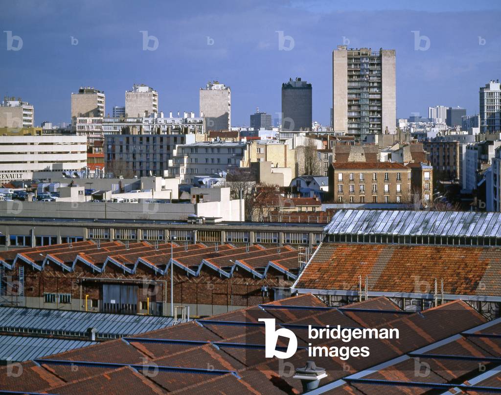
Urban landscape in Boulogne Billancourt (Hauts de Seine).

TEC4636132: Urban landscape in Boulogne Billancourt (Hauts de Seine). / Bridgeman Images
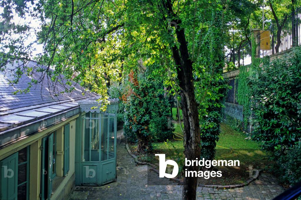
House of the writer Honore de Balzac, Paris 75016.

TEC4681703: House of the writer Honore de Balzac, Paris 75016. / Bridgeman Images
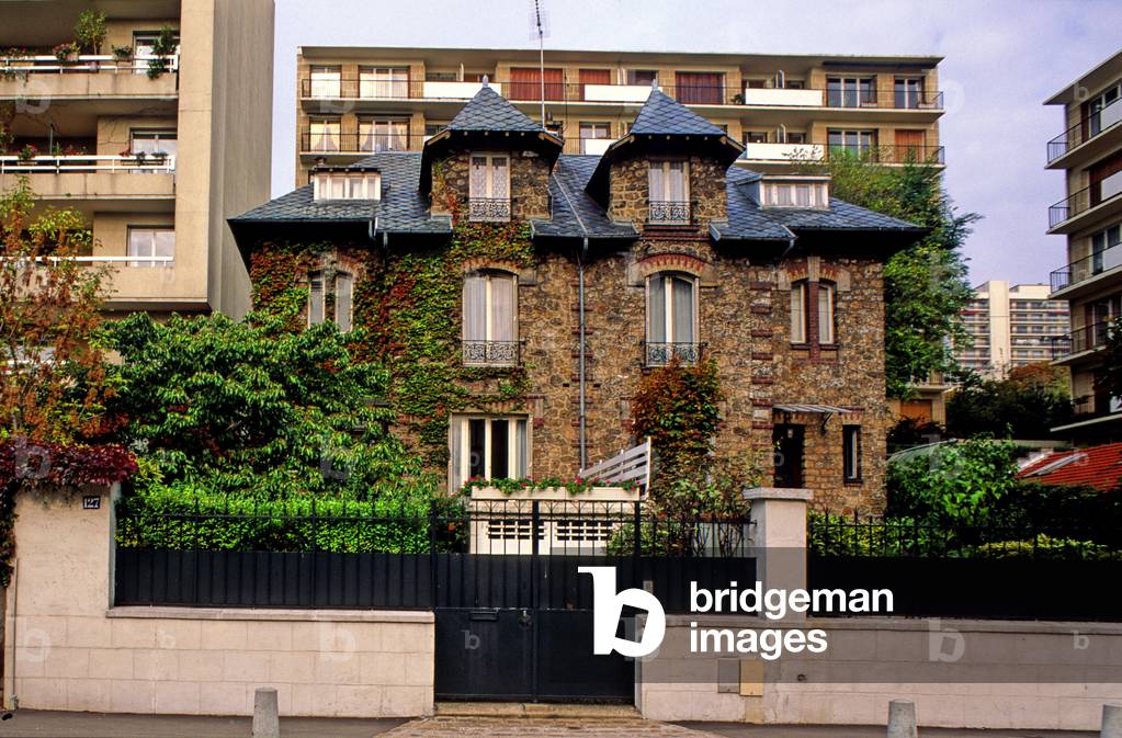
Suburbs pavilion in Courbevoie, Hauts de Seine (Hauts-de-Seine), Ile de France (Ile-De-France), France.

TEC4681846: Suburbs pavilion in Courbevoie, Hauts de Seine (Hauts-de-Seine), Ile de France (Ile-De-France), France. / Bridgeman Images
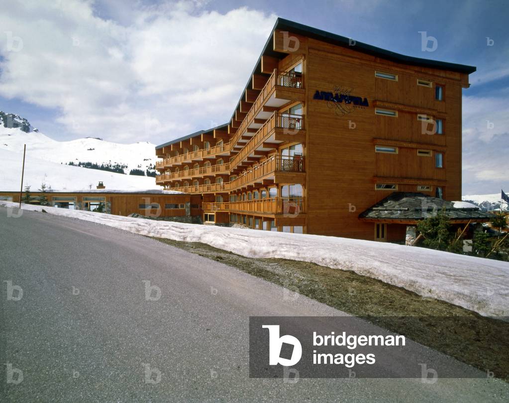
Courchevel in Savoie. Architect Architect Atelier d'Architecture en Montagne, 1947.

ITR4636563: Courchevel in Savoie. Architect Architect Atelier d'Architecture en Montagne, 1947. / Bridgeman Images


Back to top