Search options

Orientation
Colour

Display options

View

Print

To print search results, use print friendly version of this page.

2491517 Search Results

La Cour Carree du Musee du Louvre, Grand Louvre, Rue de Rivoli and Quai des Tuileries, Paris 75001. Architecture of Leoh Ming Pei in association with Michel Macary and Jean-Michel Wilmotte, 1983-2001. Photography 1998.

TEC4704396: La Cour Carree du Musee du Louvre, Grand Louvre, Rue de Rivoli and Quai des Tuileries, Paris 75001. Architecture of Leoh Ming Pei in association with Michel Macary and Jean-Michel Wilmotte, 1983-2001. Photography 1998. / Bridgeman Images

The pavilion of the Aurore of the Chateau de Sceaux (Hauts de Seine). Located in the garden behind the commons, it was built in the 17th century by Claude Perrault for Colbert. The dome painted by Le Brun represents the Aurora.

ITR4652219: The pavilion of the Aurore of the Chateau de Sceaux (Hauts de Seine). Located in the garden behind the commons, it was built in the 17th century by Claude Perrault for Colbert. The dome painted by Le Brun represents the Aurora. / Bridgeman Images

ALMA - Japanese antennas - ALMA - Japanese antennas - Two of the 12-metre Japanese antennas (ACA), June 2008, Chajnantor Plateau, Atacama Desert, Chile. View of two of the 12 - m english radiotelescope located on the 5100 meters high Chajnantor plateau in Atacama Desert, Chile. June 2008

PIX4652262: ALMA - Japanese antennas - ALMA - Japanese antennas - Two of the 12-metre Japanese antennas (ACA), June 2008, Chajnantor Plateau, Atacama Desert, Chile. View of two of the 12 - m english radiotelescope located on the 5100 meters high Chajnantor plateau in Atacama Desert, Chile. June 2008 / Bridgeman Images

Cerro Tololo Observatory - Chile - Cerro Tololo Observatory - Chile - Cerro Tololo Observatory seen from Cerro Pachon, Chile. Cerro Tololo observatory seen from Cerro Pachon. Chile

PIX4652842: Cerro Tololo Observatory - Chile - Cerro Tololo Observatory - Chile - Cerro Tololo Observatory seen from Cerro Pachon, Chile. Cerro Tololo observatory seen from Cerro Pachon. Chile / Bridgeman Images
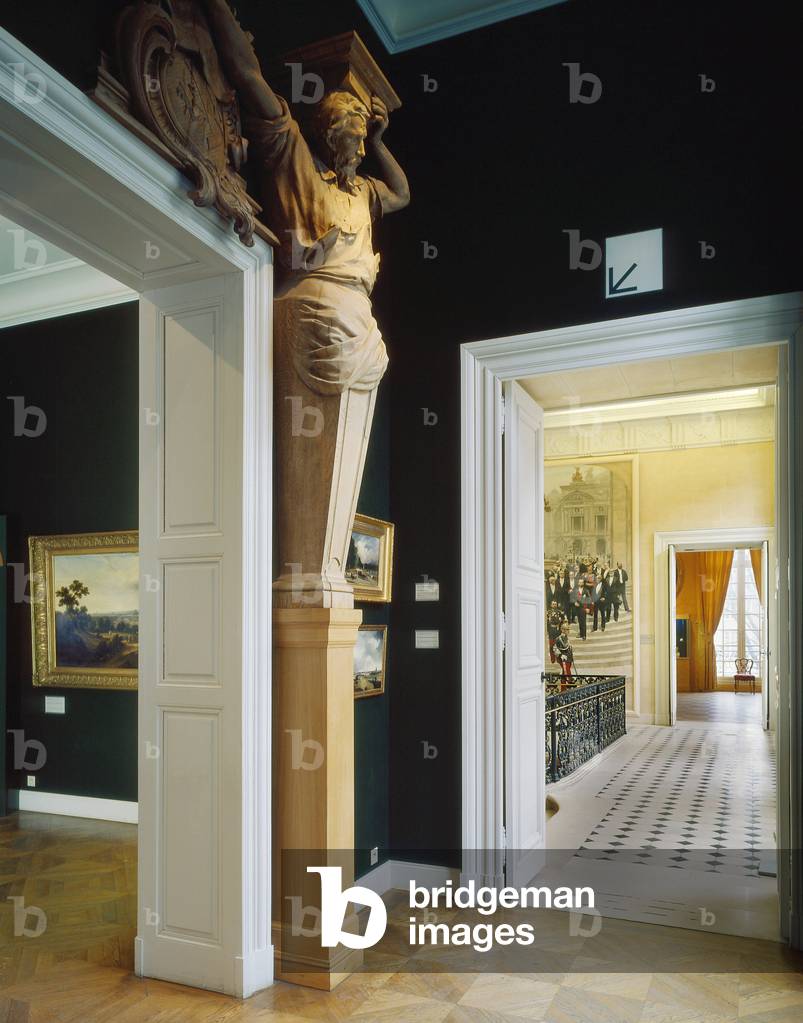
The Musee Carnavalet, 23 rue de Sevigne, Paris 75003. Architect: Nicolas Dupuis in 1548-1560 and rebuilt in 1660 by Francois Mansart. Room dedicated to the Second Empire. Photography 1992.

TEC4727344: The Musee Carnavalet, 23 rue de Sevigne, Paris 75003. Architect: Nicolas Dupuis in 1548-1560 and rebuilt in 1660 by Francois Mansart. Room dedicated to the Second Empire. Photography 1992. / Bridgeman Images

The Musee Carnavalet, 23 rue de Sevigne, Paris 75003. Architect: Nicolas Dupuis in 1548-1560 and rebuilt in 1660 by Francois Mansart. Detail of the ballroom of the Wendel hotel. Decorative set made in 1925 by the Catalan painter Jose-Maria Sert for the Wendel family mansion. Huge composition evenly covering walls and ceiling, on a silver background, representing the Depart of the Queen of Sheba going to visit King Solomon. Photography 1992

TEC4727362: The Musee Carnavalet, 23 rue de Sevigne, Paris 75003. Architect: Nicolas Dupuis in 1548-1560 and rebuilt in 1660 by Francois Mansart. Detail of the ballroom of the Wendel hotel. Decorative set made in 1925 by the Catalan painter Jose-Maria Sert for the Wendel family mansion. Huge composition evenly covering walls and ceiling, on a silver background, representing the Depart of the Queen of Sheba going to visit King Solomon. Photography 1992 / Bridgeman Images
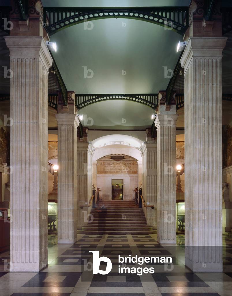
La Bibliotheque Sainte-Genevieve (Sainte Genevieve), 10 place du Pantheon, Paris 75005. Architecture by Henri Labrouste, 1845-1851.

TEC4727590: La Bibliotheque Sainte-Genevieve (Sainte Genevieve), 10 place du Pantheon, Paris 75005. Architecture by Henri Labrouste, 1845-1851. / Bridgeman Images
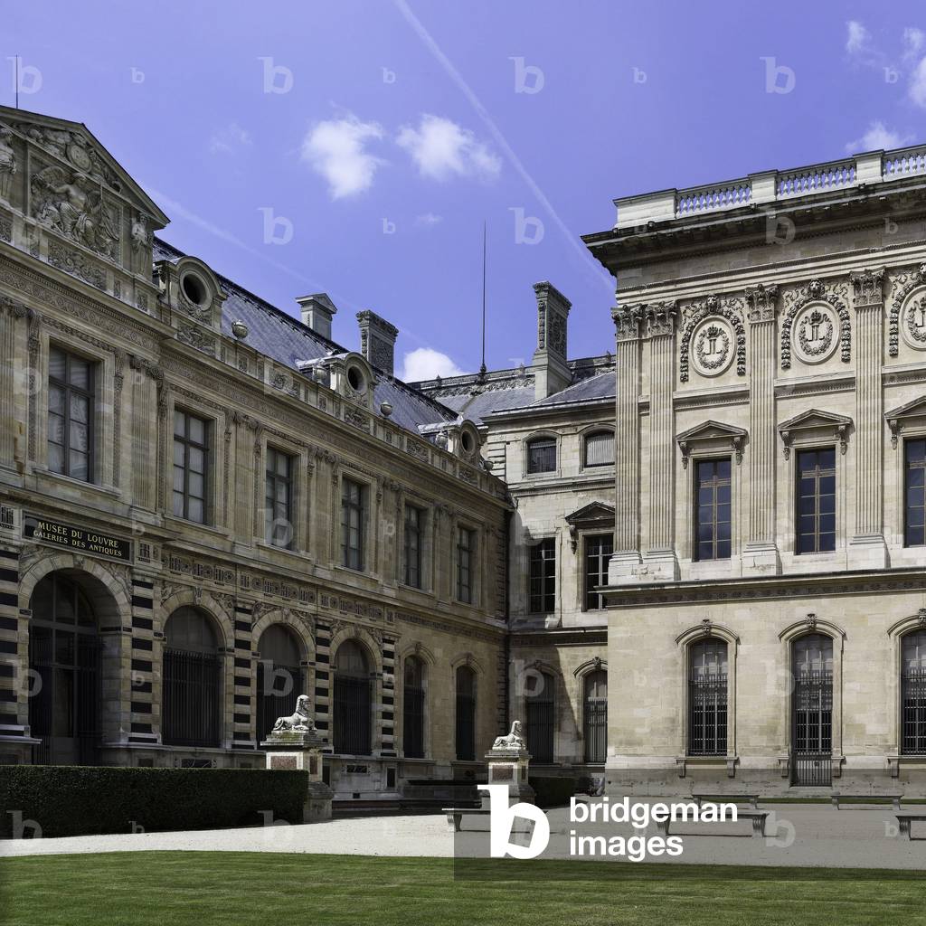
The Louvre Museum, Grand Louvre, Rue de Rivoli and Quai des Tuileries, Paris 75001. Architecture of Leoh Ming Pei in association with Michel Macary and Jean-Michel Wilmotte, 1983-2001. Photography 17/06/08

LBY4705493: The Louvre Museum, Grand Louvre, Rue de Rivoli and Quai des Tuileries, Paris 75001. Architecture of Leoh Ming Pei in association with Michel Macary and Jean-Michel Wilmotte, 1983-2001. Photography 17/06/08 / Bridgeman Images
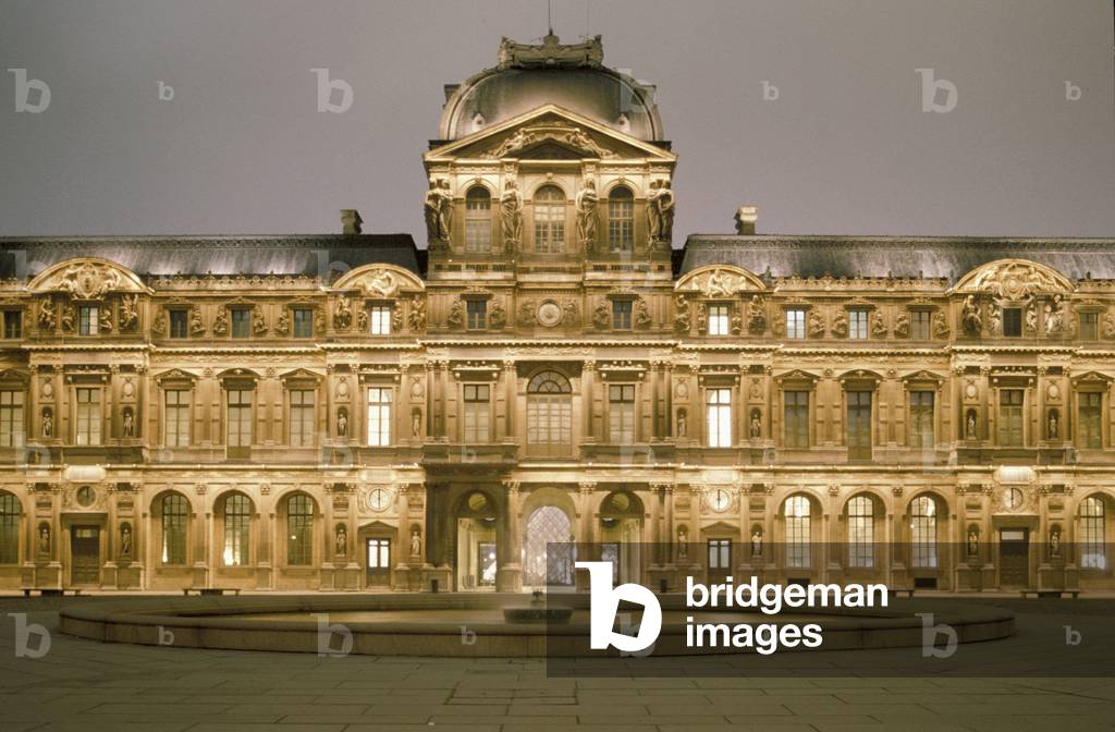
The Cour Carree du Louvre in Paris Grand Louvre, Rue de Rivoli and quai des Tuileries, Paris 75001. Architecture of Leoh Ming Pei in association with Michel Macary and Jean-Michel Wilmotte, 1983-2001. Cour Carree du Louvre, 1999.

OMG4705587: The Cour Carree du Louvre in Paris Grand Louvre, Rue de Rivoli and quai des Tuileries, Paris 75001. Architecture of Leoh Ming Pei in association with Michel Macary and Jean-Michel Wilmotte, 1983-2001. Cour Carree du Louvre, 1999. / Bridgeman Images
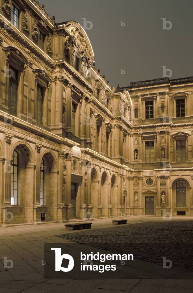
The Cour Carree du Louvre in Paris Grand Louvre, Rue de Rivoli and quai des Tuileries, Paris 75001. Architecture of Leoh Ming Pei in association with Michel Macary and Jean-Michel Wilmotte, 1983-2001. Photography Cour Carree of the Louvre Museum

OMG4705632: The Cour Carree du Louvre in Paris Grand Louvre, Rue de Rivoli and quai des Tuileries, Paris 75001. Architecture of Leoh Ming Pei in association with Michel Macary and Jean-Michel Wilmotte, 1983-2001. Photography Cour Carree of the Louvre Museum / Bridgeman Images

Gamma ray telescope HESS - Gamma rays telescope HESS - High Energy Stereoscopic System (HESS) telescope located in Namibia near Gamsberg. This network of telescopes is dedicated to the study of high energy gamma rays. High Energy Stereoscopic System or HESS is a system of Imaging Atmospheric Cherenkov Telescopes (IACT) for the investigation of cosmic gamma rays. It is located in Namibia, near Gamsberg

PIX4653270: Gamma ray telescope HESS - Gamma rays telescope HESS - High Energy Stereoscopic System (HESS) telescope located in Namibia near Gamsberg. This network of telescopes is dedicated to the study of high energy gamma rays. High Energy Stereoscopic System or HESS is a system of Imaging Atmospheric Cherenkov Telescopes (IACT) for the investigation of cosmic gamma rays. It is located in Namibia, near Gamsberg / Bridgeman Images

Mirrors of one of the gamma ray telescopes HESS - Mirror of Gamma rays telescope HESS - Telescope of the High Energy Stereoscopic System (HESS) network located in Namibia near Gamsberg. This network of telescopes is dedicated to the study of high energy gamma rays. High Energy Stereoscopic System or HESS is a system of Imaging Atmospheric Cherenkov Telescopes (IACT) for the investigation of cosmic gamma rays. It is located in Namibia, near Gamsberg

PIX4653301: Mirrors of one of the gamma ray telescopes HESS - Mirror of Gamma rays telescope HESS - Telescope of the High Energy Stereoscopic System (HESS) network located in Namibia near Gamsberg. This network of telescopes is dedicated to the study of high energy gamma rays. High Energy Stereoscopic System or HESS is a system of Imaging Atmospheric Cherenkov Telescopes (IACT) for the investigation of cosmic gamma rays. It is located in Namibia, near Gamsberg / Bridgeman Images
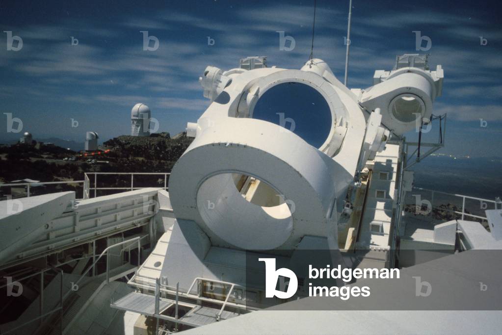
Kitt Peak Observatory - Arizona - McMath - Pierce Heliostat - Kitt Peak observatory. - Heliostat of the McMath solar telescope - Pierce. McMath - Pierce Heliosta

PIX4653474: Kitt Peak Observatory - Arizona - McMath - Pierce Heliostat - Kitt Peak observatory. - Heliostat of the McMath solar telescope - Pierce. McMath - Pierce Heliosta / Bridgeman Images
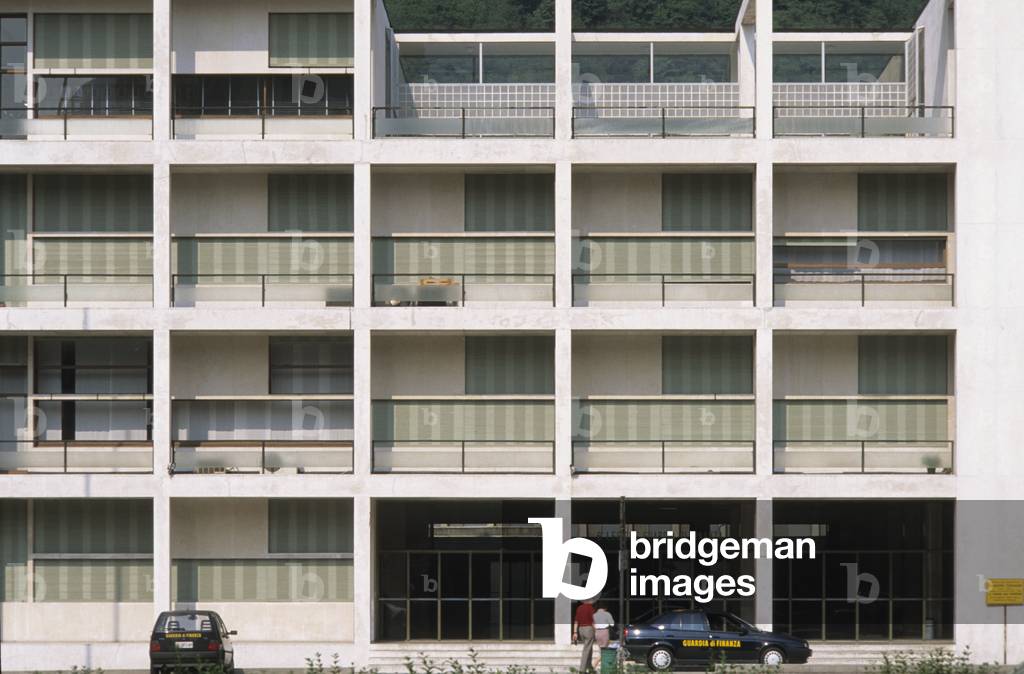
The House of the People, ex Casa del Fascio (former House of Fachism) in Come in Italy. Architect Guiseppe Terragni (1904-1943), realisation 1932-1936.

TEC4653589: The House of the People, ex Casa del Fascio (former House of Fachism) in Come in Italy. Architect Guiseppe Terragni (1904-1943), realisation 1932-1936. / Bridgeman Images

Aerial view of the city, 1990 - Photography

LRI4653640: Aerial view of the city, 1990 - Photography / Bridgeman Images

Aerial view of Bavaria with german alps, 1990 - Photography

LRI4653663: Aerial view of Bavaria with german alps, 1990 - Photography / Bridgeman Images

Aerial view of the mountain and Zugspitze in foreground, 1990 - Photography

LRI4653673: Aerial view of the mountain and Zugspitze in foreground, 1990 - Photography / Bridgeman Images

Aerial view of the highway with the city in the background, 1990 - Photography

LRI4653742: Aerial view of the highway with the city in the background, 1990 - Photography / Bridgeman Images

Aerial view of Philippsburg Nuclear Power Plant, 1990 - Photography

LRI4653990: Aerial view of Philippsburg Nuclear Power Plant, 1990 - Photography / Bridgeman Images
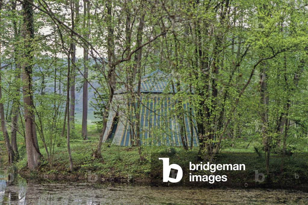
The desert of Retz to Chambourcy (Parc et jardin de Chambourcy) Desert de Retz, les Yvelines, Ile de France (Ile-de-France), France. The Desert de Retz, created between 1774 and 1789 by Monsieur de Monville, with pavilions of manure or factories of rare species to achieve the absolute of grace of that period.

TEC4728259: The desert of Retz to Chambourcy (Parc et jardin de Chambourcy) Desert de Retz, les Yvelines, Ile de France (Ile-de-France), France. The Desert de Retz, created between 1774 and 1789 by Monsieur de Monville, with pavilions of manure or factories of rare species to achieve the absolute of grace of that period. / Bridgeman Images

Lower Antelope Canyon - Textures and colors inside Lower Antelope Canyon

PIX4672687: Lower Antelope Canyon - Textures and colors inside Lower Antelope Canyon / Bridgeman Images

Lower Antelope Canyon - Textures and colors inside Lower Antelope Canyon

PIX4672712: Lower Antelope Canyon - Textures and colors inside Lower Antelope Canyon / Bridgeman Images

3 April 2016 - Canopee - Les Halles, Paris, Architects: Patrick Berger and Jacques Anziutti

OMG4672746: 3 April 2016 - Canopee - Les Halles, Paris, Architects: Patrick Berger and Jacques Anziutti / Bridgeman Images

Italy: Archeological site of Herculanum: House of Aristide: Detail base of a marble column

GYS4720223: Italy: Archeological site of Herculanum: House of Aristide: Detail base of a marble column / Bridgeman Images

Florida Shuttle View - Florida View by Shuttle STS - 95 October 199

PIX4672999: Florida Shuttle View - Florida View by Shuttle STS - 95 October 199 / Bridgeman Images

Tikal - Temple I and the constellation Orion - Tikal - Temple I and Orion constellation - Temple I or Temple of Ah Cacao or Temple of the Great Jaguar was built around 734, and rises to 47 metres in height. Tikal (or Tik'al according to modern Mayan spelling) is one of the largest archaeological sites and urban centers of the Mayan precolombian civilization. Located in what is now northern Guatemala, it was declared a UNESCO World Heritage Site in 1979. Temple I (also known as the Temple of Ah Cacao or Temple of the Great Jaguar) is a funerary pyramid dedicated to Jasaw Chan K'awil, who was entombed in the structure in AD 734, the pyramid was completed around 740 - 750. The temple rises 47 meters (154 ft) high. Tikal (or Tik'al according to the modern Mayan orthography) is one of the largest archaeological sites and urban centres of the pre-Columbian Maya civilization. It is located in the archaeological region of the Peten Basin in what is now northern Guatemala. In 1979 it was declared a UNESCO World Heritage Site

PIX4673069: Tikal - Temple I and the constellation Orion - Tikal - Temple I and Orion constellation - Temple I or Temple of Ah Cacao or Temple of the Great Jaguar was built around 734, and rises to 47 metres in height. Tikal (or Tik'al according to modern Mayan spelling) is one of the largest archaeological sites and urban centers of the Mayan precolombian civilization. Located in what is now northern Guatemala, it was declared a UNESCO World Heritage Site in 1979. Temple I (also known as the Temple of Ah Cacao or Temple of the Great Jaguar) is a funerary pyramid dedicated to Jasaw Chan K'awil, who was entombed in the structure in AD 734, the pyramid was completed around 740 - 750. The temple rises 47 meters (154 ft) high. Tikal (or Tik'al according to the modern Mayan orthography) is one of the largest archaeological sites and urban centres of the pre-Columbian Maya civilization. It is located in the archaeological region of the Peten Basin in what is now northern Guatemala. In 1979 it was declared a UNESCO World Heritage Site / Bridgeman Images

Chichen Itza - The El Caracol Observatory of Chichen Itza in Mexico. El Caracol, the observatory in Chichen Itza, Yucatan, Mexico

PIX4673284: Chichen Itza - The El Caracol Observatory of Chichen Itza in Mexico. El Caracol, the observatory in Chichen Itza, Yucatan, Mexico / Bridgeman Images

Chesapeake Bay - USA - Chesapeake Bay seen from space - Chesapeake Bay on the eastern coast of the United States houses an impact crater about 80 km in diameter buried more than 300 metres deep. This crater, dating back to 35.5 million years, was discovered in 1983. Mosaic of six photographs obtained by the Landsat-5 satellite between 2009 and 2011. In 1983 the largest impact crater of the United states of America has been discovered there. With a diameter of 80 km, this 35.5 million year - old crater is buried more than 300 meters beneath the lower part of the bay. Mosaic of six Landsat 5 images collected in July 2009 and 2011.The Washington D.C. - Baltimore - Philadelphia - New York City corridor can be clearly seen (look for silvery purple) as can the Chesapeake and Delaware Bays and the coastal Atlantic barrier islands from Fishermans Island, Virginia to Sandy Hook, New Jersey

PIX4673314: Chesapeake Bay - USA - Chesapeake Bay seen from space - Chesapeake Bay on the eastern coast of the United States houses an impact crater about 80 km in diameter buried more than 300 metres deep. This crater, dating back to 35.5 million years, was discovered in 1983. Mosaic of six photographs obtained by the Landsat-5 satellite between 2009 and 2011. In 1983 the largest impact crater of the United states of America has been discovered there. With a diameter of 80 km, this 35.5 million year - old crater is buried more than 300 meters beneath the lower part of the bay. Mosaic of six Landsat 5 images collected in July 2009 and 2011.The Washington D.C. - Baltimore - Philadelphia - New York City corridor can be clearly seen (look for silvery purple) as can the Chesapeake and Delaware Bays and the coastal Atlantic barrier islands from Fishermans Island, Virginia to Sandy Hook, New Jersey / Bridgeman Images
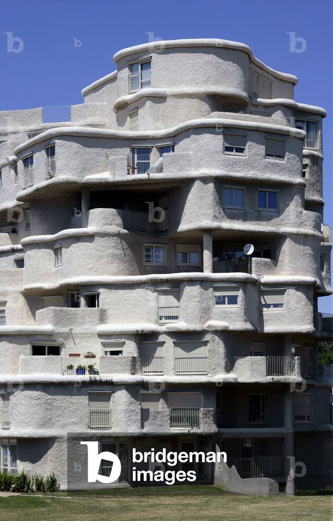
Housing cite Pasteur Montplaisir in Angers (Maine et Loire). End of construction 1976, architect Pavel Kalouguine.

TEC4673317: Housing cite Pasteur Montplaisir in Angers (Maine et Loire). End of construction 1976, architect Pavel Kalouguine. / Bridgeman Images

Hunting horn
Hunting horn

LRI4673398: Hunting horn / Bridgeman Images

New York night view - 12/2010 - New York City by night 12/2010 - New York City by night seen by the International Space Station (ISS) on December 8, 2010. New York metropolitan area at night seen from the International Space Station (ISS) on December 8, 2010

PIX4673420: New York night view - 12/2010 - New York City by night 12/2010 - New York City by night seen by the International Space Station (ISS) on December 8, 2010. New York metropolitan area at night seen from the International Space Station (ISS) on December 8, 2010 / Bridgeman Images

Lake Powell - Utah: Lake Powell, Utah, USA, seen from the International Space Station (ISS) on September 6, 2016. This panorama, photographed by an astronaut aboard the International Space Station, shows almost the full length of Lake Powell, the reservoir on the Colorado River in southern Utah and northern Arizona. Note south is at the top left of the image. Image acquired on September 6, 2016.

PIX4673489: Lake Powell - Utah: Lake Powell, Utah, USA, seen from the International Space Station (ISS) on September 6, 2016. This panorama, photographed by an astronaut aboard the International Space Station, shows almost the full length of Lake Powell, the reservoir on the Colorado River in southern Utah and northern Arizona. Note south is at the top left of the image. Image acquired on September 6, 2016. / Bridgeman Images

Corona Arch - Arches National Park - Utah - Night Sky at Corona Arch - The lactee road above Corona arch. The moon lies under the ark. The Milky Way is visible next to Corona Arch, while the Moon sets right under the arch

PIX4673621: Corona Arch - Arches National Park - Utah - Night Sky at Corona Arch - The lactee road above Corona arch. The moon lies under the ark. The Milky Way is visible next to Corona Arch, while the Moon sets right under the arch / Bridgeman Images
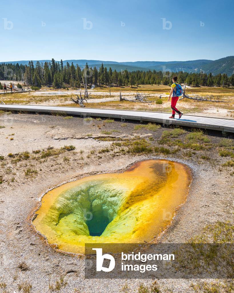
Belgian Pool - Yellowstone - 2017 - Tourist near Belgian Pool, a hot spring located in the Upper Geyser Basin of Yellowstone National Park. August 2017. A hiker walks by the Belgian Pool, in Yellowstone National Park, USA

PIX4673671: Belgian Pool - Yellowstone - 2017 - Tourist near Belgian Pool, a hot spring located in the Upper Geyser Basin of Yellowstone National Park. August 2017. A hiker walks by the Belgian Pool, in Yellowstone National Park, USA / Bridgeman Images
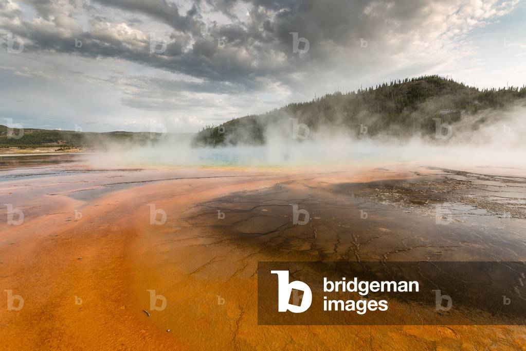
Grand Prismatic Spring - Yellowstone - 2017 - The Grand Prismatic Spring is a large heated water pool with over 70* C located in Yellowstone National Park, USA. It is the largest known American hot spring. Aug 2017

PIX4673750: Grand Prismatic Spring - Yellowstone - 2017 - The Grand Prismatic Spring is a large heated water pool with over 70* C located in Yellowstone National Park, USA. It is the largest known American hot spring. Aug 2017 / Bridgeman Images

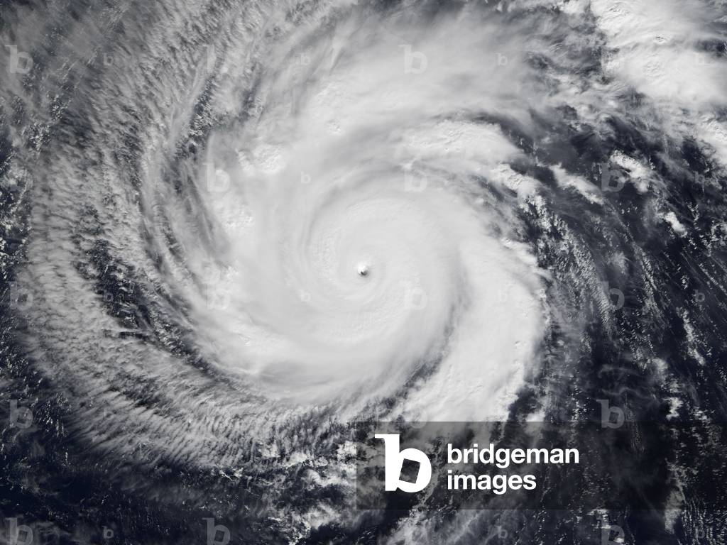
Hurricane Marilyn seen by shuttle 09/95 - Hurricane Marilyn over Puerto Rico seen by shuttle STS - 69 on 15/09/95

PIX4673781: Hurricane Marilyn seen by shuttle 09/95 - Hurricane Marilyn over Puerto Rico seen by shuttle STS - 69 on 15/09/95 / Bridgeman Images

Back to top