Search options

Orientation
Colour

Display options

View

Print

To print search results, use print friendly version of this page.

2490903 Search Results

Debut de nuit de Printemps - Beginning of a spring night - In this early night of Spring, the winter constellations lie down; from left to right, the Great Dog, Orion, the Taurus. Here, the Moon is close to the Pleiades cluster with above the brilliant planet Venus. 19 April 2007, Le Guilvinec (Finistere - France). Beginning of a spring night where winter constellations are setting. from left to right, Canis Major, Orion, Taurus. Also visible are the moon near Pleiades cluster with Venus above. April 19 2007, Le Guilvinec (Finistere - France)

PIX4594142: Debut de nuit de Printemps - Beginning of a spring night - In this early night of Spring, the winter constellations lie down; from left to right, the Great Dog, Orion, the Taurus. Here, the Moon is close to the Pleiades cluster with above the brilliant planet Venus. 19 April 2007, Le Guilvinec (Finistere - France). Beginning of a spring night where winter constellations are setting. from left to right, Canis Major, Orion, Taurus. Also visible are the moon near Pleiades cluster with Venus above. April 19 2007, Le Guilvinec (Finistere - France) / Bridgeman Images

Aquarius Constellations, Capricorn, Austral Fish and Microscope - Constellations of Aquarius, Capricorn, Piscis Austrinus, Microscopium - Field around the Aquarius constellation. The Helix planetary nebula appears as a red dot towards the center of the image. Aquarius (The Water Carrier) is a large but relatively insconspicuous southern zodiacal constellation and has an area of about 980 square degrees, which makes it the 10th largest. Its origins as a constellation can be traced back to Babylonian times and has usually been delineated as a figure pouring water from a jar in the general direction of Capricornus and Piscis Austrinus, themselves quite watery constellations. The Sun is in this part of the sky in February and March, following the Ecliptic. The constellation embraces many objects of telescopic interest, including the Helix nebula and the Mira - like variable star R Aquarii. Also notable are the globular clusters M2 (NGC 7089) and the Saturn planetary nebula NGC 7009. Best seen in the early evening in August

PIX4594319: Aquarius Constellations, Capricorn, Austral Fish and Microscope - Constellations of Aquarius, Capricorn, Piscis Austrinus, Microscopium - Field around the Aquarius constellation. The Helix planetary nebula appears as a red dot towards the center of the image. Aquarius (The Water Carrier) is a large but relatively insconspicuous southern zodiacal constellation and has an area of about 980 square degrees, which makes it the 10th largest. Its origins as a constellation can be traced back to Babylonian times and has usually been delineated as a figure pouring water from a jar in the general direction of Capricornus and Piscis Austrinus, themselves quite watery constellations. The Sun is in this part of the sky in February and March, following the Ecliptic. The constellation embraces many objects of telescopic interest, including the Helix nebula and the Mira - like variable star R Aquarii. Also notable are the globular clusters M2 (NGC 7089) and the Saturn planetary nebula NGC 7009. Best seen in the early evening in August / Bridgeman Images

Aquarius Constellations, Capricorn, Southern Fish and Microscope - Constellations of Aquarius, Capricorn, Piscis Austrinus, Microscopiu

PIX4594350: Aquarius Constellations, Capricorn, Southern Fish and Microscope - Constellations of Aquarius, Capricorn, Piscis Austrinus, Microscopiu / Bridgeman Images

Woman with green background, 19th century (watercolour)

JLJ4659442: Woman with green background, 19th century (watercolour), Guys, Constantin (1802-92) / Bridgeman Images

Lake Chad seen from space - 05/2000 - Lake Chad seen from space - 05/2000 - Lake Chad seen by space shuttle Atlantis on 24 May 2000. Lake Chad seen from space shuttle Atlantis on May 24, 2000

PIX4659469: Lake Chad seen from space - 05/2000 - Lake Chad seen from space - 05/2000 - Lake Chad seen by space shuttle Atlantis on 24 May 2000. Lake Chad seen from space shuttle Atlantis on May 24, 2000 / Bridgeman Images

Iceberg a la derive - Iceberg a la derive - View of an iceberg 69 km long by 35 km wide derivative in the South Atlantic Ocean

PIX4659517: Iceberg a la derive - Iceberg a la derive - View of an iceberg 69 km long by 35 km wide derivative in the South Atlantic Ocean / Bridgeman Images

La vallee de l'Arques, 19th century (oil on canvas)

JLJ4659562: La vallee de l'Arques, 19th century (oil on canvas), Daubigny, Charles Francois (1817-78) / Bridgeman Images

Baksei Chamkrong - Angkor - Cambodia - Baksei Chamkrong - Angkor - Cambodia - Khmer Temple of the Angkor Group with Moon. American night. Double Exposure. Hindu temple in Angkor. Day for night shoot, double exposure

PIX4659835: Baksei Chamkrong - Angkor - Cambodia - Baksei Chamkrong - Angkor - Cambodia - Khmer Temple of the Angkor Group with Moon. American night. Double Exposure. Hindu temple in Angkor. Day for night shoot, double exposure / Bridgeman Images
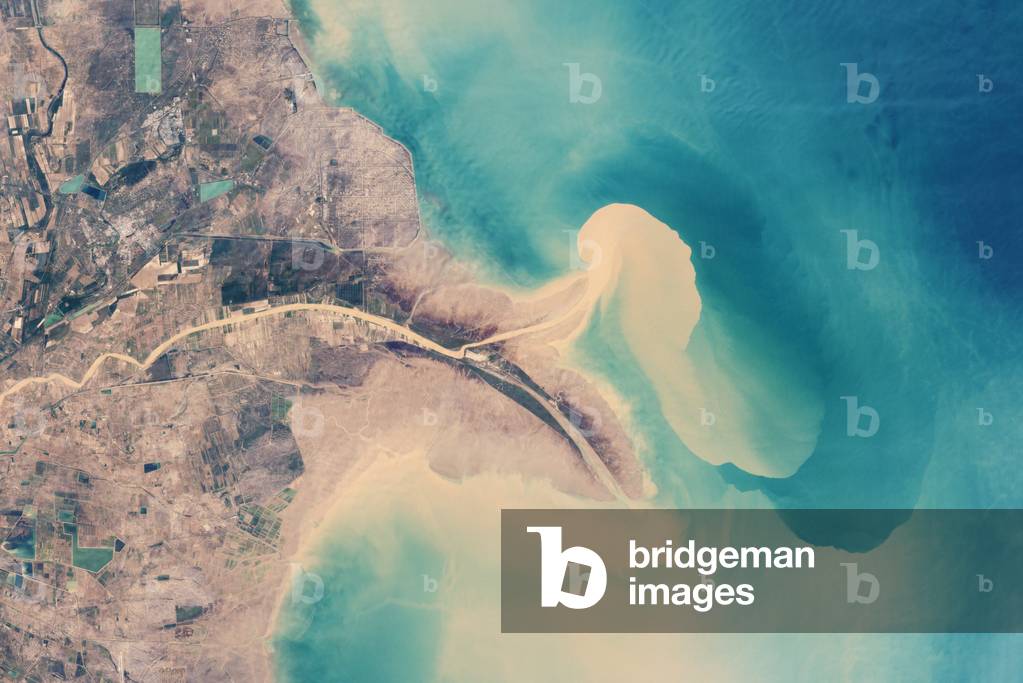
China - Yellow River Delta in 1999 - China - Yellow River delta in 1999 - Huang He is the second longest river in China and the most sediments-loaded river in the world. On his journey from Tibet, he erodes more than a million tons of sediments every year and takes on alluvial or his nickname the Yellow River. It flows into the Yellow Sea, via the Gulf of Bohai, where its delta extends over 36,000 km. In 1996, Chinese engineers derive the river causing a withdrawal of the delta and the formation of a new peninsula to the north. Image obtained by one of the Landsat satellites in 1999. China's Huang He (Yellow River) is the most sediment - filled river on Earth. In the lower reaches, where the current slows, the natural accumulation of sediment in the riverbed has caused the river to change course often in the past. Since the mid-nineteenth century, however, the lower reaches of the river and the delta have been extensively engineered to control flooding and to protect coastal development. This natural - color image from Nasa's Landsat satellite shows the Yellow River Delta at the river mouth in 1999. In 1989, the river's main channel emptied into the Bohai Sea in a southeast - bending arc. In 1996, Chinese engineers blocked the main channel and forced the river to veer northeast. By 1999, erosion and settling along the old channel caused the tip of the delta to retreat, while a new peninsula had formed to the north

PIX4659895: China - Yellow River Delta in 1999 - China - Yellow River delta in 1999 - Huang He is the second longest river in China and the most sediments-loaded river in the world. On his journey from Tibet, he erodes more than a million tons of sediments every year and takes on alluvial or his nickname the Yellow River. It flows into the Yellow Sea, via the Gulf of Bohai, where its delta extends over 36,000 km. In 1996, Chinese engineers derive the river causing a withdrawal of the delta and the formation of a new peninsula to the north. Image obtained by one of the Landsat satellites in 1999. China's Huang He (Yellow River) is the most sediment - filled river on Earth. In the lower reaches, where the current slows, the natural accumulation of sediment in the riverbed has caused the river to change course often in the past. Since the mid-nineteenth century, however, the lower reaches of the river and the delta have been extensively engineered to control flooding and to protect coastal development. This natural - color image from Nasa's Landsat satellite shows the Yellow River Delta at the river mouth in 1999. In 1989, the river's main channel emptied into the Bohai Sea in a southeast - bending arc. In 1996, Chinese engineers blocked the main channel and forced the river to veer northeast. By 1999, erosion and settling along the old channel caused the tip of the delta to retreat, while a new peninsula had formed to the north / Bridgeman Images

Saturn seen by the Cassini probe 04/2007 - Saturn from Cassini spacecraft 04/2007 - Image obtained by the Cassini probe on 13 April 2007 at a distance of 1.8 million km from the planet. Colorful Saturn tilts its darkened ringplane towards Cassini. Against the dark sky, the rings are made visible by the light that scatters through them towards the camera. The F ring shepherd moon Pandora (84 kilometers, or 52 miles across) is faintly visible at the top, left of center. Pandora's brightness was increased by a factor of three to aid its visibility. This view looks toward the unilluminated side of the rings from about 18 degrees above the ringplane. The planet is visible through the innermost and outermost portions of the rings. The images were obtained by the Cassini spacecraft wide - angle camera on April 13, 2007, at a distance of approximately 1.8 million kilometers (1.1 million miles) from Saturn

PIX4625102: Saturn seen by the Cassini probe 04/2007 - Saturn from Cassini spacecraft 04/2007 - Image obtained by the Cassini probe on 13 April 2007 at a distance of 1.8 million km from the planet. Colorful Saturn tilts its darkened ringplane towards Cassini. Against the dark sky, the rings are made visible by the light that scatters through them towards the camera. The F ring shepherd moon Pandora (84 kilometers, or 52 miles across) is faintly visible at the top, left of center. Pandora's brightness was increased by a factor of three to aid its visibility. This view looks toward the unilluminated side of the rings from about 18 degrees above the ringplane. The planet is visible through the innermost and outermost portions of the rings. The images were obtained by the Cassini spacecraft wide - angle camera on April 13, 2007, at a distance of approximately 1.8 million kilometers (1.1 million miles) from Saturn / Bridgeman Images

Princess Shirin receives Farhad in her Persian castle, 16th century Louvre, 16th century (miniature)

JLJ4659981: Princess Shirin receives Farhad in her Persian castle, 16th century Louvre, 16th century (miniature), Persian School, (16th century) / Bridgeman Images
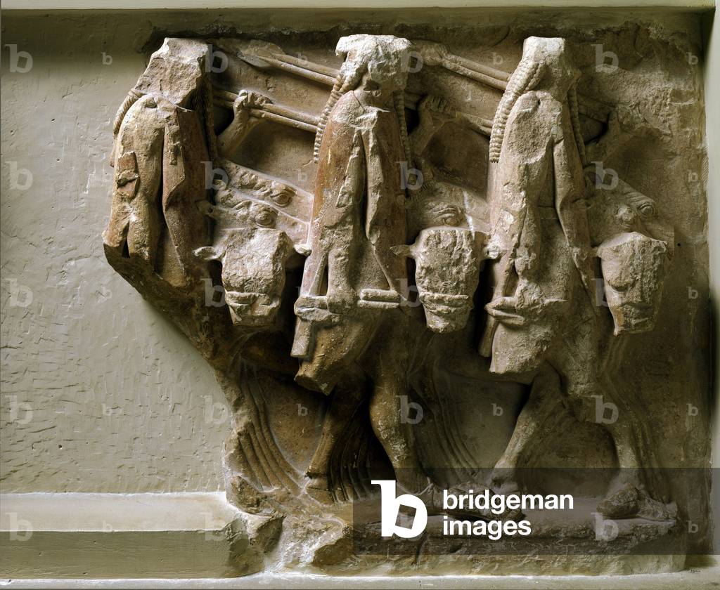
Greek art: representation of Castor, Pollux and Idas. Carved relief of the Tresor of Sicyone (or Sicyonians). 560 BC. Delphi, archeological museum

LRI4660085: Greek art: representation of Castor, Pollux and Idas. Carved relief of the Tresor of Sicyone (or Sicyonians). 560 BC. Delphi, archeological museum, Greek school, (6th century BC) / Bridgeman Images

Jeju volcanic island, South Korea - Jeju volcanic island, South Korea - Jeju volcanic island seen by Landsat satellite - 7 on April 6, 2000. This island, classified as a World Heritage Site, is home to the highest peak of South Korea, Mount Halla (1950 m), a volcano shield whose last eruption dates back to 1007. Cheju Island, is an oval - shaped volcanic landmass covering 1,845 square kilometers (712 square miles) off the southern tip of the Korean Peninsula. Geologists estimate the island's age at 2 million years, and archaeological finds suggest that people have lived on the island since prehistoric times. Today, Cheju is both a tourist attraction and home to an UNESCO World Heritage site. The Enhanced Thematic Mapper Plus on Nasa's Landsat - 7 satellite captured this image of Cheju Island on April 6, 2000. In this photo - like image, cloudless skies allow a clear view of the island and the swirling blue hues of the surrounding waters. Urbanized areas, such as the capital city, Cheju, appear in shades of gray - beige along the island's perimeter. Inland, a combination of natural vegetation, cultivated fields, and bare ground creates a patchwork of tan and green. The island's dominant feature is Halla Mountain, a volcano whose last recorded eruption occurred in the year 1007. Halla Mountain is a shield volcano with a low, broad profile resembling an ancient warrior shield. It is one of the world's few shield volcanoes located over a magma hotspot”” on a stationary plate of continental crust. Rising to a height of 1,950 meters (6,398 feet), Halla Mountain is the highest peak in South Korea, and the volcano's crater holds a natural lake and numerous waterfalls. Lava tubes from the volcano have formed a network of caves complete with lava walls with carbonate rock formations. The rarity of these features combined with their instructiveness about volcanic processes has earned the site its World Heritage status.

PIX4660095: Jeju volcanic island, South Korea - Jeju volcanic island, South Korea - Jeju volcanic island seen by Landsat satellite - 7 on April 6, 2000. This island, classified as a World Heritage Site, is home to the highest peak of South Korea, Mount Halla (1950 m), a volcano shield whose last eruption dates back to 1007. Cheju Island, is an oval - shaped volcanic landmass covering 1,845 square kilometers (712 square miles) off the southern tip of the Korean Peninsula. Geologists estimate the island's age at 2 million years, and archaeological finds suggest that people have lived on the island since prehistoric times. Today, Cheju is both a tourist attraction and home to an UNESCO World Heritage site. The Enhanced Thematic Mapper Plus on Nasa's Landsat - 7 satellite captured this image of Cheju Island on April 6, 2000. In this photo - like image, cloudless skies allow a clear view of the island and the swirling blue hues of the surrounding waters. Urbanized areas, such as the capital city, Cheju, appear in shades of gray - beige along the island's perimeter. Inland, a combination of natural vegetation, cultivated fields, and bare ground creates a patchwork of tan and green. The island's dominant feature is Halla Mountain, a volcano whose last recorded eruption occurred in the year 1007. Halla Mountain is a shield volcano with a low, broad profile resembling an ancient warrior shield. It is one of the world's few shield volcanoes located over a magma hotspot”” on a stationary plate of continental crust. Rising to a height of 1,950 meters (6,398 feet), Halla Mountain is the highest peak in South Korea, and the volcano's crater holds a natural lake and numerous waterfalls. Lava tubes from the volcano have formed a network of caves complete with lava walls with carbonate rock formations. The rarity of these features combined with their instructiveness about volcanic processes has earned the site its World Heritage status. / Bridgeman Images

Greek art: chisel gold plate used to decorate an ivory statue. 560 BC. Delphi, archeological museum

LRI4660183: Greek art: chisel gold plate used to decorate an ivory statue. 560 BC. Delphi, archeological museum, Greek school, (6th century BC) / Bridgeman Images

Japet, satellite of Saturn, seen by Cassini - Crescent of Iapetus seen by Cassini spacecraft. - Mosaic in fake colors of Japet, a satellite of 1436 kilometers in diameter, taken by the Cassini probe on 10 September 2007 has a distance of 83 000 km from the satellite. Iapetus, 1,468 kilometers (912 miles) across, seen here in false color, is unique in its dramatic variation in brightness between the northern polar region and the middle and low latitudes. Equally prominent is the moon's equatorial ridge of towering mountains. The profile of the ridge against the darkness of space reveals that it is topped by a cratered plateau approximately 15 kilometers (9 miles) wide. Further west, the profile of the ridge changes from a long plateau to discrete peaks. The mosaic consists of four image footprints across the surface of Iapetus and has a resolution of 489 meters (0.3 miles) per pixel. The color seen in this view represents an expansion of the wavelength region of the electromagnetic spectrum visible to human eyes. The intense reddish - brown hue of the dark material is far less pronounced in true color images. The use of enhanced color makes the reddish character of the dark material more visible than it would be to the naked eye. In addition, the scene has been brightened to improve the visibility of surface features. This view was acquired with the Cassini spacecraft narrow - angle camera on Sept. 10, 2007, at a distance of about 83,000 kilometers (51,600 miles) from Iapetus

PIX4625407: Japet, satellite of Saturn, seen by Cassini - Crescent of Iapetus seen by Cassini spacecraft. - Mosaic in fake colors of Japet, a satellite of 1436 kilometers in diameter, taken by the Cassini probe on 10 September 2007 has a distance of 83 000 km from the satellite. Iapetus, 1,468 kilometers (912 miles) across, seen here in false color, is unique in its dramatic variation in brightness between the northern polar region and the middle and low latitudes. Equally prominent is the moon's equatorial ridge of towering mountains. The profile of the ridge against the darkness of space reveals that it is topped by a cratered plateau approximately 15 kilometers (9 miles) wide. Further west, the profile of the ridge changes from a long plateau to discrete peaks. The mosaic consists of four image footprints across the surface of Iapetus and has a resolution of 489 meters (0.3 miles) per pixel. The color seen in this view represents an expansion of the wavelength region of the electromagnetic spectrum visible to human eyes. The intense reddish - brown hue of the dark material is far less pronounced in true color images. The use of enhanced color makes the reddish character of the dark material more visible than it would be to the naked eye. In addition, the scene has been brightened to improve the visibility of surface features. This view was acquired with the Cassini spacecraft narrow - angle camera on Sept. 10, 2007, at a distance of about 83,000 kilometers (51,600 miles) from Iapetus / Bridgeman Images

Mangrove of Hara (Iran) from space - Tidal channels near Iran's Qeshm Island - Reflections of the Sun on rivers crossing the mangrove of Hara (Qeshm Island, Iran). Image obtained on 30 May 2009 from the International Space Station (ISS). Sunglint on Hara Biosphere Reserve, the largest stretch of mangrove forest along the Persian Gulf shoreline. Image taken from the International space station (ISS) on May 30, 2009

PIX4660571: Mangrove of Hara (Iran) from space - Tidal channels near Iran's Qeshm Island - Reflections of the Sun on rivers crossing the mangrove of Hara (Qeshm Island, Iran). Image obtained on 30 May 2009 from the International Space Station (ISS). Sunglint on Hara Biosphere Reserve, the largest stretch of mangrove forest along the Persian Gulf shoreline. Image taken from the International space station (ISS) on May 30, 2009 / Bridgeman Images

Holy Grail Procession. Miniature from

JLJ4660590: Holy Grail Procession. Miniature from " Tale du Grail", (Folio 18v, detail), 1330 (miniature), Unknown Artist, (14th century) / Bridgeman Images

Cloture of the Church of Augerolles. Listen. National Renaissance Museum (photo)

JLJ4613449: Cloture of the Church of Augerolles. Listen. National Renaissance Museum (photo), French School / Bridgeman Images

The Large Magellanic Cloud - The Large Magellanic Cloud - The Great Magellan Cloud galaxy is about 160,000 light years away from Earth in the southern constellation of Bream. Visible with the naked eye in the southern hemishere it is one of the closest galaxies to ours. The irregular galaxy Large Magellanic Cloud (LMC) is located at a distance of 160,000 light years in the southern constellation of Dorado. It is one of the nearest galaxy, visible to naked eye

PIX4613476: The Large Magellanic Cloud - The Large Magellanic Cloud - The Great Magellan Cloud galaxy is about 160,000 light years away from Earth in the southern constellation of Bream. Visible with the naked eye in the southern hemishere it is one of the closest galaxies to ours. The irregular galaxy Large Magellanic Cloud (LMC) is located at a distance of 160,000 light years in the southern constellation of Dorado. It is one of the nearest galaxy, visible to naked eye / Bridgeman Images

Ceramic plate of Deruta decoree with a portrait of a woman. c.1510 Sevres, 1510 (porcelain)

JLJ4613521: Ceramic plate of Deruta decoree with a portrait of a woman. c.1510 Sevres, 1510 (porcelain), Italian School, (16th century) / Bridgeman Images

Persian art: polychrome conical bowl on a blue background depicting a prince sitting on his trone between two pages (object)

JLJ4613580: Persian art: polychrome conical bowl on a blue background depicting a prince sitting on his trone between two pages (object), Persian School / Bridgeman Images

Jupiter entrusts Bacchus to Mercure Drawing with brown wash and blood, 17th century (drawing)

JLJ4613593: Jupiter entrusts Bacchus to Mercure Drawing with brown wash and blood, 17th century (drawing), Canuti, Domenico Maria (1620-1684) / Bridgeman Images
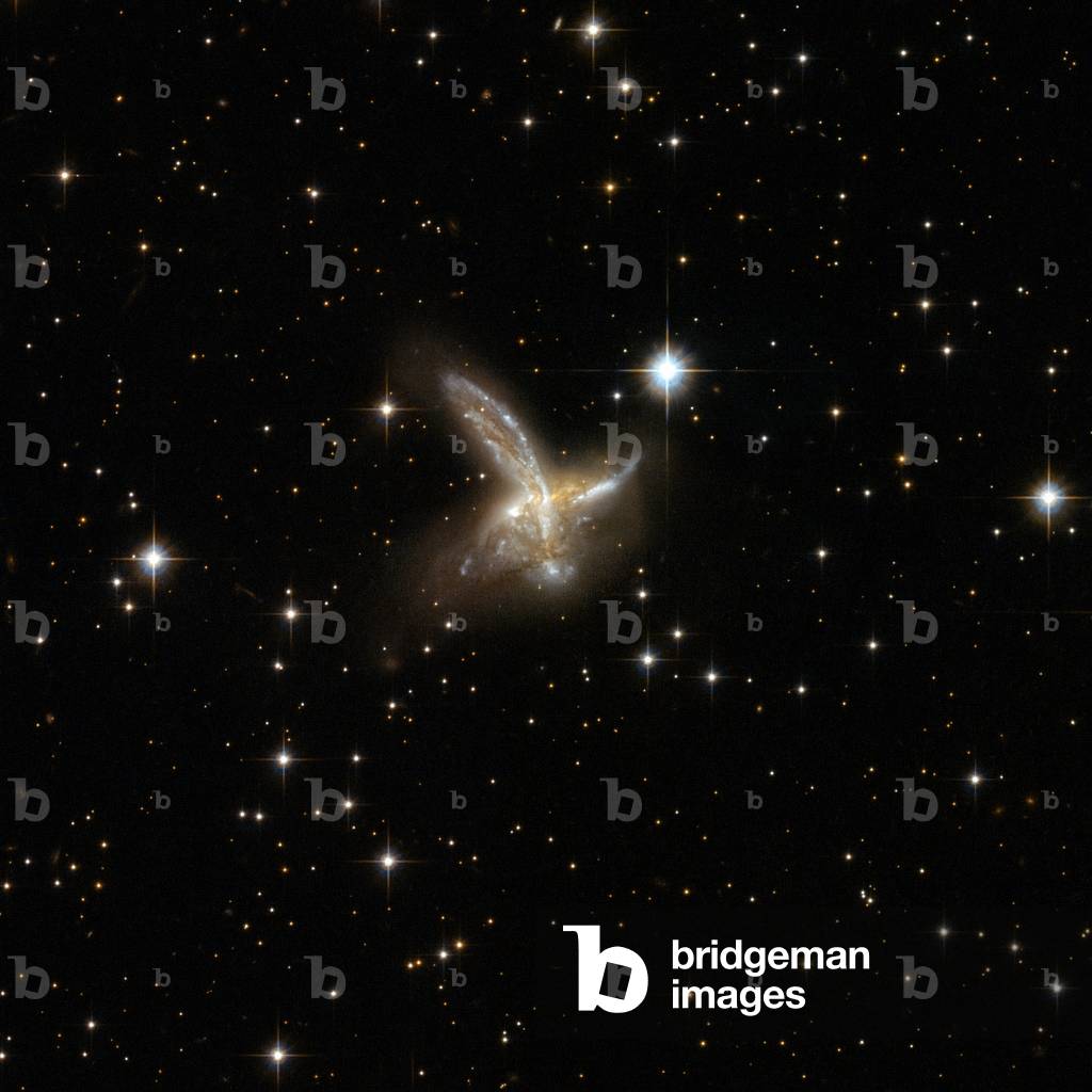
Interacting galaxies ESO 593 - 8 in Sagittarius - Interacting galaxies ESO 593 - 8 in Sagittarius - The galaxy ESO 593 - 8 is located about 650 million years away from Earth. It's a pair of interacting galaxies that will probably merge into a single galaxy. Regions of intense star formations appear in blue. Image obtained by the Hubble Space Telescope on 19 March 2002. ESO 593 - 8 is an impressive pair of interacting galaxies with a feather - like galaxy crossing a companion galaxy. The two components will probably merge to form a single galaxy in the future. The pair is adorned with a number of bright blue star clusters. ESO 593 - 8 is located in the constellation of Sagittarius, the Archer, some 650 million light - years away from Earth. Image taken by the Hubble space telescope on march 19, 2002

PIX4613620: Interacting galaxies ESO 593 - 8 in Sagittarius - Interacting galaxies ESO 593 - 8 in Sagittarius - The galaxy ESO 593 - 8 is located about 650 million years away from Earth. It's a pair of interacting galaxies that will probably merge into a single galaxy. Regions of intense star formations appear in blue. Image obtained by the Hubble Space Telescope on 19 March 2002. ESO 593 - 8 is an impressive pair of interacting galaxies with a feather - like galaxy crossing a companion galaxy. The two components will probably merge to form a single galaxy in the future. The pair is adorned with a number of bright blue star clusters. ESO 593 - 8 is located in the constellation of Sagittarius, the Archer, some 650 million light - years away from Earth. Image taken by the Hubble space telescope on march 19, 2002 / Bridgeman Images

Persian Art: bronze rider with round shield on the back, Style Amlach 8th century BC (bronze)

JLJ4613676: Persian Art: bronze rider with round shield on the back, Style Amlach 8th century BC (bronze), Persian School, (8th Century BC) / Bridgeman Images

Team of the STS-121 mission in the space station - European astronaut Thomas Reiter at the bottom of the picture poses with the crew of the STS-121 mission aboard the space station. On his right and clockwise: Michael Fossum, Lisa Nowak, Steven Lindsey, Mark Kelly, Stephanie Wilson, Piers Sellers. 13 July 2006 Space Shuttle Discovery took this crew into space from 4 to 17 July 2006. Mission STS-12

PIX4648945: Team of the STS-121 mission in the space station - European astronaut Thomas Reiter at the bottom of the picture poses with the crew of the STS-121 mission aboard the space station. On his right and clockwise: Michael Fossum, Lisa Nowak, Steven Lindsey, Mark Kelly, Stephanie Wilson, Piers Sellers. 13 July 2006 Space Shuttle Discovery took this crew into space from 4 to 17 July 2006. Mission STS-12 / Bridgeman Images

Battle of Lissa, July 20, 1866 (engraving, 19th century)

LRI4648949: Battle of Lissa, July 20, 1866 (engraving, 19th century), Unknown Artist, (19th century) / Bridgeman Images

Hubble deep field north - Hubble Deep Field North - North of the constellation of the Great Bear, the Hubble space telescope posed 75h to obtain this image of the distant universe. More than 1500 galaxies distant from 1 to 12 billion years - light are visible in this image. From Earth, the target field is the one “” that one would see through the eye of a needle held at arm's length.” If the distribution of galaxies over the entire Celestial vault were similar to this field, the number of galaxies observable up to magnitude 30 would be 50 billion. Representing a narrow “” keyhole”” view all the way to the visible horizon of the universe, the HDF image covers a speck of sky 1/30th the diameter of the full Moon. This is so narrow, just a few foreground stars in our Milky Way galaxy are visible and are vastly outnumbered by the menagerie of far more distant galaxies, some nearly as faint as 30th magnitude, or nearly four billion times fainter than the limits of human vision. Although the field is a very small sample of sky area it is considered representative of the typical distribution of galaxies in space because the universe, statistically, looks the same in all directions. The image was assembled from many separate exposures with the Wide Field and Planetary Camera 2 for ten consecutive days between December 18 to 28, 1995

PIX4613757: Hubble deep field north - Hubble Deep Field North - North of the constellation of the Great Bear, the Hubble space telescope posed 75h to obtain this image of the distant universe. More than 1500 galaxies distant from 1 to 12 billion years - light are visible in this image. From Earth, the target field is the one “” that one would see through the eye of a needle held at arm's length.” If the distribution of galaxies over the entire Celestial vault were similar to this field, the number of galaxies observable up to magnitude 30 would be 50 billion. Representing a narrow “” keyhole”” view all the way to the visible horizon of the universe, the HDF image covers a speck of sky 1/30th the diameter of the full Moon. This is so narrow, just a few foreground stars in our Milky Way galaxy are visible and are vastly outnumbered by the menagerie of far more distant galaxies, some nearly as faint as 30th magnitude, or nearly four billion times fainter than the limits of human vision. Although the field is a very small sample of sky area it is considered representative of the typical distribution of galaxies in space because the universe, statistically, looks the same in all directions. The image was assembled from many separate exposures with the Wide Field and Planetary Camera 2 for ten consecutive days between December 18 to 28, 1995 / Bridgeman Images

Steamer British Queen in 1840 (19th century print)

LRI4649019: Steamer British Queen in 1840 (19th century print), Unknown Artist, (19th century) / Bridgeman Images
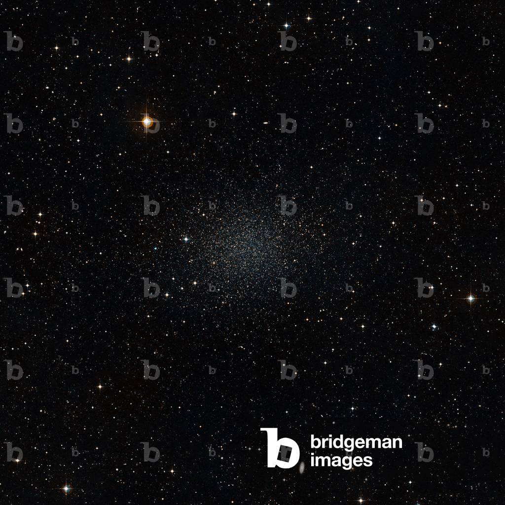
Sculptor's Dwarf Galaxy - Sculptor dwarf galaxy - The Sculptor's dwarf galaxy belongs to the local group, just like our galaxy or the Andromede galaxy. The Sculptor dwarf galaxy is one of our Milky Way's neighbouring dwarf galaxies. The Milky Way is, like all large galaxies, thought to have formed from smaller galaxies in the early days of the Universe. These small galaxies should also contain many very old stars, just as the Milky Way does, and a team of astronomers has now shown that this is indeed the case. This image was composed from data from the Digitized Sky Survey 2

PIX4613898: Sculptor's Dwarf Galaxy - Sculptor dwarf galaxy - The Sculptor's dwarf galaxy belongs to the local group, just like our galaxy or the Andromede galaxy. The Sculptor dwarf galaxy is one of our Milky Way's neighbouring dwarf galaxies. The Milky Way is, like all large galaxies, thought to have formed from smaller galaxies in the early days of the Universe. These small galaxies should also contain many very old stars, just as the Milky Way does, and a team of astronomers has now shown that this is indeed the case. This image was composed from data from the Digitized Sky Survey 2 / Bridgeman Images

Seventh Crusade: King of France Saint Louis (1214-1270), 15th century (miniature)

JLJ4649126: Seventh Crusade: King of France Saint Louis (1214-1270), 15th century (miniature), Fouquet, Jean (c.1420-80) / Bridgeman Images

The coach (diligence) connecting Birmingham to London, 19th century (litho)

JLJ4664166: The coach (diligence) connecting Birmingham to London, 19th century (litho), English School, (19th century) / Bridgeman Images

Ornithocheirus - Ornithocheirus giganteus is a flying reptile of the order Pterosaurs and the family Ornithocheirides. With a wingspan of 12 metres, he lived in the cretace. Soaring through Cretaceous British airspace, Ornithocheirus giganteus was a huge pterosaur with a 12 m wingspan

PIX4664241: Ornithocheirus - Ornithocheirus giganteus is a flying reptile of the order Pterosaurs and the family Ornithocheirides. With a wingspan of 12 metres, he lived in the cretace. Soaring through Cretaceous British airspace, Ornithocheirus giganteus was a huge pterosaur with a 12 m wingspan / Bridgeman Images

Egyptian antiquite: palette and wooden scribe box (wood)

JLJ4664260: Egyptian antiquite: palette and wooden scribe box (wood), Egyptian School / Bridgeman Images

Elasmotherium and White Rhinoceros - Comparison - Elasmotherium and Rhino Compared - An adult Elasmotherium that lived 2 million years ago is compared to today's adult White Rhinoceros (Ceratotherium simum). Elasmotherium was 2.1 metres high at withers and weighed 3.6 tonnes, while white rhinoceros was 1.8 metres high at withers and 3.2 tonnes. An adult Elasmotherium from 2 million years ago is compared to a modern adult White Rhinoceros (Ceratotherium simum). The Elasmotherium is over 7 feet tall at the shoulder and weighs 8,000 pounds*, while the White Rhinoceros is 6 feet tall at the shoulder and weighs 7,000 pounds.* Values are estimates only based upon available paleontological data

PIX4664296: Elasmotherium and White Rhinoceros - Comparison - Elasmotherium and Rhino Compared - An adult Elasmotherium that lived 2 million years ago is compared to today's adult White Rhinoceros (Ceratotherium simum). Elasmotherium was 2.1 metres high at withers and weighed 3.6 tonnes, while white rhinoceros was 1.8 metres high at withers and 3.2 tonnes. An adult Elasmotherium from 2 million years ago is compared to a modern adult White Rhinoceros (Ceratotherium simum). The Elasmotherium is over 7 feet tall at the shoulder and weighs 8,000 pounds*, while the White Rhinoceros is 6 feet tall at the shoulder and weighs 7,000 pounds.* Values are estimates only based upon available paleontological data / Bridgeman Images

Portrait of Jean Baptiste Colbert (1651-1690), 1676 (oil on canvas)

JLJ4664442: Portrait of Jean Baptiste Colbert (1651-1690), 1676 (oil on canvas), Nattier, Jean-Marc (1685-1766) / Bridgeman Images

Portrait of lace An old woman smiling with a pair of lorgnons in front of her work. Painting of the Venetian school. 19th century Venice, Correr museum

LRI4664589: Portrait of lace An old woman smiling with a pair of lorgnons in front of her work. Painting of the Venetian school. 19th century Venice, Correr museum, Italian School, (19th century) / Bridgeman Images


Back to top