2490903 Search Results

JLJ4625140: Cover of the book "Bayard" by Theodore Cahu (engraving), Semant, Paul de (1855-1915) / Bridgeman Images

PIX4625214: Saturn seen by the Cassini probe on 23/07/2008 - Saturn seen by Cassini spacecraft on july 23 2008 - Saturn seen by the Cassini probe on 23 July 2008 at a distance of 1.1 million km from the planet. Mosaic of 30 images. Several satellites are visible in this image: Titan, Janus, Mimas, Pandora, Epimethee and Enceladus. As Saturn advances in its orbit toward equinox and the sun gradually moves northward on the planet, the motion of Saturn's ring shadows and the changing colors of its atmosphere continue to transform the face of Saturn as seen by Cassini. This captivating natural color view was created from images collected shortly after Cassini began its extended Equinox Mission in July 2008. This mosaic combines 30 images - - 10 each of red, green and blue light - - taken over the course of approximately two hours as Cassini panned its wide - angle camera across the entire planet and ring system on July 23, 2008, from a southerly elevation of 6 degrees. Six moons complete this constructed panorama: Titan (5,150 kilometers, or 3,200 miles, across), Janus (179 kilometers, or 111 miles, across), Mimas (396 kilometers, or 246 miles, across), Pandora (81 kilometers, or 50 miles, across), Epimetheus (113 kilometers, or 70 miles, across) and Enceladus (504 kilometers, or 313 miles, across). Nasa's Cassini spacecraft captured these images at a distance of approximately 1.1 million kilometers (690,000 miles) from Saturn and at a sun - Saturn - spacecraft, or phase, angle of 20 degrees. Image scale is 70 kilometers (43.6 miles) per pixel / Bridgeman Images
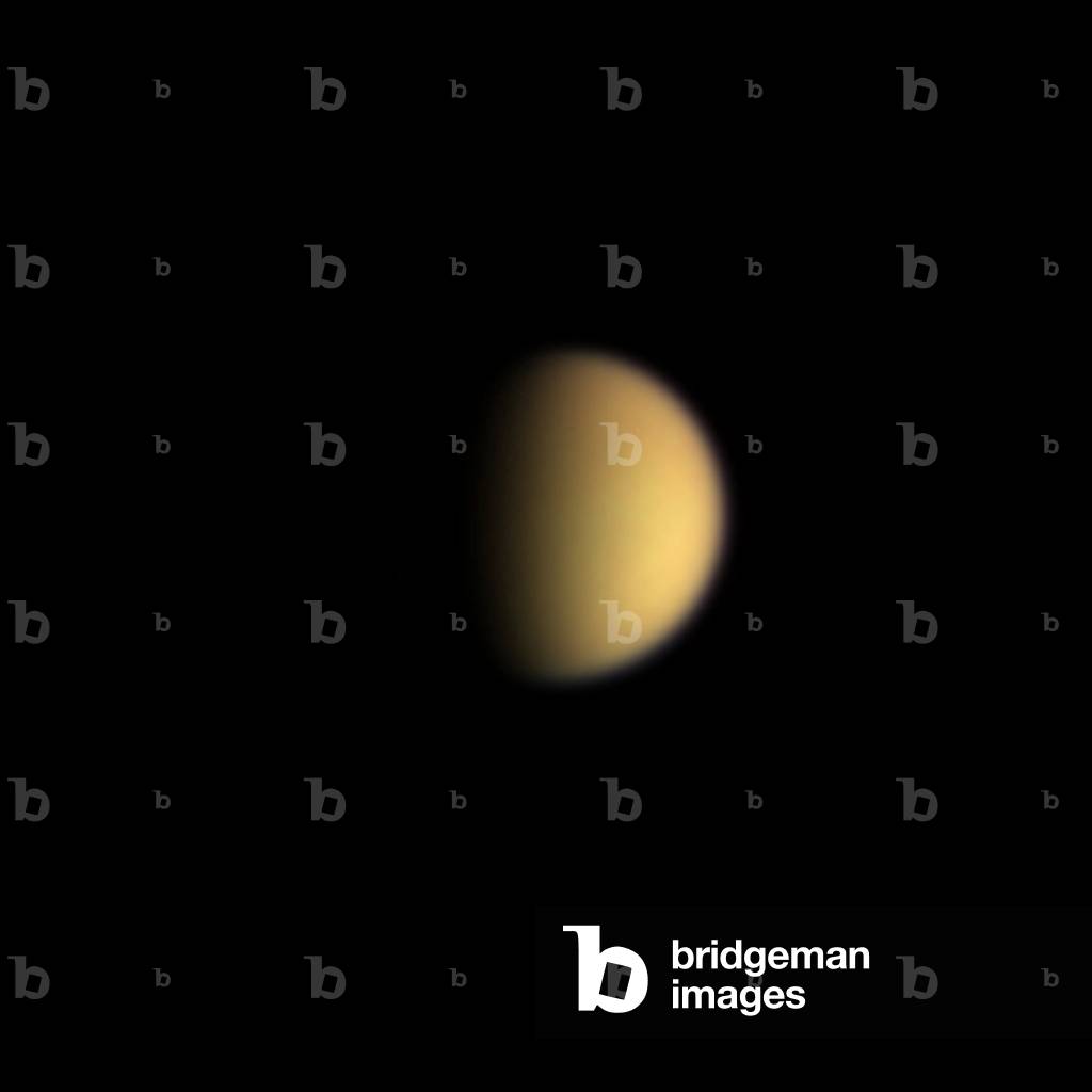
PIX4625273: Titan - Saturn satellite - Cassini probe - 10 - 06 - 2004 - View of Titan in real colors taken by Cassini on June 10, 2004 at a distance of13.1 million Km / Bridgeman Images

JLJ4625285: Cover of the book " Le bon roy Henri", Librairie Mame (litho), Job, pseudonym for Onfray de Breville, Jacques (1858-1931) / Bridgeman Images

JLJ4660376: A concert in the garden. Drawing comes from a Chinese vase, 1735 (drawing), Fraisse, Jean Antoine (fl.1733-40) / Bridgeman Images

PIX4660497: Mountains Zagros, Iran, seen by Landsat - 7 - Mountains Zagros, Iran, seen by satellite Landsat - 7 on 02/02/200 / Bridgeman Images

JLJ4625458: Illustration from the book "Le bon roy Henri" (litho), Job, pseudonym for Onfray de Breville, Jacques (1858-1931) / Bridgeman Images

JLJ4625547: Illustration from the book "Le bon roy Henri": Henri IV (litho), Job, pseudonym for Onfray de Breville, Jacques (1858-1931) / Bridgeman Images
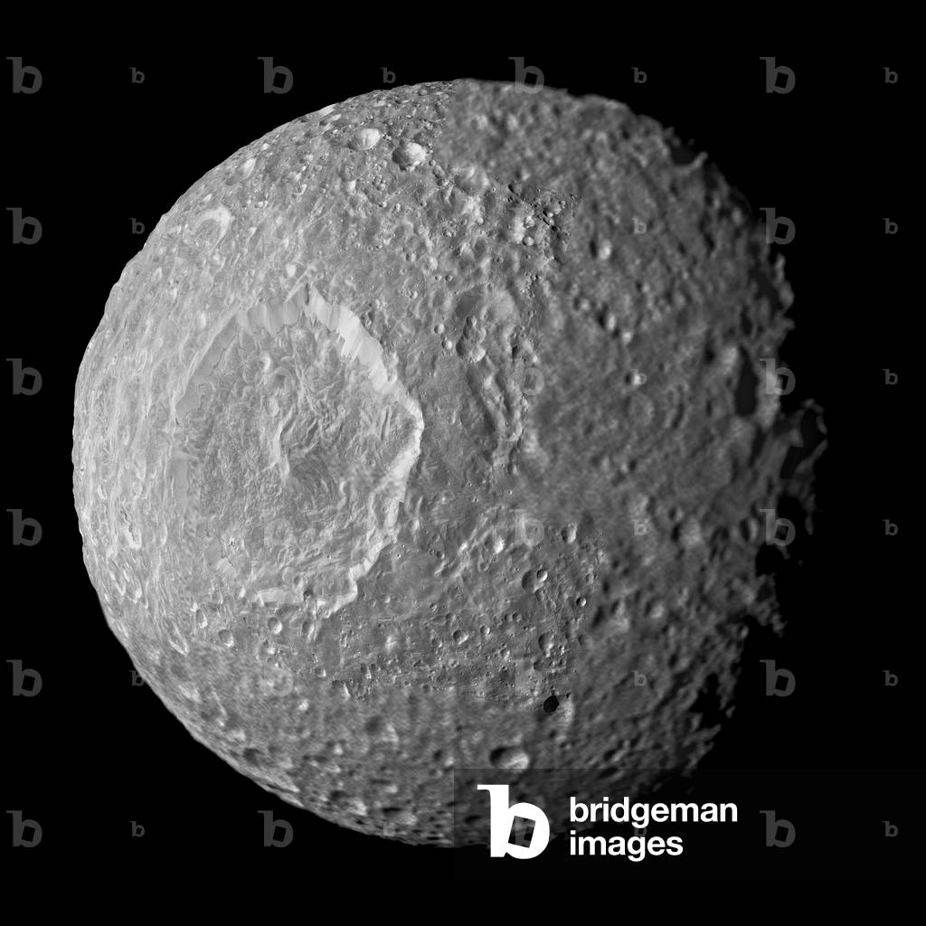
PIX4625578: Mimas, satellite of Saturn, seen by the Cassini probe on 13/02/2010 - Saturn's moon Mimas seen by Cassini spacecraft - February 13 2010 - The Mimas satellite photographed by the Cassini probe on 13 February 2010 has a distance of 16,000 km from the satellite. Mimas is about 400 km in diameter. In the centre left, the large impact crater Herschel, 130 km wide. Relatively dark regions below bright crater walls and streaks on some of the walls are seen in this mosaic of Saturn's moon Mimas, created from images taken by Nasa's Cassini spacecraft during its closest flyby of the moon. The crater floors and surroundings are about 20 percent darker than the steep crater walls in this view. Mimas 'original surface, like the surfaces of most of the other major Saturnian moons without atmospheres, is not pure ice but contains some dark impurities. The relatively dark markings appear along the lower portion of the walls of Herschel Crater (130 kilometers, 80 miles wide) and some of the smaller craters and are marked in green in the annotated version of the image. Cassini scientists interpret this darkening as evidence for the gradual concentration of impurities from evaporating icy materials in areas where the dark impurities slide slowly down the crater wall. There, the bright ice is baked away by the sun and the vacuum of space. At Herschel, the edge where the darker regions contact the crater floor is interrupted by an extensive hummocky area. Scientists believe the hummocky texture came from the flow of melted ice that occurred during the impact that created the crater. That melt filled the bottom of the crater around the central peak. Dark streaks are seen making their way down the sides of some craters and often originated from pockets of dark contaminants embedded just below the rim of the crater wall. The pockets themselves likely represent small, pre - existing, dark - floored craters that were buried by the blanket of material thrown out from the newer im / Bridgeman Images

PIX4625591: Rhea, satellite of Saturn, seen by Cassini - Saturn's moon Rhea seen by Cassini - Mosaic of images obtained by the Cassini probe in March 2015. Rhea is the second largest satellite in Saturn (1528 km in diameter). After a couple of years in high - inclination orbits that limited its ability to encounter Saturn's moons, Nasa's Cassini spacecraft returned to Saturn's equatorial plane in March 2015.Image taken using clear, green, infrared and ultraviolet spectral filters were combined to create these enhanced color views, which offer an expanded range of the colors visible to human eyes in order to highlight subtle color differences across Rhea's surface. The moon's surface is fairly uniform in natural color.This view at right is centered at 9 degrees north latitude, 254 degrees west longitude. Resolution in this mosaic is 300 meters (984 feet) per pixel. The image was acquired at a distance that ranged from about 36,000 to 32.100 miles (57,900 to 51,700 kilometers) from Rhea / Bridgeman Images
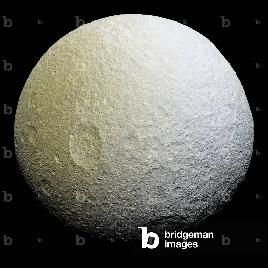
PIX4625625: Tethys, Saturn satellite, seen by the Cassini probe - Saturn's moon Tethys seen by Cassini spacecraft: The Tethys satellite photographed by the Cassini probe on 11 April 2015 has a distance of 53,000 km from the satellite. Tethys is about 1070 km in diameter. - This enhancement-color mosaic of Saturn's icy moon Tethys shows a range of features on the moon's trailing hemisphere. Tethys is tidally locked to Saturn, so the trailing hemisphere is the side of the moon that always faces opposite its direction of motion as it orbits the planet - Images taken using clear, green, infrared and ultraviolet spectral filters were combined to create the view, which highlights subtle color differences across Tethys' surface at wavelengths not visible to human eyes. The moon's surface is fairly uniform in natural color - The color of the surface changes conspicuously across the disk, from yellowish hues to nearly white. These broad color changes are affected by a number of external processes. First, Saturn's diffuse E-ring preferentially bombards Tethys' leading hemisphere, towards the right side of this image, with ice bright ice grains. At the same time, charged particles from Saturn's radiation belt bombard the surface on the trailing side, causing color changes due to chemical alteration of the materials there. The albedo - a measure of the surface's reflectivity - drops by 10 to 15 percent from the moon's leading side to the trailing side. Similar global color patterns exist on other Saturnian moons - This mosaic is an orthographic projection constructed from 52 Cassini images obtained on April 11, 2015 with the Cassini spacecraft narrow-angle camera. Resolution is about 1,000 feet (300 meters) per pixel. The images were obtained at a distance of approximately 33,000 miles (53,000 kilometers) from Tethys / Bridgeman Images

PIX4594435: Constellations of the Virgin, the Raven and the Cup - Constellations of Virgo, Corvus and Crate / Bridgeman Images

LRI4594442: Agar and his son Ishmael, in the desert, are saved by an angel. Marble bas relief, 1739, Donner, Georg Raphael (1693-1741) / Bridgeman Images

JLJ4594510: Jules Boilly (1796, 1874) child a book in hand, 1808 (oil on canvas), Boilly, Louis Leopold (1761-1845) / Bridgeman Images

PIX4594538: Constellation of the Ship Argo - Constellation of Argo Navis - Constellation of the Ship Argo from the Uranographia of Hevelius. Recolorized image. Vessel Argo is a missing constellation; the astronomer Nicolas - Louis de Lacaille divided it in the 1750s into three smaller constellations: the Carene, the Poupe and the Voiles. Map showing the constellation of Argo Navis with its mythological form from “” Uranographia”” star atlas by Hevelius (1690). Recolored image. Argo Navis (or simply Argo) was a large constellation in the southern sky that has since been divided into three constellations (Carina, Puppis and Vela) / Bridgeman Images

PIX4594601: The Southern Milky Way and south celestial pole - The Southern Milky Way and south celestial pole - The Octant constellation houses the south celeste pole (mark of a cross) This part of the sky was mostly uncharted by Europeans until the 17th and 18th centuries, so many of the constellations in the southern (lower) half of the image are relatively modern constructions without mythlogical connotations. Octans, the Octant (a forerunner of the sextant) is an Enlightenment - period instrument whose outline was constructed on the sky by the vivid imagination of the Abbe Lacaille. The constellation is quite large but totally undistinguished. Its only notable feature is the South Celestial Pole, with is marked (within a degree or so) by the faint star s Octantis. Apus, the Bird of Paradise, first appeared in the star charts of the German astronomer Johann Bayer in 1603. It contains no named stars. Chameleon, a type of lizard. The stars here are even fainter than those in Apus. Mensa, the constellation was invented by de Lacaille to commemorate his sojourn at the Cape of Good Hope in the 1750s. The original name was Mons Mensa, Latin for Table Mountain. Its northern border crosses part of the Large Magellanic Cloud, possibly reminding Lacaille of the recurrent cloud over the mountain as seen from Cape Town. Musca, the Fly, is another undistinguished constellation that first appeared on Bayer's star charts in 1603 / Bridgeman Images

PIX4594700: Christian constellations - Christian constellations - Map of the sky with the classical Christian constellations. Engraving from “Harmonia Macrocosmica” by Andreas Cellarius, 1660 - 1661. First hemisphere with the christianized constellations. Plate of the Harmonia Macrocosmica of Andreas Cellarius, 1660 - 1661 / Bridgeman Images

PIX4594875: Star sky and light pollution - Starry sky and light pollution - Orion faces the Bull on the horizon. Higher, the Gemels and the Coach in the heart of the Lactee Way. In overprint, the mythological forms of these constellations, extracted from the Uranographia of Hevelius. Constellations of Orion and Taurus near horizon; above, Gemini and Auriga. Mythological Constellations forms from “Uranographia” star atlas by Hevelius (1690) have been added / Bridgeman Images

PIX4594993: Decollage Apollo 4 - 11/1967 - Apollo 4 launch - Decollage of the Saturn V/Apollo 4 rocket on 9/11/1967. Apollo 4 was launched from Pad A Launch Complex 39 on Nov 9 1967. The successful objectives of the Apollo 4 Earth - orbital unmanned space mission obtained included flight information on launch vehicle and spacecraft structural integrity and compatibility, flight loads, stage separation, subsystem operation, emergency detection subsystem operation, and evaluation of the Apollo Command Module heat shield under conditions encountered on return from a moon mission / Bridgeman Images

JLJ4595005: The French army taken part by the Prussian peasants, 19th century (colour litho), German School, (19th century) / Bridgeman Images

JLJ4625902: Illustration for 'The Memorial of Saint Helene' by Count Emmanuel de Las Cases (lithograph), Bombled, Louis Charles (1862-1927) / Bridgeman Images

JLJ4625986: Illustration for 'The Memorial of Saint Helene' by Count Emmanuel de Las Cases (lithograph), Bombled, Louis Charles (1862-1927) / Bridgeman Images

JLJ4626029: “The Memorial of Saint Helene": Portrait of military surgeons and nurses of the Great Armee (litho), Bombled, Louis Charles (1862-1927) / Bridgeman Images

LRI4626093: Scene of struggle between Greeks and Trojans. Detail of the Siphnian Tresor frieze in Delphi, marble relief, circa 525 BC, Greek school, (6th century BC) / Bridgeman Images
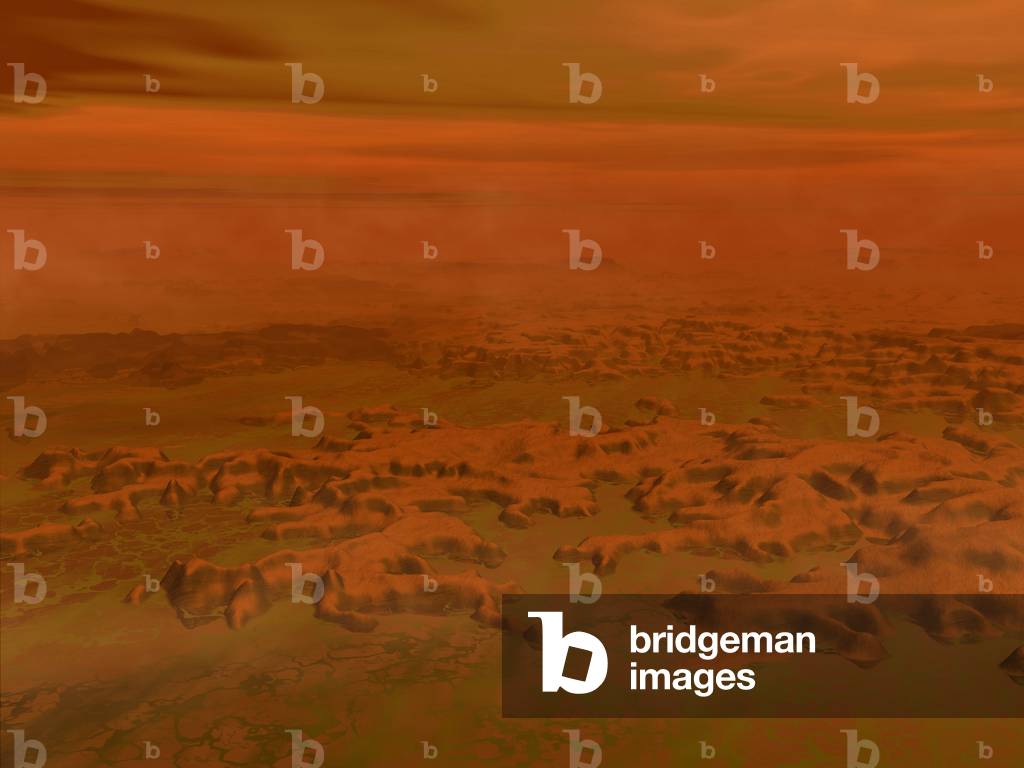
PIX4626110: Oil Marsh on Titan - Ethane swamp on Titan - Artist's view of an ethane marsh on the surface of Titan. Initially astronomers thought that Titan's entire surface may be covered by a liquid hydrocarbon ocean. More recent observations in infrared wavelengths suggest otherwise. In this image the artist is suggesting that Titan may be host to extremely cold ethane - methane swamps / Bridgeman Images

JLJ4626249: Illustration for 'The Memorial of Saint Helene' by Count Emmanuel de Las Cases (lithograph), Bombled, Louis Charles (1862-1927) / Bridgeman Images
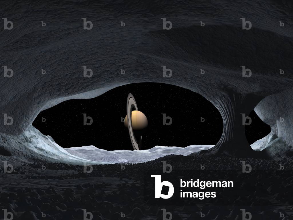
PIX4626319: Saturn seen from its satellite Japet - Iapetus ice cave - The planet Saturn seen from the inside of an ice cave on the satellite Japet. This is how Saturn might appear from within a hypothetical ice cave on the surface of Iapetus. As of yet there is no evidence that such caves exist / Bridgeman Images

LRI4626348: View of the Arc de Triomphe realized by Jean Francois Chalgrin (1739-1811), 1806-1836 on the Place de l'Etoile in Paris, Chalgrin, Jean Francois Therese (1739-1811) / Bridgeman Images
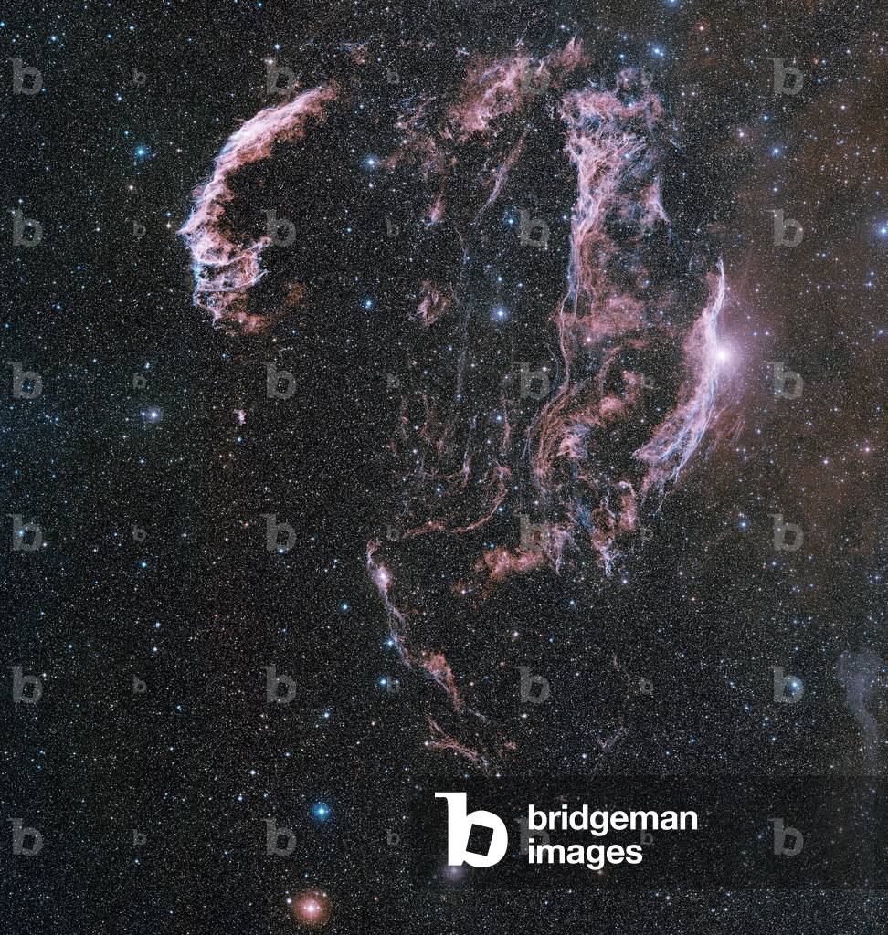
PIX4626477: Remains of supernova located about 1400 light years ago in the constellation Swan. The supernova would have exploded less than 10,000 years ago. Image obtained by the Oschin telescope of Mount Palomar through several filters and composed - The Veil Nebula, also known as the Cygnus Loop, is a large supernova remnant, relatively faint supernova remnant in the constellation Cygnus. The source supernova exploded some 5000 to 8000 years ago. The distance to the nebula is not precisely known, with estimates ranging from 1400 to 2600 light years. It was discovered on 1784 September 5 by William Herschel. This image is based on data acquired by the Oschin Telescope at the Mount Palomar Observatory.: Les laces du Swan - The Veil nebula / Bridgeman Images
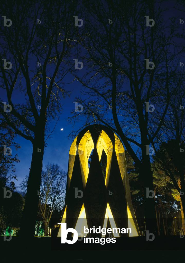
PIX4660765: Mausolee de Omar Khayyam - Mausoleum of Omar Khayyam - Mausolee de Omar Khayyam, in Nichapur, Khorasan Province, Iran. Mausoleum of Omar Khayyam in the historic city of Nishapur in north east Iran. Khayyam was a Persian poet, mathematician, philosopher and astronomer who lived in 11 - 12 century / Bridgeman Images

PIX4660798: The Moon on the village of Masuleh in Iran - Moonset above Masuleh village in Iran - The Moon on the historic village of Masuleh, in Gilan province in Iran. Moonset above Masuleh historic village in Gilan province, northern Iran / Bridgeman Images

PIX4660817: Dead Sea from Space 2013 - Dead Sea from Space in 2013 - Dead Sea from Space in July 2013 by Landsat-8 satellite. The most prominent feature in this image is the Dead Sea: the lowest point on Earth's surface, more than 420 m below sea level. The extremely high salinity means fish cannot live in this water body, although there are bacteria and fungi. Note the greenish rectangles just south of the Sea. This is a large complex of mineral evaporation ponds used to produce sodium chloride and other salts for the chemical industry and human and animal consumption. These ponds are separated from the northern part of the Dead Sea by what once was the Lisan Peninsula but lowering water levels have exposed the sea bed, dividing the two sections completely. Throughout the rest of the image we can see built-up areas such as Amman, the capital of Jordan, in the upper right and Jerusalem near the green hills west of the Dead Sea. Further west we can see green patches of agriculture on the coastal plain, with Tel Aviv on the Mediterranean coast. In the lower-left corner of the image, we can clearly see the division between Israel and the Gaza Strip not only by the outline of the border, but in the difference in agricultural practices. Landsat-8 image, acquired on 4 July 2013 / Bridgeman Images

PIX4661036: Evaporation of the Aral Sea - Evaporation of the Aral Sea - Comparison of satellite images taken on 19 August 2000 (left) and 16 August 2009 (right) by the Terra satellite. In overprint, the shore of the Aral Sea in 1960. In the first half of the 20th century, the Aral Sea was the fourth largest lake. In the 1960s, the Sovietic Union began a massive irrigation project in what is now Kazakhstan, Uzbekistan and Turkmenistan, moving water from rivers that feed the Aral Sea to irrigate agricultural land. In August 2009, virtually nothing remains of the eastern lobe of the southern Aral Sea. In 2005, Kazakhstan built the Kok-Aral dam between the northern and southern parts of the lake to successfully preserve water levels in the north. The southern part of the Aral Sea is considered irrecuperable. Comparison of satellite images taken on August 19 2000 (left) and August 16 2009 (right) by satellite Terra. Approximate shoreline in 1960 has been added. The Aral Sea, is actually a lake rather than a sea. In the 1960s, the Soviet Union began a massive irrigation project in what are now Kazakhstan, Uzbekistan, and Turkmenistan, diverting water from the rivers that feed the Aral Sea to irrigate farmland. Although the Northern Aral Sea (upper right) still appears healthy, the Southern Aral Sea consists of two isolated water bodies: an irregular oval shape directly southwest of the Northern Aral Sea, and the long, thin remainder of the Southern Aral Sea's far western lobe. Although the faintest glimmers of blue - green appear in the eastern lobe, earth tones predominate, surrounded by a ghostly film of pale beige. Lake sediments from this depleted water body have provided ample material for frequent dust storms. Much of what finally doomed the Southern Aral Sea was an attempt to save its neighbor to the north. In 2005, Kazakhstan built the Kok - Aral Dam between the lake's northern and southern p / Bridgeman Images

LRI4661053: Assyrian civilization: engraved box of cuneiform characters concerning the production of two silver mines. Istanbul, Archeological Museum, Assyrian / Bridgeman Images

PIX4661056: Mulaku and Felidhu Atoll - Maldives, Image taken from the space shuttle Atlantis in january 1997 / Bridgeman Images

PIX4648841: Discovery Shuttle Discovery 23 - 10 - 2007 - Space Shuttle Discovery lift off Oct 23 2007 - Discovery Space Shuttle Decolation October 23, 2007. Mission STS - 120 The Space Shuttle Discovery and its seven - member STS - 120 crew head towards Earth - orbit and a scheduled link - up with the International Space Station. Liftoff from Kennedy Space Center's launch pad 39A occurred at 11:38:19 a.m. (EDT). Onboard are astronauts Pam Melroy, commander; George Zamka, pilot; Scott Parazynski, Stephanie Wilson, Doug Wheelock, European Space Agency's (ESA) Paolo Nespoli and Daniel Tani, all mission specialists. Discovery will link up with the station on Thursday, Oct. 25, to begin a joint mission to continue construction by delivering the Italian - built U.S. Node 2, called Harmony. During the 14 - day mission, the crew will install Harmony and move the P6 solar arrays to their permanent position and deploy them / Bridgeman Images
