Search options

Orientation
Colour

Display options

View

Print

To print search results, use print friendly version of this page.

2491125 Search Results

The musician (Drawing, 20th century)

LRI4615899: The musician (Drawing, 20th century), La Fresnaye, Roger de (1885-1925) / Bridgeman Images

Allegory of the Seven Theological and Cardinal Virtues, 1349 (watercolour)

JLJ4615912: Allegory of the Seven Theological and Cardinal Virtues, 1349 (watercolour), Bartoli, Andrea de (fl.1355-67) / Bridgeman Images

Mars: crater in Myers Valles - Mars: crater in Myers Valles - Mamers Valles is a valley about 1000 km long located in the region of Deuteronilus Mensae, north of Arabia Terra. The image obtained by the Mars Express probe on 5 August 2006 shows a crater at the end of this valley. This circular formation measures about thirty kilometres in diameter and is 1400 metres deep. There are traces of flow of material probably composed of water ice, similar to the relief left by the passage of glaciers on Earth. The darker area could be caused by local erosion or wind-driven material. The High - Resolution Stereo Camera (HRSC) onboard the ESA spacecraft Mars Express obtained images focusing on a depression that displays a crater at the end of the long, winding valley, Mamers Valles. The data was obtained on 5 August 2006 with a ground resolution of approximately 14 m/per pixel. The image is centred at approximately 39* north and 17* east on the planet. The valley of Mamers Valles is approximately 1000 km long, running along the boundary between the northern lowlands and southern highlands in the region of Deuteronilus Mensae. This region shows numerous deep and wide labyrinth - like valleys and circular depressions which often show structures formed by flowing liquid on their even floors. The structures formed by the flows are thought to be ice - rich debris flows. They show some resemblance to block glaciers seen on Earth. The patches of rock at the centre of the depression are thought to be remnants of rock detached from the flanks of the depression and transported into its centre. The wrinkle ridges, are formed by compressive forces acting on the surface. The dark coloured material inside the crater could have formed in - situ or was transported by the wind. The depression is approximately 30 km wide and 1400 m deep

PIX4616083: Mars: crater in Myers Valles - Mars: crater in Myers Valles - Mamers Valles is a valley about 1000 km long located in the region of Deuteronilus Mensae, north of Arabia Terra. The image obtained by the Mars Express probe on 5 August 2006 shows a crater at the end of this valley. This circular formation measures about thirty kilometres in diameter and is 1400 metres deep. There are traces of flow of material probably composed of water ice, similar to the relief left by the passage of glaciers on Earth. The darker area could be caused by local erosion or wind-driven material. The High - Resolution Stereo Camera (HRSC) onboard the ESA spacecraft Mars Express obtained images focusing on a depression that displays a crater at the end of the long, winding valley, Mamers Valles. The data was obtained on 5 August 2006 with a ground resolution of approximately 14 m/per pixel. The image is centred at approximately 39* north and 17* east on the planet. The valley of Mamers Valles is approximately 1000 km long, running along the boundary between the northern lowlands and southern highlands in the region of Deuteronilus Mensae. This region shows numerous deep and wide labyrinth - like valleys and circular depressions which often show structures formed by flowing liquid on their even floors. The structures formed by the flows are thought to be ice - rich debris flows. They show some resemblance to block glaciers seen on Earth. The patches of rock at the centre of the depression are thought to be remnants of rock detached from the flanks of the depression and transported into its centre. The wrinkle ridges, are formed by compressive forces acting on the surface. The dark coloured material inside the crater could have formed in - situ or was transported by the wind. The depression is approximately 30 km wide and 1400 m deep / Bridgeman Images

Louis XIII style: four-poster bed in velvet, silk and walnut from the Chateau d'Effiat. c.1650 (object)

JLJ4616134: Louis XIII style: four-poster bed in velvet, silk and walnut from the Chateau d'Effiat. c.1650 (object), French School, (17th century) / Bridgeman Images

Mars: craters and channels in Hephaestus Fossae - Mars: craters and channels in Hephaestus Fossae - Impact crateres and channel system in Hephaestus Fossae, a region on Mars located on the western flank of Elysium Mons. The large impact crater at the top of the picture is 20 km in diameter. The image covering an area of about 150 square km was obtained by the Mars Express probe on 28 December 2007. This image of Hephaestus Fossae was obtained by Esa's Mars Express orbiter on 28 December 2007. The region is dotted with craters and channel systems and lies at about 21* North and 126* East on the Red Planet. Named after the Greek god of fire, Hephaestus Fossae extends for more than 600 km on the western flank of Elysium Mons in the Utopia Planitia region. The surface is mostly smooth, and is covered by several small impact craters measuring 800 to 2800 m in diameter. Smaller craters are scattered across the entire region. A larger impact crater measuring 20 km in diameter is a prominent feature. Covering an area of approximately 150 sq km, this crater could harbour cities such as Bonn or Kiel. In contrast to the smaller craters, it shows a blanket of ejecta with flow forms surrounding the rim. The large craters were formed when loose, soft material was ejected due to impact, and the smaller ones formed due to secondary impacts, when consolidated material was ejected in a ballistic path and impacted the original crater at varying distances. Most martian water exists in the form of subsurface ice. The presence of a blanket of ejecta and outflow channels around the crater suggest that the primary impact may have penetrated the surface enough to melt a buried frozen water reservoir

PIX4616151: Mars: craters and channels in Hephaestus Fossae - Mars: craters and channels in Hephaestus Fossae - Impact crateres and channel system in Hephaestus Fossae, a region on Mars located on the western flank of Elysium Mons. The large impact crater at the top of the picture is 20 km in diameter. The image covering an area of about 150 square km was obtained by the Mars Express probe on 28 December 2007. This image of Hephaestus Fossae was obtained by Esa's Mars Express orbiter on 28 December 2007. The region is dotted with craters and channel systems and lies at about 21* North and 126* East on the Red Planet. Named after the Greek god of fire, Hephaestus Fossae extends for more than 600 km on the western flank of Elysium Mons in the Utopia Planitia region. The surface is mostly smooth, and is covered by several small impact craters measuring 800 to 2800 m in diameter. Smaller craters are scattered across the entire region. A larger impact crater measuring 20 km in diameter is a prominent feature. Covering an area of approximately 150 sq km, this crater could harbour cities such as Bonn or Kiel. In contrast to the smaller craters, it shows a blanket of ejecta with flow forms surrounding the rim. The large craters were formed when loose, soft material was ejected due to impact, and the smaller ones formed due to secondary impacts, when consolidated material was ejected in a ballistic path and impacted the original crater at varying distances. Most martian water exists in the form of subsurface ice. The presence of a blanket of ejecta and outflow channels around the crater suggest that the primary impact may have penetrated the surface enough to melt a buried frozen water reservoir / Bridgeman Images

March: Chaotic terrain between Kasei Valles and Sacra Fossae - Mars: Chaotic terrain between Kasei Valles and Sacra Fossae - Region bordering Kasei Valles (top) and Sacra Fossae (bottom). Kasei Valles is one of the largest Martian canal systems. The large impact crater on the right is 35 km in diameter. The image covering an area of 225 km by 95 km was obtained by the Mars Express probe. Mars Express flew over the boundary between Kasei Valles and Sacra Fossae and imaged the region, acquiring spectacular views of the chaotic terrain in the area. The images are centred at 12* N/285* E and have a ground resolution of about 21 m/pixel. They cover 225 x 95 km or 21.375 sq km, an area roughly half the size of the Netherlands. The upper portion of the image swath shows the eastern margin of Kasei Valles and the western margin of the Lunae Planum plateau and the adjoining Sacra Fossae. Kasei Valles is one of the largest outflow channels on Mars, spanning 3000 km, from the Chryse Planitia basin in the north to Etus Chasma to the south. The impact crater at right is 35 km diameter

PIX4616154: March: Chaotic terrain between Kasei Valles and Sacra Fossae - Mars: Chaotic terrain between Kasei Valles and Sacra Fossae - Region bordering Kasei Valles (top) and Sacra Fossae (bottom). Kasei Valles is one of the largest Martian canal systems. The large impact crater on the right is 35 km in diameter. The image covering an area of 225 km by 95 km was obtained by the Mars Express probe. Mars Express flew over the boundary between Kasei Valles and Sacra Fossae and imaged the region, acquiring spectacular views of the chaotic terrain in the area. The images are centred at 12* N/285* E and have a ground resolution of about 21 m/pixel. They cover 225 x 95 km or 21.375 sq km, an area roughly half the size of the Netherlands. The upper portion of the image swath shows the eastern margin of Kasei Valles and the western margin of the Lunae Planum plateau and the adjoining Sacra Fossae. Kasei Valles is one of the largest outflow channels on Mars, spanning 3000 km, from the Chryse Planitia basin in the north to Etus Chasma to the south. The impact crater at right is 35 km diameter / Bridgeman Images

March: chaotic terrain between Kasei Valles and Sacra Fossae - Mars: Chaotic terrain between Kasei Valles and Sacra Fossae - Region bordering Kasei Valles and Sacra Fossae. The large impact crater is 35 km in diameter. The image covering an area of 225 km by 95 km was obtained by the Mars Express probe. Mars Express flew over the boundary between Kasei Valles and Sacra Fossae and imaged the region, acquiring spectacular views of the chaotic terrain in the area. The images are centred at 12* N/285* E and have a ground resolution of about 21 m/pixel. They cover 225 x 95 km or 21.375 sq km, an area roughly half the size of the Netherlands. The image shows an old 35 km - diameter impact crater in the north. The crater's southwestern rim is eroded strongly, mostly by flowing water. The source of the water was located in Echo Chasma, which lies about 850 km to the southwest

PIX4616171: March: chaotic terrain between Kasei Valles and Sacra Fossae - Mars: Chaotic terrain between Kasei Valles and Sacra Fossae - Region bordering Kasei Valles and Sacra Fossae. The large impact crater is 35 km in diameter. The image covering an area of 225 km by 95 km was obtained by the Mars Express probe. Mars Express flew over the boundary between Kasei Valles and Sacra Fossae and imaged the region, acquiring spectacular views of the chaotic terrain in the area. The images are centred at 12* N/285* E and have a ground resolution of about 21 m/pixel. They cover 225 x 95 km or 21.375 sq km, an area roughly half the size of the Netherlands. The image shows an old 35 km - diameter impact crater in the north. The crater's southwestern rim is eroded strongly, mostly by flowing water. The source of the water was located in Echo Chasma, which lies about 850 km to the southwest / Bridgeman Images
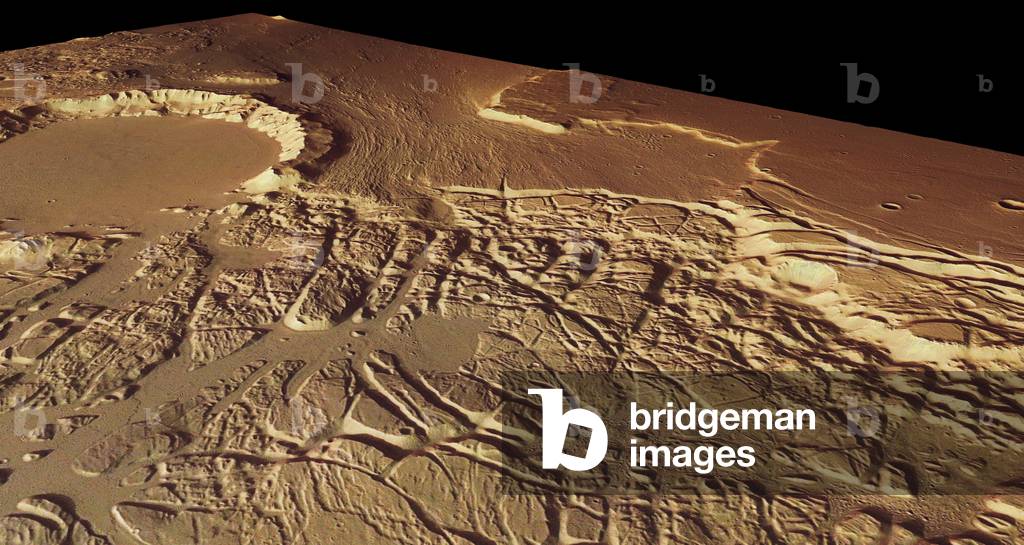
March: chaotic terrain between Kasei Valles and Sacra Fossae - Mars: Chaotic terrain between Kasei Valles and Sacra Fossae - Region bordering Kasei Valles and Sacra Fossae. To the north, the large impact crater is 35 km in diameter. The image covering an area of 225 km by 95 km was obtained by the Mars Express probe. Mars Express flew over the boundary between Kasei Valles and Sacra Fossae and imaged the region, acquiring spectacular views of the chaotic terrain in the area. The images are centred at 12* N/285* E and have a ground resolution of about 21 m/pixel. They cover 225 x 95 km or 21.375 sq km, an area roughly half the size of the Netherlands. The image shows an old 35 km - diameter impact crater in the north. The crater's southwestern rim is eroded strongly, mostly by flowing water. The source of the water was located in Etus Chasma, which lies about 850 km to the southwest. The crater floor and the northwestern part are remarkably flat, formed by sediments and basaltic lava flows from the Tharsis volcanic region

PIX4616176: March: chaotic terrain between Kasei Valles and Sacra Fossae - Mars: Chaotic terrain between Kasei Valles and Sacra Fossae - Region bordering Kasei Valles and Sacra Fossae. To the north, the large impact crater is 35 km in diameter. The image covering an area of 225 km by 95 km was obtained by the Mars Express probe. Mars Express flew over the boundary between Kasei Valles and Sacra Fossae and imaged the region, acquiring spectacular views of the chaotic terrain in the area. The images are centred at 12* N/285* E and have a ground resolution of about 21 m/pixel. They cover 225 x 95 km or 21.375 sq km, an area roughly half the size of the Netherlands. The image shows an old 35 km - diameter impact crater in the north. The crater's southwestern rim is eroded strongly, mostly by flowing water. The source of the water was located in Etus Chasma, which lies about 850 km to the southwest. The crater floor and the northwestern part are remarkably flat, formed by sediments and basaltic lava flows from the Tharsis volcanic region / Bridgeman Images

Jupiter seen by Hubble Space Telescope - Jupiter seen by HST - Image obtained on April 3, 2017 by Hubble Space Telescope. On April 3, 2017, as Jupiter made its nearest approach to Earth in a year, Nasa's Hubble Space Telescope viewed the solar system's largest planet in all of its up-close glory. At a distance of 415 million miles (668 million kilometers) from Earth, Jupiter offered spectacular views of its colorful, roiling atmosphere, the legendary Great Red Spot, and its smaller companion at farther southern latitudes dubbed “” Red Spot Jr.””

PIX4614034: Jupiter seen by Hubble Space Telescope - Jupiter seen by HST - Image obtained on April 3, 2017 by Hubble Space Telescope. On April 3, 2017, as Jupiter made its nearest approach to Earth in a year, Nasa's Hubble Space Telescope viewed the solar system's largest planet in all of its up-close glory. At a distance of 415 million miles (668 million kilometers) from Earth, Jupiter offered spectacular views of its colorful, roiling atmosphere, the legendary Great Red Spot, and its smaller companion at farther southern latitudes dubbed “” Red Spot Jr.”” / Bridgeman Images

Sunrise Full Moon - Full moon rising - Moonrise Full Moon. Each image of this montage was taken three minutes after the previous one. 6 November 2006. Full moon is rising. Each picture from this composite had been taken 3 minutes after the previous one. November 6, 2006

PIX4578863: Sunrise Full Moon - Full moon rising - Moonrise Full Moon. Each image of this montage was taken three minutes after the previous one. 6 November 2006. Full moon is rising. Each picture from this composite had been taken 3 minutes after the previous one. November 6, 2006 / Bridgeman Images
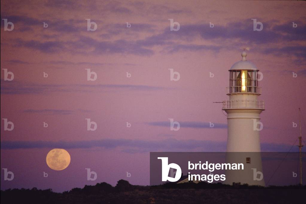
Moon Sunrise and Lighthouse - Australia - Althorpe Islands

PIX4578882: Moon Sunrise and Lighthouse - Australia - Althorpe Islands / Bridgeman Images

Romanesque art: view of the nave of the Cathedrale Saint Philibert de Tournus made at the end of the 10th century, Abbey of Tournus, France (photo)

JLJ4578943: Romanesque art: view of the nave of the Cathedrale Saint Philibert de Tournus made at the end of the 10th century, Abbey of Tournus, France (photo), Romanesque art, (10th century) / Bridgeman Images

La Visitation (drawing)

JLJ4614155: La Visitation (drawing), Bononi, Carlo (1569-1632) / Bridgeman Images

French Revolution:
French Revolution:

JLJ4614429: French Revolution: "" Portrait of Jean Sylvain Bailly (1736-1793), 1789 (etching), French School, (18th century) / Bridgeman Images

Moon seen just after Full Moon. 14,5days - Full moon (14,5 days)

PIX4614494: Moon seen just after Full Moon. 14,5days - Full moon (14,5 days) / Bridgeman Images

Porcelain plate representing a Chinese chess scene., 18th century (porcelain)

JLJ4614520: Porcelain plate representing a Chinese chess scene., 18th century (porcelain), Liotard, Jean-Michel (1702-96) / Bridgeman Images

Saint Norbert holding an ostensoire (ostensoir) and a candle Painting with camaieu on canvas, 17th century (painting)

JLJ4614627: Saint Norbert holding an ostensoire (ostensoir) and a candle Painting with camaieu on canvas, 17th century (painting), La Hyre, Laurent de (1606-56) / Bridgeman Images

Crescent Moon on Pekin - New Moon from Beijing: First crescent of Moon above Pekin. 20 December 2017

PIX4614658: Crescent Moon on Pekin - New Moon from Beijing: First crescent of Moon above Pekin. 20 December 2017 / Bridgeman Images

Love, 1935-1937 (Photocollage)

LRI4614749: Love, 1935-1937 (Photocollage), Eluard, Paul (1895-1952) / Bridgeman Images

Gnocchi with baccalà, Al Pompiere restaurant, Verona, Veneto, Italy.

CUB4522766: Gnocchi with baccalà, Al Pompiere restaurant, Verona, Veneto, Italy. / Bridgeman Images

Rice with Amarone, La Bottega dei Vini restaurant, Verona, Veneto, Italy.

CUB4522774: Rice with Amarone, La Bottega dei Vini restaurant, Verona, Veneto, Italy. / Bridgeman Images

The arch of the tower, Numana, Marche, Italy.

CUB4522853: The arch of the tower, Numana, Marche, Italy. / Bridgeman Images

Fillet of brill, Il Giardino restaurant, Ancona, Marche, Italy.

CUB4522960: Fillet of brill, Il Giardino restaurant, Ancona, Marche, Italy. / Bridgeman Images

Gondole, Venice, Veneto, Italy

CUB4523108: Gondole, Venice, Veneto, Italy / Bridgeman Images

San Marco church, Venice, Veneto, Italy

CUB4523134: San Marco church, Venice, Veneto, Italy / Bridgeman Images
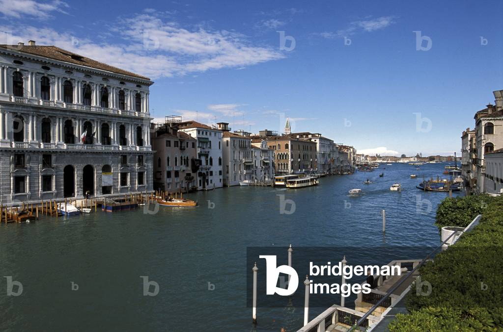
Canal Grande seen from Peggy Guggenheim collection, Venice, Veneto, Italy

CUB4523152: Canal Grande seen from Peggy Guggenheim collection, Venice, Veneto, Italy / Bridgeman Images

Stuffed crayfish, Avogaria design restaurant, Venice, Veneto, Italy

CUB4523177: Stuffed crayfish, Avogaria design restaurant, Venice, Veneto, Italy / Bridgeman Images

Bedroom, Cà Maria Adele hotel, Venice, Veneto, Italy

CUB4523237: Bedroom, Cà Maria Adele hotel, Venice, Veneto, Italy / Bridgeman Images

Portrait of Jean Le Rond d'Alembert (1717-1783), 18th century (engraving)

JLJ4614974: Portrait of Jean Le Rond d'Alembert (1717-1783), 18th century (engraving), Unknown artist, (18th century) / Bridgeman Images

Portrait of George Louis Le Clerc, Count of Buffon (1707-1788), 18th century (engraving)

JLJ4615038: Portrait of George Louis Le Clerc, Count of Buffon (1707-1788), 18th century (engraving), Unknown artist, (18th century) / Bridgeman Images

Portrait of Francois de Neufville, Duke of Villeroy (1644-1730), 18th century (engraving)

JLJ4615057: Portrait of Francois de Neufville, Duke of Villeroy (1644-1730), 18th century (engraving), Unknown artist, (18th century) / Bridgeman Images

Portrait of Queen Marie Stuart (1542-1587), 16th century (engraving)

JLJ4615141: Portrait of Queen Marie Stuart (1542-1587), 16th century (engraving), Unknown Artist, (16th century) / Bridgeman Images

Rock crystal vase handle representing Noe drunkenness, c.1550 (crystal)

JLJ4615248: Rock crystal vase handle representing Noe drunkenness, c.1550 (crystal), Unknown Artist, (16th century) / Bridgeman Images

Mars - South pole - Image recomposed from altimetric data obtained by the Mars Global Surveyor probe in 2000

PIX4615288: Mars - South pole - Image recomposed from altimetric data obtained by the Mars Global Surveyor probe in 2000 / Bridgeman Images

Clouds on Mars - Clouds over Tharsis volcanoes (left) and around Valles Marineris, below. The three volcanoes of Tharsis form a diagonal; from top to bottom are Ascraeus Mons, Pavonis Mons and Arsia Mons. Top left is the volcano Olympus Mons. Image obtained by the Mars Global Surveyor probe in May 2003

PIX4615331: Clouds on Mars - Clouds over Tharsis volcanoes (left) and around Valles Marineris, below. The three volcanoes of Tharsis form a diagonal; from top to bottom are Ascraeus Mons, Pavonis Mons and Arsia Mons. Top left is the volcano Olympus Mons. Image obtained by the Mars Global Surveyor probe in May 2003 / Bridgeman Images

Mars - View of the north pole - Mars north pole - Image based on altimetric data obtained by the Mars Global Surveyor probe. The northern polar cap is mostly made up of water ice. It's about 1100 km long. The ice - rich north polar cap (the quasi - circular white area at center) is approximately 1,000 kilometers (621 miles) across. The white cap is riven with dark, spiral - shaped bands. These are deep troughs that are in shadow. They do not reflect sunlight as well or have more internal layers exposed. To the right of center, a large canyon, Chasma Boreale, almost bisects the ice cap. Chasma Boreale is about the length of the United States' famous Grand Canyon and up to 2 kilometers (1.2 miles) deep. The image synthesizes topographic data from Mars Orbiter Laser Altimeter (MOLA) and images from the Mars Orbiter Camera (MOC)

PIX4615389: Mars - View of the north pole - Mars north pole - Image based on altimetric data obtained by the Mars Global Surveyor probe. The northern polar cap is mostly made up of water ice. It's about 1100 km long. The ice - rich north polar cap (the quasi - circular white area at center) is approximately 1,000 kilometers (621 miles) across. The white cap is riven with dark, spiral - shaped bands. These are deep troughs that are in shadow. They do not reflect sunlight as well or have more internal layers exposed. To the right of center, a large canyon, Chasma Boreale, almost bisects the ice cap. Chasma Boreale is about the length of the United States' famous Grand Canyon and up to 2 kilometers (1.2 miles) deep. The image synthesizes topographic data from Mars Orbiter Laser Altimeter (MOLA) and images from the Mars Orbiter Camera (MOC) / Bridgeman Images


Back to top