Unknown Artist Assets (3858 in total)

Search options

Orientation
Colour

Display options

View

Print

To print search results, use print friendly version of this page.

Results

Vault on the chapel of Saint Charles

MEV5050310: Vault on the chapel of Saint Charles, Unknown Artist / Bridgeman Images

A View of the Green in Richmond, Surrey, 1752

MCC45929: A View of the Green in Richmond, Surrey, 1752, Unknown Artist / Bridgeman Images

Flowers, (painting, hanging scroll)

CBL14854: Flowers, (painting, hanging scroll), Unknown Artist / Bridgeman Images

The Second Shinhasan Cakra: The Ruler Sits Cross-legged on his Seven-storied Throne, 1570-1571 (vellum)

CBL111139: The Second Shinhasan Cakra: The Ruler Sits Cross-legged on his Seven-storied Throne, 1570-1571 (vellum), Unknown Artist / Bridgeman Images

Flowers, (painting, hanging scroll)

CBL14855: Flowers, (painting, hanging scroll), Unknown Artist / Bridgeman Images

Butterflies: Papilio Menelaus and Papilio Rhetenor, London 1798

CBL16301: Butterflies: Papilio Menelaus and Papilio Rhetenor, London 1798, Unknown Artist / Bridgeman Images

Jeanne d Arc Cheese Label (print)

GEG2727536: Jeanne d Arc Cheese Label (print), Unknown Artist / Bridgeman Images

coat of arms of the Grocers and Apothecaries Corporation of Paris under the Ancien Regime

GEG2727532: coat of arms of the Grocers and Apothecaries Corporation of Paris under the Ancien Regime, Unknown Artist / Bridgeman Images

Luggage tag hotel Manin et Pilsen in Venice (poster)

GEG2729692: Luggage tag hotel Manin et Pilsen in Venice (poster), Unknown Artist / Bridgeman Images

Cavalry charge rue de Castiglione in Paris (engraving)

BLO2699201: Cavalry charge rue de Castiglione in Paris (engraving), Unknown Artist / Bridgeman Images

Map showing ethnology and linguistic groups of Africa that conflict with national boundaries, based: Map showing ethnology and linguistic groups of Africa that conflict with national boundaries, based on European colonization. The conflict contributes to the instability of modern African nations.

EVB2695250: Map showing ethnology and linguistic groups of Africa that conflict with national boundaries, based: Map showing ethnology and linguistic groups of Africa that conflict with national boundaries, based on European colonization. The conflict contributes to the instability of modern African nations., Unknown Artist / Bridgeman Images

Portuguese map showing detailed views of the South Eastern tip of Africa (present day South Africa)from a 1630 atlas

EVB2931831: Portuguese map showing detailed views of the South Eastern tip of Africa (present day South Africa)from a 1630 atlas, Unknown Artist / Bridgeman Images

1654 French map of Arabian Peninsula by Nicolas Sanson. At center top is

EVB2931858: 1654 French map of Arabian Peninsula by Nicolas Sanson. At center top is "Yerack," present day Iraq. Bahrain has clear borders. Mecca is included, Unknown Artist / Bridgeman Images

1630 Portuguese maps, showing details of Asian coastal forts and cities, gathered by a century of the Portuguese explorations in Asia. Included are Manila, and Red Sea ports

EVB2931924: 1630 Portuguese maps, showing details of Asian coastal forts and cities, gathered by a century of the Portuguese explorations in Asia. Included are Manila, and Red Sea ports, Unknown Artist / Bridgeman Images

Early 20th century British map shows red coated soldiers looking into the Indus Valley and Afghanistan from Indian territory. In the late 19th century, the British failed to extend their colonial rule over Afghanistan

EVB2931842: Early 20th century British map shows red coated soldiers looking into the Indus Valley and Afghanistan from Indian territory. In the late 19th century, the British failed to extend their colonial rule over Afghanistan, Unknown Artist / Bridgeman Images

1591, exploration era map of Florida and Cuba by Frenchmen Jacque Le Moyne. The map includes many Native American and European place names, including Havana

EVB2931848: 1591, exploration era map of Florida and Cuba by Frenchmen Jacque Le Moyne. The map includes many Native American and European place names, including Havana, Unknown Artist / Bridgeman Images

1639 Maps of British Colonies in North America, with locations of Plymouth and Jamestown

EVB2931935: 1639 Maps of British Colonies in North America, with locations of Plymouth and Jamestown, Unknown Artist / Bridgeman Images

1720 map of Baja California and northwest Mexico, showing California as an island

EVB2931838: 1720 map of Baja California and northwest Mexico, showing California as an island, Unknown Artist / Bridgeman Images

1570 map of Spain. From Abraham Ortelius' atlas,

EVB2931847: 1570 map of Spain. From Abraham Ortelius' atlas, "Theatrvm orbis terrarvm.", Unknown Artist / Bridgeman Images

Map of Egypt with engravings of the Cairo, Alexandria, temples at Karnak, and Pyramids and Sphinx at Giza, 1851 (engraving)

EVB2931856: Map of Egypt with engravings of the Cairo, Alexandria, temples at Karnak, and Pyramids and Sphinx at Giza, 1851 (engraving), Unknown Artist / Bridgeman Images

1712 French map of Southwest Asia and Southeast Europe recreating the geography of the late Roman Empire of 400 AD. Map uses Latin place names

EVB2931862: 1712 French map of Southwest Asia and Southeast Europe recreating the geography of the late Roman Empire of 400 AD. Map uses Latin place names, Unknown Artist / Bridgeman Images

2003 map published for the bicentennial commemoration of the Lewis and Clark Expedition. Legend includes preparation, recruitment, exploration and homecoming, Indian reservations, Louisiana Purchase boundary, and Lewis and Clark National Historic Trail

EVB2931868: 2003 map published for the bicentennial commemoration of the Lewis and Clark Expedition. Legend includes preparation, recruitment, exploration and homecoming, Indian reservations, Louisiana Purchase boundary, and Lewis and Clark National Historic Trail, Unknown Artist / Bridgeman Images

1570 map of the British Isles. From Abraham Ortelius, Theatrvm orbis terrarvm

EVB2931874: 1570 map of the British Isles. From Abraham Ortelius, Theatrvm orbis terrarvm, Unknown Artist / Bridgeman Images

1874 view of Pittsburgh, Pennsylvania at the confluence of the Monongahela and Allegheny Rivers

EVB2931898: 1874 view of Pittsburgh, Pennsylvania at the confluence of the Monongahela and Allegheny Rivers, Unknown Artist / Bridgeman Images

1836 Map of the Indian tribes of North America, about 1600 A.D. along the Atlantic, and about 1800 A.D. in the western areas

EVB2931937: 1836 Map of the Indian tribes of North America, about 1600 A.D. along the Atlantic, and about 1800 A.D. in the western areas, Unknown Artist / Bridgeman Images

Portuguese maps showing views of port settlements and fortifications in Africa and Asia, from 1630 atlas

EVB2931955: Portuguese maps showing views of port settlements and fortifications in Africa and Asia, from 1630 atlas, Unknown Artist / Bridgeman Images

18th century European engraving depicting Chinese men and women of various social classes

EVB2931958: 18th century European engraving depicting Chinese men and women of various social classes, Unknown Artist / Bridgeman Images

1656 map of Central America and Mexico, showing many modern place names and boundaries

EVB2931961: 1656 map of Central America and Mexico, showing many modern place names and boundaries, Unknown Artist / Bridgeman Images

Portuguese maps showing views of port settlements and fortifications in Africa and Asia, from 1630 atlas

EVB2931967: Portuguese maps showing views of port settlements and fortifications in Africa and Asia, from 1630 atlas, Unknown Artist / Bridgeman Images

1570 map of France. From Abraham Ortelius, Theatrvm orbis terrarvm

EVB2931970: 1570 map of France. From Abraham Ortelius, Theatrvm orbis terrarvm, Unknown Artist / Bridgeman Images
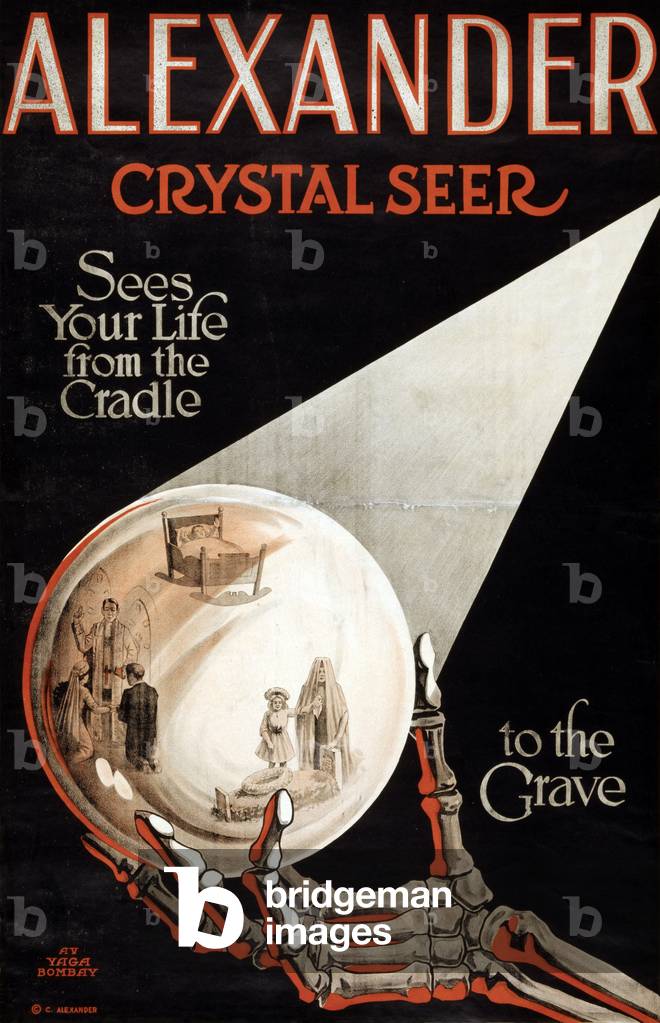
Alexander Crystal Seer, Sees Your Life from the Cradle to the Grave, c.1910 (poster)

EVB2928534: Alexander Crystal Seer, Sees Your Life from the Cradle to the Grave, c.1910 (poster), Unknown Artist / Bridgeman Images

Sir Lawrence Alma-Tadema (1836-1912), in his studio.

EVB2932639: Sir Lawrence Alma-Tadema (1836-1912), in his studio., Unknown Artist / Bridgeman Images

Jean-Baptiste-Joseph Delambre (1749-1822) French astronomer

EVB2932579: Jean-Baptiste-Joseph Delambre (1749-1822) French astronomer, Unknown Artist / Bridgeman Images

St. Louis, Missouri, as seen from above the Mississippi River. 1850s bird's eye view shows the active waterfront with steamboats. St. Louis was the entry point to the Western frontier

EVB2931794: St. Louis, Missouri, as seen from above the Mississippi River. 1850s bird's eye view shows the active waterfront with steamboats. St. Louis was the entry point to the Western frontier, Unknown Artist / Bridgeman Images

A view of Savannah, Georgia as it stood in 1734. Georgia was last founded of the original thirteen colonies

EVB2931818: A view of Savannah, Georgia as it stood in 1734. Georgia was last founded of the original thirteen colonies, Unknown Artist / Bridgeman Images

1785 map of Korea by Hayashi Shihei, a Japanese scholar and specialist in military affairs. Korean national identity has survived many invasions by its powerful neighbors, Japan and China

EVB2931845: 1785 map of Korea by Hayashi Shihei, a Japanese scholar and specialist in military affairs. Korean national identity has survived many invasions by its powerful neighbors, Japan and China, Unknown Artist / Bridgeman Images


Back to top