Search options

Orientation
Colour

Display options

View

Print

To print search results, use print friendly version of this page.

2491557 Search Results

Earth seen from space - Clouds over ocean seen from the space shuttle Discovery - Storm on the Atlantic Ocean seen by the shuttle Discovery in October 2000. Thunderstorms over the Atlantic Ocean. October 2000

PIX4674402: Earth seen from space - Clouds over ocean seen from the space shuttle Discovery - Storm on the Atlantic Ocean seen by the shuttle Discovery in October 2000. Thunderstorms over the Atlantic Ocean. October 2000 / Bridgeman Images

Thunderstorms seen from space shuttle Discovery in April 1991 - Thunderstorms seen from space shuttle Discovery in April 1991 - Thunderstorms over the Indian Ocean seen by space shuttle Discovery on 30 April 1991. Thunderstorms above Indian ocean seen from the space shuttle Discovery on April 30 1991

PIX4674492: Thunderstorms seen from space shuttle Discovery in April 1991 - Thunderstorms seen from space shuttle Discovery in April 1991 - Thunderstorms over the Indian Ocean seen by space shuttle Discovery on 30 April 1991. Thunderstorms above Indian ocean seen from the space shuttle Discovery on April 30 1991 / Bridgeman Images
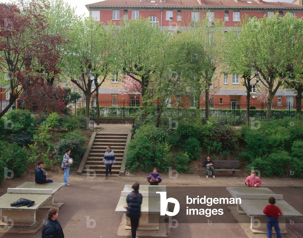
Cite garden in Suresnes (Hauts de Seine). Realisation 1921-1939, architect Alexandre Maistrasse. Photography 1992.

TEC4674526: Cite garden in Suresnes (Hauts de Seine). Realisation 1921-1939, architect Alexandre Maistrasse. Photography 1992. / Bridgeman Images
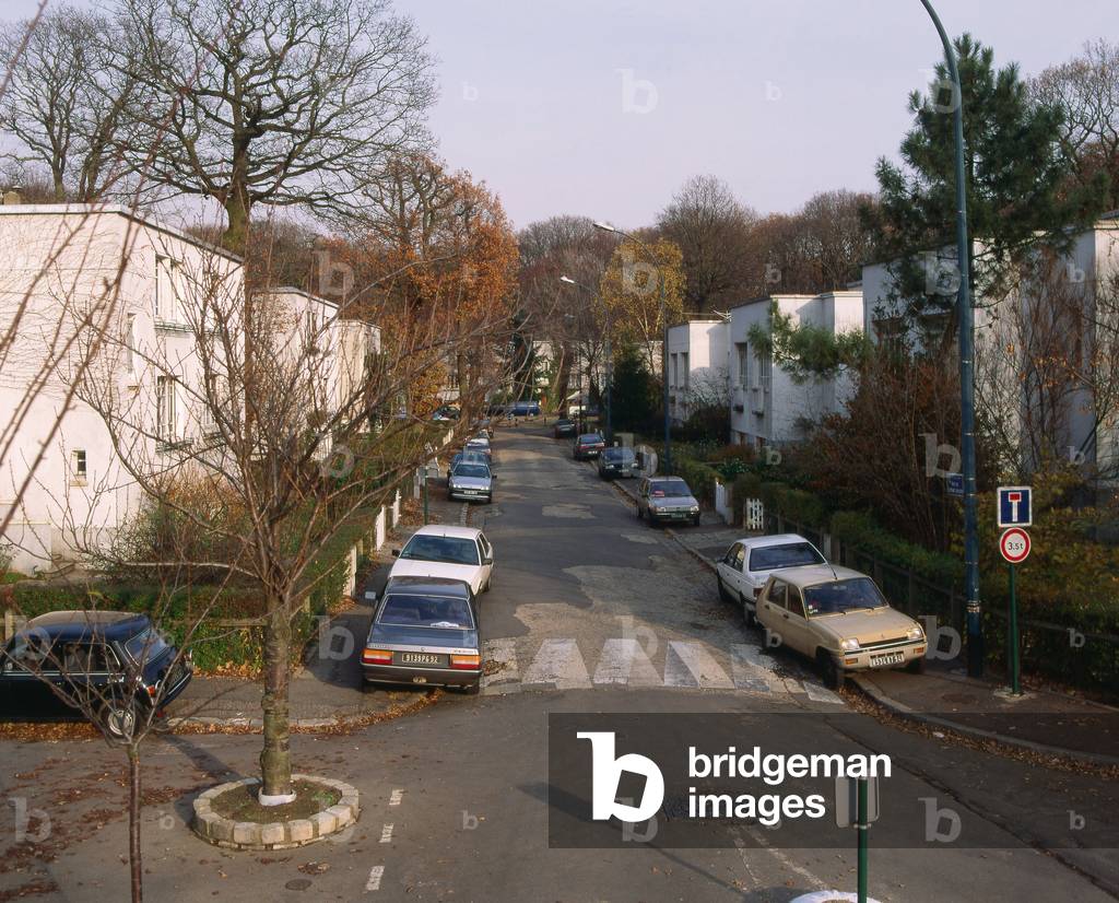
Cite garden at Plessis Robinson (Plessis-Robinson) (Hauts de Seine). Architect Maurice Payret Dortail, realisation 1924-1925. Photography 1992.

TEC4674554: Cite garden at Plessis Robinson (Plessis-Robinson) (Hauts de Seine). Architect Maurice Payret Dortail, realisation 1924-1925. Photography 1992. / Bridgeman Images

Thunderstorm seen from space - Thunderstorm seen from space - Storm on the Atlantic Ocean seen from the International Space Station in 2002. Thunderstorm over Atlantic ocean as photographed from the international space station in 2002

PIX4674711: Thunderstorm seen from space - Thunderstorm seen from space - Storm on the Atlantic Ocean seen from the International Space Station in 2002. Thunderstorm over Atlantic ocean as photographed from the international space station in 2002 / Bridgeman Images

Cumulonimbus over Africa 02/2008 - Cumulonimbus Cloud over Africa 02/2008 - Cumulonimbus seen from the International Space Station on 5/02/2008. Cumulonimbus as seen from the International Space Station. Feb 5 2008

PIX4674821: Cumulonimbus over Africa 02/2008 - Cumulonimbus Cloud over Africa 02/2008 - Cumulonimbus seen from the International Space Station on 5/02/2008. Cumulonimbus as seen from the International Space Station. Feb 5 2008 / Bridgeman Images

Clouds seen from space - Cumulonimbus seen from space - Cumulonimbus isolated over Nigeria seen from the International Space Station (ISS) in February 2010. Isolated cumulonimbus over Nigeria. Image taken from the international space station (ISS) in february 2010

PIX4674838: Clouds seen from space - Cumulonimbus seen from space - Cumulonimbus isolated over Nigeria seen from the International Space Station (ISS) in February 2010. Isolated cumulonimbus over Nigeria. Image taken from the international space station (ISS) in february 2010 / Bridgeman Images

Earth clouds and atmosphere - Earth clouds and atmosphere - Clouds and reflections of the sun on the ocean. Image obtained from Space Shuttle Atlantis in October 1997. Sunset over the Atlantic Ocean taken during the STS - 86 mission from the space shuttle Atlantis

PIX4674889: Earth clouds and atmosphere - Earth clouds and atmosphere - Clouds and reflections of the sun on the ocean. Image obtained from Space Shuttle Atlantis in October 1997. Sunset over the Atlantic Ocean taken during the STS - 86 mission from the space shuttle Atlantis / Bridgeman Images

Sprite and Thunderstorm seen from Space - Red Sprites and Thunderstorm seen from space: A sprite (upper left, in the atmosphere) seen from the International Space Station (ISS) in August 2015. This electric discharge rises 100 km above the surface of the Earth - The Moon is the bright spot in the sky, to the right of the sprite. Lights from Dallas, Texas appear in the foreground - This photo shows the spring's tendrils reaching as much as 100 kilometers above Earth's surface. Sprites are major electrical discharges, but they are not lightning in the usual sense. Instead, they are a cold plasma phenomenon without the extremely hot temperatures of lightning that we see underneath thunderstorms. Red sprites are more like the discharge of a fluorescent tube. Bursts of sprite energy are thought to occur during most large thunderstorm events. They were first photographed in 1989

PIX4674923: Sprite and Thunderstorm seen from Space - Red Sprites and Thunderstorm seen from space: A sprite (upper left, in the atmosphere) seen from the International Space Station (ISS) in August 2015. This electric discharge rises 100 km above the surface of the Earth - The Moon is the bright spot in the sky, to the right of the sprite. Lights from Dallas, Texas appear in the foreground - This photo shows the spring's tendrils reaching as much as 100 kilometers above Earth's surface. Sprites are major electrical discharges, but they are not lightning in the usual sense. Instead, they are a cold plasma phenomenon without the extremely hot temperatures of lightning that we see underneath thunderstorms. Red sprites are more like the discharge of a fluorescent tube. Bursts of sprite energy are thought to occur during most large thunderstorm events. They were first photographed in 1989 / Bridgeman Images
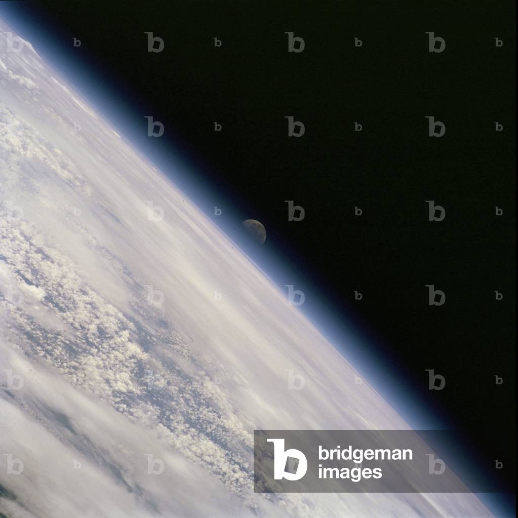
Moonset over Earth - Moonset over Earth - Sunset seen by the shuttle Atlantis in February 2001. Image taken from the space shuttle Atlantis in february 2001

PIX4675139: Moonset over Earth - Moonset over Earth - Sunset seen by the shuttle Atlantis in February 2001. Image taken from the space shuttle Atlantis in february 2001 / Bridgeman Images

The Moon above the Earth's atmosphere - Gibbous moon above the atmosphere - The moon observed from the International Space Station (ISS). A gibbous moon above Earth's atmosphere is featured in this view, photographed by an Expedition 22 crewmember on the International Space Station (ISS)

PIX4675215: The Moon above the Earth's atmosphere - Gibbous moon above the atmosphere - The moon observed from the International Space Station (ISS). A gibbous moon above Earth's atmosphere is featured in this view, photographed by an Expedition 22 crewmember on the International Space Station (ISS) / Bridgeman Images

Forsythia X intermedia/Forsythia de Paris/Border Forsythia

HFE4748002: Forsythia X intermedia/Forsythia de Paris/Border Forsythia / Bridgeman Images

Italy: Puglia: fishing boats at the dock at the small port of Monopoli

GYS4721607: Italy: Puglia: fishing boats at the dock at the small port of Monopoli / Bridgeman Images

anglo - norman islands: Jersey: Golf de Gorey

GYS4721641: anglo - norman islands: Jersey: Golf de Gorey / Bridgeman Images

Morocco: city of Tetouan

GYS4721694: Morocco: city of Tetouan / Bridgeman Images

Senegal N* 50: Saloum River

GYS4721749: Senegal N* 50: Saloum River / Bridgeman Images

Sunrise from shuttle 09/92 - Sunrise from shuttle 09/92 - Earth and sunrise in the atmosphere seen by shuttle STS - 47 on 20/09/92

PIX4675260: Sunrise from shuttle 09/92 - Sunrise from shuttle 09/92 - Earth and sunrise in the atmosphere seen by shuttle STS - 47 on 20/09/92 / Bridgeman Images

Sunrise seen from shuttle Endeavour 09/1992 - Sunrise in earth atmosphere 09/1992 - Sunrise in atmosphere seen from shuttle Endeavour on 18 September 1992. Sunrise in earth atmosphere seen from space shuttle Endeavour on September 18, 1992

PIX4675283: Sunrise seen from shuttle Endeavour 09/1992 - Sunrise in earth atmosphere 09/1992 - Sunrise in atmosphere seen from shuttle Endeavour on 18 September 1992. Sunrise in earth atmosphere seen from space shuttle Endeavour on September 18, 1992 / Bridgeman Images
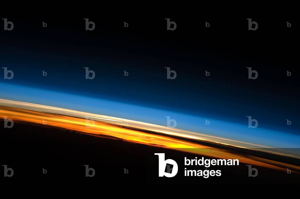
Earth's atmosphere and setting sun - Earth's atmosphere and setting sun - Earth's atmosphere seen at sunset from the International Space Station (ISS) on May 25, 2010. This spectacular image of sunset on the Indian Ocean was taken by astronauts aboard the International Space Station (ISS). The image presents an edge - on, or limb view, of the Earth's atmosphere as seen from orbit. The Earth's curvature is visible along the horizon line, or limb, that extends across the image from center left to lower right. Above the darkened surface of the Earth, a brilliant sequence of colors roughly denotes several layers of the atmosphere. Deep oranges and yellows appear in the troposphere, which extends from the Earth's surface to 6 - 20 km high. This layer contains over 80 percent of the mass of the atmosphere and almost all of the water vapor, clouds, and precipitation. Several dark cloud layers are visible within this layer. Variations in the colors are due mainly to varying concentrations of either clouds or aerosols (airborne particles or droplets). The pink to white region above the clouds appears to be the stratosphere; this atmospheric layer generally has little or no clouds and extends up to approximately 50 km above the Earth's surface. Above the stratosphere, blue layers mark the upper atmosphere (including the mesosphere, thermosphere, ionosphere, and exosphere) as it gradually fades into the blackness of outer space. The ISS was located over the southern Indian Ocean when this picture was taken, with the astronaut observer looking towards the west. Astronauts aboard the ISS see 16 sunrises and sunsets per day due to their high orbital velocity (greater than 28,000 km per hour). The multiple chances for photography are fortunate, as at that speed each sunrise or sunset event only lasts a few seconds. This astronaut photograph was acquired on May 25, 2010

PIX4675392: Earth's atmosphere and setting sun - Earth's atmosphere and setting sun - Earth's atmosphere seen at sunset from the International Space Station (ISS) on May 25, 2010. This spectacular image of sunset on the Indian Ocean was taken by astronauts aboard the International Space Station (ISS). The image presents an edge - on, or limb view, of the Earth's atmosphere as seen from orbit. The Earth's curvature is visible along the horizon line, or limb, that extends across the image from center left to lower right. Above the darkened surface of the Earth, a brilliant sequence of colors roughly denotes several layers of the atmosphere. Deep oranges and yellows appear in the troposphere, which extends from the Earth's surface to 6 - 20 km high. This layer contains over 80 percent of the mass of the atmosphere and almost all of the water vapor, clouds, and precipitation. Several dark cloud layers are visible within this layer. Variations in the colors are due mainly to varying concentrations of either clouds or aerosols (airborne particles or droplets). The pink to white region above the clouds appears to be the stratosphere; this atmospheric layer generally has little or no clouds and extends up to approximately 50 km above the Earth's surface. Above the stratosphere, blue layers mark the upper atmosphere (including the mesosphere, thermosphere, ionosphere, and exosphere) as it gradually fades into the blackness of outer space. The ISS was located over the southern Indian Ocean when this picture was taken, with the astronaut observer looking towards the west. Astronauts aboard the ISS see 16 sunrises and sunsets per day due to their high orbital velocity (greater than 28,000 km per hour). The multiple chances for photography are fortunate, as at that speed each sunrise or sunset event only lasts a few seconds. This astronaut photograph was acquired on May 25, 2010 / Bridgeman Images

Earth's atmosphere and setting sun - Earth's atmosphere and setting sun - Earth's atmosphere and sunset seen from the International Space Station (ISS) in February 2010. Earth's atmosphere and the setting sun are featured in this image photographed by a crew member on the International Space Station (ISS) in february 2010

PIX4675438: Earth's atmosphere and setting sun - Earth's atmosphere and setting sun - Earth's atmosphere and sunset seen from the International Space Station (ISS) in February 2010. Earth's atmosphere and the setting sun are featured in this image photographed by a crew member on the International Space Station (ISS) in february 2010 / Bridgeman Images

Earth from space, Australia - Earth from space, Australia - Earth from space shuttle on 24 December 1999. Between the clouds, the Great Coral Barriere is seen off Queensland, Australia. The Earth seen from the space shuttle Discovery on December 24 1999. Between the clouds, the Great Barrier Reef along the northeast coast of Australia is visible

PIX4675468: Earth from space, Australia - Earth from space, Australia - Earth from space shuttle on 24 December 1999. Between the clouds, the Great Coral Barriere is seen off Queensland, Australia. The Earth seen from the space shuttle Discovery on December 24 1999. Between the clouds, the Great Barrier Reef along the northeast coast of Australia is visible / Bridgeman Images

Reconversion of the Leblan spinning plant into social housing in Lille (North). Realisation 1982, architects Jean Paul Robert and Bernard Reichen. Photography 1982.

TEC4675484: Reconversion of the Leblan spinning plant into social housing in Lille (North). Realisation 1982, architects Jean Paul Robert and Bernard Reichen. Photography 1982. / Bridgeman Images

Argyle Diamond Mine - Australia - Argyle Diamond Mine - Australia: The Argyle Diamond Mine is a mine located in the Eastern Kimberley region of northern Australia. It is the largest diamond mine in the world in volume terms, although due to the low proportion of quality diamonds, it is not a leader in value. Image taken from the International Space Station (ISS) on 22 June 2006. The Argyle Diamond Mine is a diamond mine located in the East Kimberley region in the remote north of Western Australia. Argyle is the largest diamond producer in the world by volume, although due to the low proportion of gemquality diamonds it is set to close by 2020. Image taken from the international space station on June 22 2006.

PIX4675492: Argyle Diamond Mine - Australia - Argyle Diamond Mine - Australia: The Argyle Diamond Mine is a mine located in the Eastern Kimberley region of northern Australia. It is the largest diamond mine in the world in volume terms, although due to the low proportion of quality diamonds, it is not a leader in value. Image taken from the International Space Station (ISS) on 22 June 2006. The Argyle Diamond Mine is a diamond mine located in the East Kimberley region in the remote north of Western Australia. Argyle is the largest diamond producer in the world by volume, although due to the low proportion of gemquality diamonds it is set to close by 2020. Image taken from the international space station on June 22 2006. / Bridgeman Images
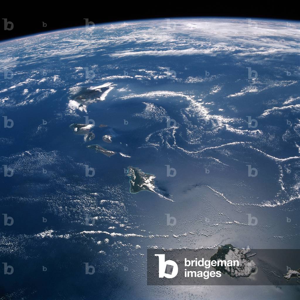
Hawaii Archipelago seen by shuttle 1988 - Hawaii Archipelago seen by shuttle STS - 26 on 10/03/88

PIX4675559: Hawaii Archipelago seen by shuttle 1988 - Hawaii Archipelago seen by shuttle STS - 26 on 10/03/88 / Bridgeman Images

Noumea, New Caledonia - Noumea, New Caledonia, seen from space - Image obtained from the International Space Station on 13/09/2003. This image, taken from the International Space Station on September 13, 2003, shows details of New Caledonia's main city, Noumea, which is built on a peninsula that juts into the lagoon on the southwest side of the island. The reefs here face localized problems from pollution and overfishing

PIX4675657: Noumea, New Caledonia - Noumea, New Caledonia, seen from space - Image obtained from the International Space Station on 13/09/2003. This image, taken from the International Space Station on September 13, 2003, shows details of New Caledonia's main city, Noumea, which is built on a peninsula that juts into the lagoon on the southwest side of the island. The reefs here face localized problems from pollution and overfishing / Bridgeman Images

Rose Atoll - American Samoas - Rose Atoll - American Samoa - The Rose Atoll in the American Samoas archipelago, seen in August 2006 from the International Space Station (ISS). Rose Atoll or Rose island, is an uninhabited wildlife refuge in american Samoa. It is the southermost point in the United States. Astronaut photograph taken from the International Space Station (ISS) in august 2006

PIX4675665: Rose Atoll - American Samoas - Rose Atoll - American Samoa - The Rose Atoll in the American Samoas archipelago, seen in August 2006 from the International Space Station (ISS). Rose Atoll or Rose island, is an uninhabited wildlife refuge in american Samoa. It is the southermost point in the United States. Astronaut photograph taken from the International Space Station (ISS) in august 2006 / Bridgeman Images

Upsala Glacier, Argentina - Upsala Glacier in Argentina - Upsala Glacier in Argentina, observed from the International Space Station on February 5, 2002. Upsala Glacier in Argentina seen from the international space station on February 5 2002

PIX4675750: Upsala Glacier, Argentina - Upsala Glacier in Argentina - Upsala Glacier in Argentina, observed from the International Space Station on February 5, 2002. Upsala Glacier in Argentina seen from the international space station on February 5 2002 / Bridgeman Images

Glacier Viedma, Argentina - Viedma Glacier in Argentina - The Viedma Glacier in Argentina, observed from the International Space Station on January 10, 2004. This detailed view was taken with an 800 mm lens from the International Space Station on 10 January, 2004. The image shows the lower end of the Viedma Glacier that flows into Lake Viedma, one of three major glacially formed lakes on the Patagonian side of the southern Andean ice sheet, at 50 degrees South. The image reveals the slender dark lines of rock material (moraine) which is carried in the slowly flowing ice. Lighter lines at right angles are patterns of crevasse. The glacier diverges into two lakes where calved icebergs can be seen floating in the lakes. The glacier here is about 1.8 km wide

PIX4675760: Glacier Viedma, Argentina - Viedma Glacier in Argentina - The Viedma Glacier in Argentina, observed from the International Space Station on January 10, 2004. This detailed view was taken with an 800 mm lens from the International Space Station on 10 January, 2004. The image shows the lower end of the Viedma Glacier that flows into Lake Viedma, one of three major glacially formed lakes on the Patagonian side of the southern Andean ice sheet, at 50 degrees South. The image reveals the slender dark lines of rock material (moraine) which is carried in the slowly flowing ice. Lighter lines at right angles are patterns of crevasse. The glacier diverges into two lakes where calved icebergs can be seen floating in the lakes. The glacier here is about 1.8 km wide / Bridgeman Images

Social housing, avenue du Marechal de Lattre de Tassigny a Rueil Malmaison (Hauts de Seine). Rehabilitation in 1994. Photographie 1995, published in Housing social dans les Hauts de Seine, Topos number 14-15, editions CAUE 92.

TEC4675778: Social housing, avenue du Marechal de Lattre de Tassigny a Rueil Malmaison (Hauts de Seine). Rehabilitation in 1994. Photographie 1995, published in Housing social dans les Hauts de Seine, Topos number 14-15, editions CAUE 92. / Bridgeman Images
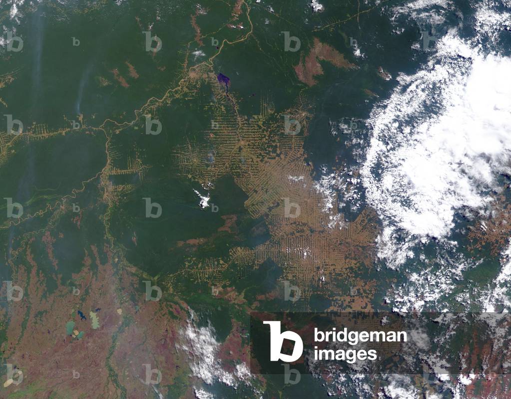
Deforestation in Brazil - 2000 - Deforestation in Brazil - 2000 - View of deforestation in Rondonia, one of the Brazilian states where deforestation is the most intensive. In 1978, deforestation covered 4200 square km of the state, in 1988 about 30,000 square km and in 2003 about 67,000 square km. Image obtained by Terra satellite on 30 July 2000. The Amazon forest appears in green, the areas deforested in light colours. The state of Rondonia in western Brazil is one of the most deforested parts of the Amazon. In the past three decades, clearing and degradation of the state's original 208,000 square kilometers of forest (about 51.4 million acres, an area slightly smaller than the state of Kansas) has been rapid: 4,200 square kilometers cleared by 1978; 30,000 by 1988; and 53,300 by 1998. By 2003, an estimated 67,764 square kilometers of rainforest - - an area larger than the state of West Virginia - - had been cleared. Here is a satellite image from the Moderate Resolution Imaging Spectroradiometer (MODIS) on NASA's Terra satellite taken on July 30, 2000. Intact forest is deep green, while cleared areas are tan (bare ground) or light green (crops, pasture, or occasionally, second - growth forest)

PIX4675872: Deforestation in Brazil - 2000 - Deforestation in Brazil - 2000 - View of deforestation in Rondonia, one of the Brazilian states where deforestation is the most intensive. In 1978, deforestation covered 4200 square km of the state, in 1988 about 30,000 square km and in 2003 about 67,000 square km. Image obtained by Terra satellite on 30 July 2000. The Amazon forest appears in green, the areas deforested in light colours. The state of Rondonia in western Brazil is one of the most deforested parts of the Amazon. In the past three decades, clearing and degradation of the state's original 208,000 square kilometers of forest (about 51.4 million acres, an area slightly smaller than the state of Kansas) has been rapid: 4,200 square kilometers cleared by 1978; 30,000 by 1988; and 53,300 by 1998. By 2003, an estimated 67,764 square kilometers of rainforest - - an area larger than the state of West Virginia - - had been cleared. Here is a satellite image from the Moderate Resolution Imaging Spectroradiometer (MODIS) on NASA's Terra satellite taken on July 30, 2000. Intact forest is deep green, while cleared areas are tan (bare ground) or light green (crops, pasture, or occasionally, second - growth forest) / Bridgeman Images

Social housing, HBM Square Payret Dortail, 13 rue de Chatillon a Vanves (Hauts de Seine). Realisation 1929, architect Maurice Payret Dortail. Photographie 1995, published in Housing social dans les Hauts de Seine, Topos number 14-15, editions CAUE 92.

TEC4675981: Social housing, HBM Square Payret Dortail, 13 rue de Chatillon a Vanves (Hauts de Seine). Realisation 1929, architect Maurice Payret Dortail. Photographie 1995, published in Housing social dans les Hauts de Seine, Topos number 14-15, editions CAUE 92. / Bridgeman Images

The towers of Torres del Paine - Torres del Paine - Torres del Paine, the three granite formations, emblem of this Chilean National Park. Granite rocks of Torres del Paine, Patagonia, Chile

PIX4675992: The towers of Torres del Paine - Torres del Paine - Torres del Paine, the three granite formations, emblem of this Chilean National Park. Granite rocks of Torres del Paine, Patagonia, Chile / Bridgeman Images

Campanula punctata/Spotted Campanula/Very Large Flower Campanula

HFE4748553: Campanula punctata/Spotted Campanula/Very Large Flower Campanula / Bridgeman Images

Houttuynia cordata 'Chameleon'/Plant chameleon/Houttuynie tricoloured

HFE4748601: Houttuynia cordata 'Chameleon'/Plant chameleon/Houttuynie tricoloured / Bridgeman Images
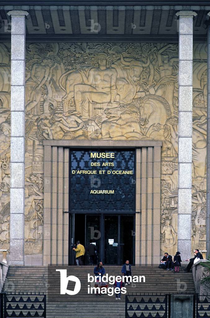
The Museum of African and Oceanian Arts, Paris

TEC4706696: The Museum of African and Oceanian Arts, Paris / Bridgeman Images

Musee Carnavalet, 23 rue de Sevigne, Paris 75003. Architecture by Nicolas Dupuis in 1560 and refurbished in 1660 by Francois Mansart

TEC4707740: Musee Carnavalet, 23 rue de Sevigne, Paris 75003. Architecture by Nicolas Dupuis in 1560 and refurbished in 1660 by Francois Mansart / Bridgeman Images


Back to top