Search options

Orientation
Colour

Display options

View

Print

To print search results, use print friendly version of this page.

2491514 Search Results

Houseleek, Sempervivum tectorum, and rock stonecrop, Sedum reflexum. Handcoloured woodblock engraving of a botanical illustration from Adam Lonicer's Krauterbuch, or Herbal, Frankfurt, 1557. This from a 17th century pirate edition or atlas of illustrations only, with captions in Latin, Greek, French, Italian, German, and in English manuscript.

FLO4668986: Houseleek, Sempervivum tectorum, and rock stonecrop, Sedum reflexum. Handcoloured woodblock engraving of a botanical illustration from Adam Lonicer's Krauterbuch, or Herbal, Frankfurt, 1557. This from a 17th century pirate edition or atlas of illustrations only, with captions in Latin, Greek, French, Italian, German, and in English manuscript. / Bridgeman Images

Spikenard, Nardostachys jatamansi, and lavender, Lavandula angustifolia. Handcoloured woodblock engraving of a botanical illustration from Adam Lonicer's Krauterbuch, or Herbal, Frankfurt, 1557. This from a 17th century pirate edition or atlas of illustrations only, with captions in Latin, Greek, French, Italian, German, and in English manuscript.

FLO4667603: Spikenard, Nardostachys jatamansi, and lavender, Lavandula angustifolia. Handcoloured woodblock engraving of a botanical illustration from Adam Lonicer's Krauterbuch, or Herbal, Frankfurt, 1557. This from a 17th century pirate edition or atlas of illustrations only, with captions in Latin, Greek, French, Italian, German, and in English manuscript. / Bridgeman Images
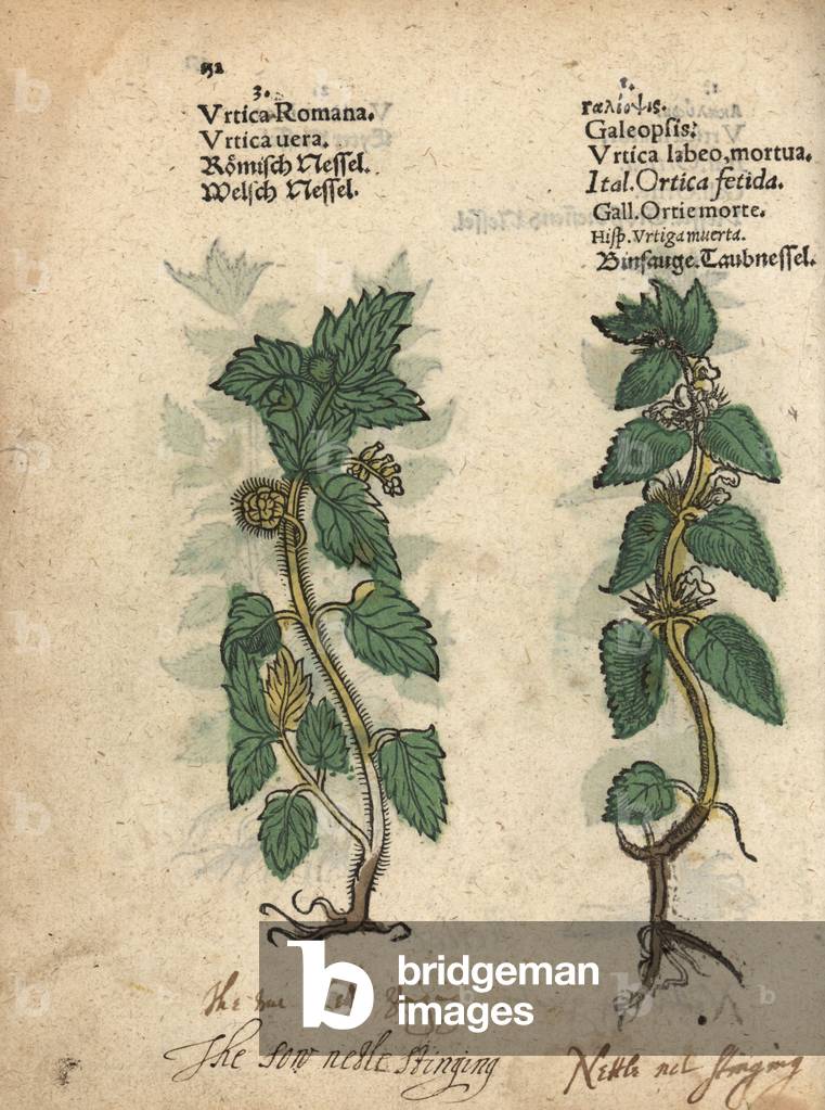
Stinging nettle, Urtica dioica, and hemp nettle, Galeopsis speciosa. Handcoloured woodblock engraving of a botanical illustration from Adam Lonicer's Krauterbuch, or Herbal, Frankfurt, 1557. This from a 17th century pirate edition or atlas of illustrations only, with captions in Latin, Greek, French, Italian, German, and in English manuscript.

FLO4667445: Stinging nettle, Urtica dioica, and hemp nettle, Galeopsis speciosa. Handcoloured woodblock engraving of a botanical illustration from Adam Lonicer's Krauterbuch, or Herbal, Frankfurt, 1557. This from a 17th century pirate edition or atlas of illustrations only, with captions in Latin, Greek, French, Italian, German, and in English manuscript. / Bridgeman Images

Felted peperomia, Peperomia incana (Piper incanum). Handcoloured copperplate engraving by George Cooke from Conrad Loddiges' Botanical Cabinet, Hackney, London, 1821.

FLO4665593: Felted peperomia, Peperomia incana (Piper incanum). Handcoloured copperplate engraving by George Cooke from Conrad Loddiges' Botanical Cabinet, Hackney, London, 1821. / Bridgeman Images

Geranium or cranesbill, Geranium species, and Herb Robert, Geranium robertianum. Handcoloured woodblock engraving of a botanical illustration from Adam Lonicer's Krauterbuch, or Herbal, Frankfurt, 1557. This from a 17th century pirate edition or atlas of illustrations only, with captions in Latin, Greek, French, Italian, German, and in English manuscript.

FLO4667905: Geranium or cranesbill, Geranium species, and Herb Robert, Geranium robertianum. Handcoloured woodblock engraving of a botanical illustration from Adam Lonicer's Krauterbuch, or Herbal, Frankfurt, 1557. This from a 17th century pirate edition or atlas of illustrations only, with captions in Latin, Greek, French, Italian, German, and in English manuscript. / Bridgeman Images

Dwarf lettuce, Lactuca sessilis, and prickly lettuce, Lactuca serriola. Handcoloured woodblock engraving of a botanical illustration from Adam Lonicer's Krauterbuch, or Herbal, Frankfurt, 1557. This from a 17th century pirate edition or atlas of illustrations only, with captions in Latin, Greek, French, Italian, German, and in English manuscript.

FLO4667192: Dwarf lettuce, Lactuca sessilis, and prickly lettuce, Lactuca serriola. Handcoloured woodblock engraving of a botanical illustration from Adam Lonicer's Krauterbuch, or Herbal, Frankfurt, 1557. This from a 17th century pirate edition or atlas of illustrations only, with captions in Latin, Greek, French, Italian, German, and in English manuscript. / Bridgeman Images

Variete of hibiscus with ecarlate red flowers (Hibiscus rosa sinensis rubra). This plant and its many varieties have been cultivated in China for a long time. In India, flowers are used to decorate the interior of houses and temples. Drawing by T. Boys. Engraving by George Cooke (1781-1834). In Botanical Cabinet, an illustrative catalogue of nursery plants, published monthly from 1717 to 1833, by Conrad Loddiges and Sons.

FLO4666899: Variete of hibiscus with ecarlate red flowers (Hibiscus rosa sinensis rubra). This plant and its many varieties have been cultivated in China for a long time. In India, flowers are used to decorate the interior of houses and temples. Drawing by T. Boys. Engraving by George Cooke (1781-1834). In Botanical Cabinet, an illustrative catalogue of nursery plants, published monthly from 1717 to 1833, by Conrad Loddiges and Sons. / Bridgeman Images

Queen Victoria and Prince Albert at a service in the Chapel Royal, St. James' Palace. Steel engraving by W. Radclyffe after an illustration by Thomas Hosmer Shepherd from London Interiors, Their Costumes and Ceremonies, Joshua Mead, London, 1841.

FLO4669595: Queen Victoria and Prince Albert at a service in the Chapel Royal, St. James' Palace. Steel engraving by W. Radclyffe after an illustration by Thomas Hosmer Shepherd from London Interiors, Their Costumes and Ceremonies, Joshua Mead, London, 1841. / Bridgeman Images

Islamic Art: “” The First Meeting of Roustam and His Aieul Sam”” Persian miniature from a manuscript of the epic poem “” Shahnameh”” (Shah Nama, Shahnama) (Book of Kings) by Ferdowsi (Firdawsi, or Ferdawsi, or Firdousi, ca. 940-around 1020) (ms. 607) Chantilly, ee Conde

LRI4667403: Islamic Art: “” The First Meeting of Roustam and His Aieul Sam”” Persian miniature from a manuscript of the epic poem “” Shahnameh”” (Shah Nama, Shahnama) (Book of Kings) by Ferdowsi (Firdawsi, or Ferdawsi, or Firdousi, ca. 940-around 1020) (ms. 607) Chantilly, ee Conde, Islamic School, (16th century) / Bridgeman Images

Portrait of the French politician Anatole France (1844-1924) Chalk, 1920 (pencil)

JLJ4669902: Portrait of the French politician Anatole France (1844-1924) Chalk, 1920 (pencil), Steinlen, Theophile Alexandre (1859-1923) / Bridgeman Images

Pink dog, Bauera rubioides (Bauera rubiaefolia). Handcoloured copperplate engraving by George Cooke from Conrad Loddiges' Botanical Cabinet, Hackney, 1828.

FLO4665067: Pink dog, Bauera rubioides (Bauera rubiaefolia). Handcoloured copperplate engraving by George Cooke from Conrad Loddiges' Botanical Cabinet, Hackney, 1828. / Bridgeman Images

Plaque de la rue de la Mire in Paris - Street Plaque in Paris - Rue du XVIIIème arrondissement de Paris. It owes its name to the Mire du Nord, although it is located on Junot Avenue. Rue de la Mire, street sign

PIX4665733: Plaque de la rue de la Mire in Paris - Street Plaque in Paris - Rue du XVIIIème arrondissement de Paris. It owes its name to the Mire du Nord, although it is located on Junot Avenue. Rue de la Mire, street sign / Bridgeman Images

Plaque de la rue Cassini in Paris - Street Plaque in Paris - Rue du 14eme arrondissement de Paris, in tribute to the Italian astronomer Jean - Dominique Cassini (1625 - 1712), naturalise French in 1673. Attrained to France by Colbert in 1669, he became the first director of the Paris Observatory in 1671, at the request of Louis XIV. In 1665, he discovered Jupiter's Grande Tache Rouge and determined the rotation speeds of Venus, Mars and Jupiter. From 1671 he discovered 4 satellites around Saturn, as well as a separation in the rings, which today bears his name (division of Cassini). In 1673, he made the first precise measurement of the distance from Earth to Sun, thanks to a transit of Venus. Rue Cassini, street sign. Astronomer Jean - Dominique Cassini, was the first director of Paris observatory

PIX4665539: Plaque de la rue Cassini in Paris - Street Plaque in Paris - Rue du 14eme arrondissement de Paris, in tribute to the Italian astronomer Jean - Dominique Cassini (1625 - 1712), naturalise French in 1673. Attrained to France by Colbert in 1669, he became the first director of the Paris Observatory in 1671, at the request of Louis XIV. In 1665, he discovered Jupiter's Grande Tache Rouge and determined the rotation speeds of Venus, Mars and Jupiter. From 1671 he discovered 4 satellites around Saturn, as well as a separation in the rings, which today bears his name (division of Cassini). In 1673, he made the first precise measurement of the distance from Earth to Sun, thanks to a transit of Venus. Rue Cassini, street sign. Astronomer Jean - Dominique Cassini, was the first director of Paris observatory / Bridgeman Images

Aurora boreale 10 - 2003 - Aurora borealis 10 - 2003 - Aurora boreale observed in Alaska, October 16, 2003. This image is taken from near Talkeetna, Alaska on the night of October 16 - 17, 2003. It is a crowning aurora looking up through the forest canopy

PIX4669941: Aurora boreale 10 - 2003 - Aurora borealis 10 - 2003 - Aurora boreale observed in Alaska, October 16, 2003. This image is taken from near Talkeetna, Alaska on the night of October 16 - 17, 2003. It is a crowning aurora looking up through the forest canopy / Bridgeman Images

The Harpea Cave - Pyrenees - Atlantic - The Harpea Cave - Located in Beherobie, on the edge of the Basque Country, it is an A-shaped rocky fold (anticlinal). It was formed by compression of horizontal layers during tectonic shoots that raised the Pyrenees. Anticline fold in Pyrenees - Atlantiques, France

PIX4668864: The Harpea Cave - Pyrenees - Atlantic - The Harpea Cave - Located in Beherobie, on the edge of the Basque Country, it is an A-shaped rocky fold (anticlinal). It was formed by compression of horizontal layers during tectonic shoots that raised the Pyrenees. Anticline fold in Pyrenees - Atlantiques, France / Bridgeman Images

Seven o'clock rock - Montherme - Ardennes - France - Outcrop of folded rocks, shale (slate phyllades) and quartzites. Sedimentary deposits dating from the Cambrian. Former slate quarry of Montherme. Schist and quartzites outcrop in the old slate quarry in Montherme, Ardennes, France

PIX4667459: Seven o'clock rock - Montherme - Ardennes - France - Outcrop of folded rocks, shale (slate phyllades) and quartzites. Sedimentary deposits dating from the Cambrian. Former slate quarry of Montherme. Schist and quartzites outcrop in the old slate quarry in Montherme, Ardennes, France / Bridgeman Images

English Channel seen from space - English Channel seen from space - La Manche seen by Envisat satellite on 14 July 2003. This image taken by satellite ENVISAT on July 14 2003, shows the English Channel separating the island of Great Britain from northern France, it also connects the North Sea to the Atlantic. The Strait of Dover is the narrowest point, only 34 km, from Dover to Cape Gris - Nez. In the upper part of the image most of England can be observed, from Plymouth to Margate along the coast and from Bristol to London (large bright area). The light green - bluish colours in the sea are the shallow waters of the Goodwin Sands. On the opposite side of the channel are the French regions of Brittany and Lower Normandy. To the left of Lower Normandy are the British islands of Jersey and Guernsey

PIX4665078: English Channel seen from space - English Channel seen from space - La Manche seen by Envisat satellite on 14 July 2003. This image taken by satellite ENVISAT on July 14 2003, shows the English Channel separating the island of Great Britain from northern France, it also connects the North Sea to the Atlantic. The Strait of Dover is the narrowest point, only 34 km, from Dover to Cape Gris - Nez. In the upper part of the image most of England can be observed, from Plymouth to Margate along the coast and from Bristol to London (large bright area). The light green - bluish colours in the sea are the shallow waters of the Goodwin Sands. On the opposite side of the channel are the French regions of Brittany and Lower Normandy. To the left of Lower Normandy are the British islands of Jersey and Guernsey / Bridgeman Images

The glacier of Argentiere - Argentiere Glacier - France - The glacier of Argentiere, under the Aiguille du Chardonnet (Massif du Mont - Blanc). The Argentiere Glacier is a glacier lying above the village of Argentiere in Haute - Savoie departement, France

PIX4668991: The glacier of Argentiere - Argentiere Glacier - France - The glacier of Argentiere, under the Aiguille du Chardonnet (Massif du Mont - Blanc). The Argentiere Glacier is a glacier lying above the village of Argentiere in Haute - Savoie departement, France / Bridgeman Images

The Devil's Cave - Huelgoat - Finistere - Huelgoat, Brittany - The Devil's Cave is a close cavity located between the huge granite rocks of Huelgoat's rocky chaos. The Full Moon lights the landscape as in broad daylight. January 30, 2010. Entrance of “” La cave du diable”” (Devil's cave) among the chaos of rocks in Huelgoat, Brittany, France. The landscape is lightened by the full Moon. January 30, 2010

PIX4667573: The Devil's Cave - Huelgoat - Finistere - Huelgoat, Brittany - The Devil's Cave is a close cavity located between the huge granite rocks of Huelgoat's rocky chaos. The Full Moon lights the landscape as in broad daylight. January 30, 2010. Entrance of “” La cave du diable”” (Devil's cave) among the chaos of rocks in Huelgoat, Brittany, France. The landscape is lightened by the full Moon. January 30, 2010 / Bridgeman Images

Antennas of a French ground station Bercenay - en - Othe - Antennas of a French ground station - Bercenay - en - Othe has been home to a teleport (space telecommunications centre) since 1978, with 18 antennas ranging from 1.5 m to 32.5 m (BY4 antenna). The main network covered is: Intelsat, Eutelsat, Arabsat, NSS, Telecom 2. Ground station for telecommunication with artificial satellites. Bercenay - en - Othe, Aube, France

PIX4667509: Antennas of a French ground station Bercenay - en - Othe - Antennas of a French ground station - Bercenay - en - Othe has been home to a teleport (space telecommunications centre) since 1978, with 18 antennas ranging from 1.5 m to 32.5 m (BY4 antenna). The main network covered is: Intelsat, Eutelsat, Arabsat, NSS, Telecom 2. Ground station for telecommunication with artificial satellites. Bercenay - en - Othe, Aube, France / Bridgeman Images

Huelgoat Forest - Finistere - Huelgoat Forest, Brittany - Huelgoat Forest in winter. Circular panorama. 30 January 2010. Huelgoat forest in winter. Composite fisheye view. Brittany, France. January 30, 2010

PIX4667588: Huelgoat Forest - Finistere - Huelgoat Forest, Brittany - Huelgoat Forest in winter. Circular panorama. 30 January 2010. Huelgoat forest in winter. Composite fisheye view. Brittany, France. January 30, 2010 / Bridgeman Images

Kvalvika Beach - Lofoten Islands - Norway - Walk at sunset in Lofoten: A young woman walks over Kvalvika beach at the end of the day. A female hiker walks a trail above the beach at Kvalvika at sunset

PIX4666909: Kvalvika Beach - Lofoten Islands - Norway - Walk at sunset in Lofoten: A young woman walks over Kvalvika beach at the end of the day. A female hiker walks a trail above the beach at Kvalvika at sunset / Bridgeman Images

Southern Aurora Observed from Space Station - Southern Aurora Observed from Space Station - Southern Aurora Observed from International Space Station April 30, 2003

PIX4669687: Southern Aurora Observed from Space Station - Southern Aurora Observed from Space Station - Southern Aurora Observed from International Space Station April 30, 2003 / Bridgeman Images

La Rochelle et l'ile de Re - Photo satellite - Satellite image of La Rochelle - France: La Rochelle et l'île de Re observed by satellite Sentinel-2A on 26 December 2015. - Capital of the Charente-Maritime department in western France, La Rochelle and surroundings are featured in this Sentinel-2A image, captured on 26 December 2015. Home to some 80,000 people, La Rochelle is a city and a seaport on the Bay of Biscay, a part of the Atlantic Ocean, connected to the Ile de Re by a 2.9 km-long bridge, clearly visible in the centre of the image

PIX4665258: La Rochelle et l'ile de Re - Photo satellite - Satellite image of La Rochelle - France: La Rochelle et l'île de Re observed by satellite Sentinel-2A on 26 December 2015. - Capital of the Charente-Maritime department in western France, La Rochelle and surroundings are featured in this Sentinel-2A image, captured on 26 December 2015. Home to some 80,000 people, La Rochelle is a city and a seaport on the Bay of Biscay, a part of the Atlantic Ocean, connected to the Ile de Re by a 2.9 km-long bridge, clearly visible in the centre of the image / Bridgeman Images

Aurora boreale observed from space station - Aurora borealis seen from space - Aurora boreale over Canada observed from the International Space Station (ISS) on September 15, 2017. In the foreground on the left, the solar panels of the resort. Aurora borealis over Canada seen from the International Space Station (ISS) on September 15, 2017. The ISS main solar arrays are seen in the left foreground

PIX4669763: Aurora boreale observed from space station - Aurora borealis seen from space - Aurora boreale over Canada observed from the International Space Station (ISS) on September 15, 2017. In the foreground on the left, the solar panels of the resort. Aurora borealis over Canada seen from the International Space Station (ISS) on September 15, 2017. The ISS main solar arrays are seen in the left foreground / Bridgeman Images

Europe at night - 2012 - Europe by night - 2012 - View of Europe at night consisting of images taken by the Suomi NPP satellite in April and October 2012. This image of Europe at night is a composite assembled from data acquired by the Suomi NPP satellite in April and October 2012

PIX4667174: Europe at night - 2012 - Europe by night - 2012 - View of Europe at night consisting of images taken by the Suomi NPP satellite in April and October 2012. This image of Europe at night is a composite assembled from data acquired by the Suomi NPP satellite in April and October 2012 / Bridgeman Images

Corsica seen from the International Space Station (ISS) 12-2016 - Corsica from ISS 12-2016:

PIX4665254: Corsica seen from the International Space Station (ISS) 12-2016 - Corsica from ISS 12-2016: / Bridgeman Images

Chateau du Clos Luce - Clos Luce - Amboise - The Chateau du Clos Luce is located in the heart of the Loire Valley, in the city center of Amboise. Once called the Chateau du Cloux and summer residence of the kings of France until 1516, Francois I put it at the disposal of Leonard de Vinci, who lived there for three years, until his death on 2 May 1519

PIX4668085: Chateau du Clos Luce - Clos Luce - Amboise - The Chateau du Clos Luce is located in the heart of the Loire Valley, in the city center of Amboise. Once called the Chateau du Cloux and summer residence of the kings of France until 1516, Francois I put it at the disposal of Leonard de Vinci, who lived there for three years, until his death on 2 May 1519 / Bridgeman Images

Abbey of Fontevraud - Maine-et-Loire - Abbey of Fontevraud - Maine-et-Loire: The Abbey of Notre-Dame de Fontevraud was founded by Robert d'Arbrissel in 1101. Located 15 km from Saumur in the Maine-et-Loire, it was classified as a historical monument in 1840 and declared a UNESCO World Heritage Site in 2000 with the entire cultural site of the Loire Valley. The Royal Abbey of Our Lady of Fontevraud or Fontevrault was a monastery in the village of Fontevraud-l'Abbaye, near Saumur, in Anjou, France. It was founded in 1101 by Robert of Arbrissel. The complex of monastic buildings served as a prison from 1804 to 1963

PIX4668621: Abbey of Fontevraud - Maine-et-Loire - Abbey of Fontevraud - Maine-et-Loire: The Abbey of Notre-Dame de Fontevraud was founded by Robert d'Arbrissel in 1101. Located 15 km from Saumur in the Maine-et-Loire, it was classified as a historical monument in 1840 and declared a UNESCO World Heritage Site in 2000 with the entire cultural site of the Loire Valley. The Royal Abbey of Our Lady of Fontevraud or Fontevrault was a monastery in the village of Fontevraud-l'Abbaye, near Saumur, in Anjou, France. It was founded in 1101 by Robert of Arbrissel. The complex of monastic buildings served as a prison from 1804 to 1963 / Bridgeman Images

La France vue par satellite - France as seen from satellite - Image de la France obtained on 18 May 2009 by the European satellite Envisat. View of France obtained by the European satellite Envisat on May 18 2009

PIX4665162: La France vue par satellite - France as seen from satellite - Image de la France obtained on 18 May 2009 by the European satellite Envisat. View of France obtained by the European satellite Envisat on May 18 2009 / Bridgeman Images

Northern Europe seen by satellite - 2002 - Northern Europe observed on 6 April 2002 by Terra satellite. NB: the borders are drawn

PIX4667236: Northern Europe seen by satellite - 2002 - Northern Europe observed on 6 April 2002 by Terra satellite. NB: the borders are drawn / Bridgeman Images

Corsica view by satellite - Corsica seen by satellite Landsat-8 - Corsica seen by satellite Landsat-8 on 29 August 2014.

PIX4665266: Corsica view by satellite - Corsica seen by satellite Landsat-8 - Corsica seen by satellite Landsat-8 on 29 August 2014. / Bridgeman Images

Abbey of Fontevraud - Maine-et-Loire - Abbey of Fontevraud - Maine-et-Loire: The Abbey of Notre-Dame de Fontevraud was founded by Robert d'Arbrissel in 1101. Located 15 km from Saumur in the Maine-et-Loire, it was classified as a historical monument in 1840 and declared a UNESCO World Heritage Site in 2000 with the entire cultural site of the Loire Valley. The Royal Abbey of Our Lady of Fontevraud or Fontevrault was a monastery in the village of Fontevraud-l'Abbaye, near Saumur, in Anjou, France. It was founded in 1101 by Robert of Arbrissel. The complex of monastic buildings served as a prison from 1804 to 1963

PIX4668607: Abbey of Fontevraud - Maine-et-Loire - Abbey of Fontevraud - Maine-et-Loire: The Abbey of Notre-Dame de Fontevraud was founded by Robert d'Arbrissel in 1101. Located 15 km from Saumur in the Maine-et-Loire, it was classified as a historical monument in 1840 and declared a UNESCO World Heritage Site in 2000 with the entire cultural site of the Loire Valley. The Royal Abbey of Our Lady of Fontevraud or Fontevrault was a monastery in the village of Fontevraud-l'Abbaye, near Saumur, in Anjou, France. It was founded in 1101 by Robert of Arbrissel. The complex of monastic buildings served as a prison from 1804 to 1963 / Bridgeman Images

Lofoten Landscape: Boats and traditional fishing cabin (Rorbu). Lofoten, Norway. Calm waters in the fjord next to Reine, Lofoten. A traditional red fishermen cabin can be seen on the shore

PIX4666859: Lofoten Landscape: Boats and traditional fishing cabin (Rorbu). Lofoten, Norway. Calm waters in the fjord next to Reine, Lofoten. A traditional red fishermen cabin can be seen on the shore / Bridgeman Images

Aurora boreale observed in Alaska 03 - 2007 - Aurora borealis above Mounts Drum and Sanford - Alaska. 03 - 2007 - Aurora boreale observed on March 28, 2007 from Willow Lake in Wrangell National Park - St. Elias, Alaska. The two snowy peaks are Mount Drum and Mount Sanford (right). The photo is taken from Willow Lake on March 28, 2007 and is looking at Mount Drum and Mount Sanford (right) located in the Wrangell St Elias National Park

PIX4669971: Aurora boreale observed in Alaska 03 - 2007 - Aurora borealis above Mounts Drum and Sanford - Alaska. 03 - 2007 - Aurora boreale observed on March 28, 2007 from Willow Lake in Wrangell National Park - St. Elias, Alaska. The two snowy peaks are Mount Drum and Mount Sanford (right). The photo is taken from Willow Lake on March 28, 2007 and is looking at Mount Drum and Mount Sanford (right) located in the Wrangell St Elias National Park / Bridgeman Images

Summit of volcano Herdubreid in Iceland - Summit of volcano Herdubreid in Iceland - The summit plateau of Herdubreid volcano seen from the summit of the volcanic cone. The flat rooftop of volcano Herdubreid seen from the top of the volcanic cone

PIX4666361: Summit of volcano Herdubreid in Iceland - Summit of volcano Herdubreid in Iceland - The summit plateau of Herdubreid volcano seen from the summit of the volcanic cone. The flat rooftop of volcano Herdubreid seen from the top of the volcanic cone / Bridgeman Images


Back to top